Download
1 / 12
120 likes | 227 Views
This presentation by Ignacio Láinez Aracama at EWEC 2012 explores EDPR's vision on utilizing remote and alternative wind measurement techniques to reduce uncertainties in energy forecasting and power output performance. It highlights the transition from traditional met masts to more advanced technologies including SODAR, LIDAR, and satellite data. The session emphasizes the ongoing adaptation efforts in the wind industry, the advantages and challenges of different measurement technologies, and the importance of a tailored approach for each project to optimize efficiency and accuracy.

E N D
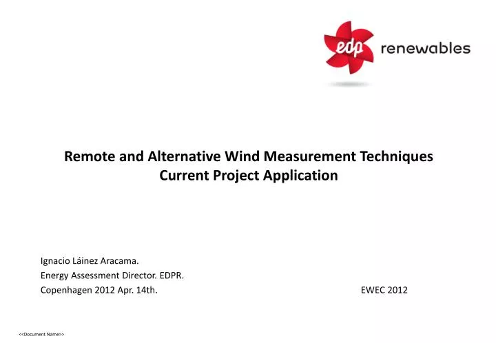
Remote and Alternative Wind Measurement TechniquesCurrent Project Application • Ignacio Láinez Aracama. • EnergyAssessment Director. EDPR. • Copenhagen 2012 Apr. 14th. EWEC 2012
This presentation summarizes EDPR vision on recent Wind Measurement Techniques, and how they can be applied to REDUCE UNCERTAINTIES (and it has not the intention to be a complete revision of the current technologies). Purpose Summary • Measurement are carried out for two main reasons: (i) To Reduce Uncertainties in Energy Forecasting, and (ii) To Power Output Performance. • Remote or Alternative Wind Measurement Techniques are being transferred to the wind industry, coming from different applications in other industries, and this transition required some adaptation effort, that still continues. • Wind Industry has grown based on Met Masts data, these new technologies has suffered, and they are still suffering, this comparison. • Anyhow, any project has its own characteristics (Technical and Commercial), this try to collect a general approach to these techniques and business decisions. General Considerations
EDPR Key Figures Around 25 remote sensors installed, onshore and offshore.
Uncertainties Reduction through Measurement Main Uncertainties Sources (*) • Wind Measurement • Wind speed • Wind direction • Calibration • Sensor Mounting • Filling Data Gaps • Long term • Number of years at Ref. Site • Long Term Representative • Wind Modeling • Coastal Effect • Horizontal Extrapolation • Vertical Extrapolation • Modelisation • Inter-correlation • Wake Effect • Wake Model • Ct Model • Standard Layout • Cumulative Effect • Net Output factors • Availability Efficiency • Availability Time Exclusion • Electrical Grid Availability • Power Curve • Non Std. Weather Conditions 4% to 14% 4% to 8% 4% to 10% 6% to 15% 3% to 6% • Off-shore Met Masts • SODAR & LIDAR • Satellite/MeteoData • Lidar Measurement • Off-shore Met Masts • Wind Met Buoys • Wake Modeling Validation • Satellite/Meteo Data • Local Ref. Stations • Off-shore Met Masts • Sodar & Lidar • Lidar Measurement • Off-shore Met Masts • Wind Met Buoys • Wake Modeling Validation • Whole Wind Farm Integrated Design Measurement Campaign Definition: Maximize return for the available resources. Remote and Alternative Measurement are complementary to met masts (*) Large offshore array
Summary Remote Measurement SODAR LIDAR (2D/3D) FLOATING LIDAR Direct Measurement FLOATING MET MAST Other Products SATELLITE IMAGINERY and METEO DATA Source: IDERMAR
Market introduction: High. Several equipment have been installed across quite different topographies and climates, over the last 5 years Data analysis: High. The quality factor threshold filter is not enough. A detailed analysis on each level should be done. And due to the decrease availability along the vertical axis, vertical profile estimation should be done with care. Cost range: Low. Relative to others technologies. Advantages: Easy and quick deployment. Different providers. Fairly easy to deploy, require minimal maintenance. PROSPECTING ACTIVITIES. Disadvantages: Low availability at medium levels (around 90m-100m). Low data availability under stable atmosphere conditions and during winter. SODAR
LiDAR – 2D: Market : Medium. Data analysis: Medium. The quality factor threshold filter is fairly enough for a detailed analysis on each level. But due to the decrease availability along the vertical axis, vertical profile estimation should be done with care. Cost range: Medium Compared to Sodar, but going down rapidly Advantages: Easy and quick deployment. Information along the vertical axis. Better Accuracy than Sodar. No noise emission. POWER PERFORMANCE Disadvantages: Low availability at high levels (above 150m). Energy consumption (standing alone). LiDAR – 3D: Market: Low. Data analysis: High. Because it is a new point of view, new strategies should be created for a detailed analysis. Cost range: Medium/High Advantages: Simultaneous information along vertical and horizontal axis. Real-time WAKE ANALYSIS. Disadvantages: Energy consumption. Very few providers. LIDAR
Floating -MAST: Market introduction: Very low. Still under Certification Process Data analysis: High. Internal software analysis could not be enough for a detailed analysis on each level. Cost range: Medium ½ to ¼ of a Traditional Offshore Met mast. Advantages: Anemometer and wind vane data. STANDARD RELATION WIND-POWER. DirectMeasurement Disadvantages: Costly installation and maintenance. Not yet validated. Floating -LiDAR: Market introduction: Very low. Still under Certification Process. Data analysis: High. Internal software analysis could not be enough for a detailed analysis on each level. Cost range: Medium ¼ of a Traditional Offshore Met mast. Advantages: Information along the vertical axis. CHEAPER and easy to handle Disadvantages: High wave conditions. Not yet validated for any sea condition FLOATING DEVICES
Market introduction: High Data analysis: High if data used are download from free Weather Services servers. Low if data are provided by specialized companies. Cost range: Free or Supplier dependence. Advantages: Global Information over the last 30 years. LONG TERM Disadvantages: Low spatial and time resolution. NWP – Unable to simulate local wind flows SATELLITES IMAGINERY
Achievements & Challenges BUSSINESS LINE Wind Farm Development Contracting & Financials Construction & Acceptance Operation & Maintenance STATUS PROSPECTION DESIGN VERIFICATION Relative values • Satellite/NWP Refinement and Unbiased Accuracy for Wind Potential Mapping Wind Speed and Energy estimation without Masts. Power Curve vs Remote Sensing!! Wind Direction for preliminary layouts • SoDAR/LiDAR(2D) • SoDAR/LiDAR(2D) Relative Values Wind Shear Long term reference • LiDAR(2D-3D) /SoDAR. • Floating LiDAR/MAST at Offshore sites. • Satellite/NWP(Long-term) • LiDAR(2D-3D) • Floating LiDAR/MAST • Satellite/NWP(Long-term/Win Index) WTG Performance Verification Wake model design and verification Long term comparison (wind index)
Do not discard standing alone Remote Sensing because they are not valid for Project Financing. These technologies provide added value to the whole life-cycle of any project. And sometimes, more valuable information than a traditional met mast. CONCLUSIONS