Download
1 / 27
270 likes | 450 Views
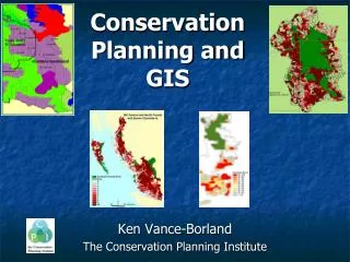
The Roll of GIS In School Board Planning. Presentation Overview. Introduction Board’s Roll in the Planning Process GIS at York Catholic GIS At York Public Student Transportation Collaboration Between Boards. Introduction. There are currently 169,000 students attending our schools

E N D
Presentation Overview • Introduction • Board’s Roll in the Planning Process • GIS at York Catholic • GIS At York Public • Student Transportation • Collaboration Between Boards
Introduction • There are currently 169,000 students attending our schools • There are projected to be be 198,000 students attending our schools by 2018 • 289 schools; 120 proposed future schools • 45,000 students receive transportation on a daily basis • GIS is used primarily within the Planning Departments at both Boards. • Both Boards are ESRI users, with a full District Site License that allows for unlimited use of all ESRI software throughout the Board, (both at the Board office as well as in the schools) • While the 2 school Boards cover the same jurisdiction, for the same purpose, they operate completely independently of one another
Role in the Planning Process • Commenting Agency • Residential development / developments that have the potential to generate students • Boards designate school sites at the secondary plan stage • Involved in community design • Walkable communities • School / Park / School ‘Campus’ facilities • Minimize number of students requiring transportation • School Site design • Funding for school sites (propety) is generated through the collection of EDC’s (Educational Development Charges • Funding for the construction of schools is received from the Ministry of Education
Organizational StructureYork Catholic • The Board is split into 2 main entities • Learning Services • Academic arm of the Board responsible for curriculum, staffing, research, • Corportate (Leading) Services • Finance, Plant (Operations), IT, Admin Services
GIS at York Catholic • Creation and Maintenance of school attendance areas
GIS At York Catholic • Geocode Student address points for analysis
GIS At York Catholic • Development Tracking
GIS At York Catholic • Development Tracking • Plans of Subdivision are circulated through the Planning Department • Plans are entered into our development tracking application • Depending on community / type of residential product being offered, a specific ‘yield’ is applied to each unit type • In Woodbridge a typical yield for a single family house (for us) would be 0.6 • In Markham, the yield would be considerably lower • Yields, in conjunction with development phasing drives the enrolment projections for a new community
GIS At York Catholic • Accommodation Planning • Enrolment Projections – produced annually • GIS used to as a tool to encorporate and analyze • Census data (age cohorts) • Assessment data (community profiles) • Annual summer subdivision surveys (phasing) • Student distribution (historical knowledge • Boundary Changes • Plot distribution of existing students that may be impacted by a boundary change • ‘Boundary Option’ maps are a critical tool when hosting public meetings • Incorporate new boundaries into enrolment projections software in order to determine impact of new boundary on future growth • Accommodation Reviews
GIS At York Catholic • Application Development • Address Validation Application • A module within the Student Admin software that validates a student’s adderss and confirms their ‘home’ school
GIS At York Catholic • Application Development • Address Validation Application • A module within the Student Admin software that validates a student’s adderss and confirms their ‘home’ school • ArcIMS website available internally • Used primarly as an address look-up tool to determine ‘home’ school of an address
Planning and Property Development Services at YRDSB • Major Functions: • Accommodation Planning • Land Use Planning • Facility Planning
Accommodation Planning • Staffing • Allocation and tracking of teaching staff through the review and provision of school level projections • Capital Strategy • outlines the new schools and additions to be undertaken during the five years following the approval of the Capital Strategy • Boundaries • School attendance areas or boundaries are necessary to create school communities that are appropriately sized for the capacity of each school facility • Boundaries are usually split by streets, natural features and/or individual lot parcels
Land Use Planning • School Site Valuation and Acquisition • Applications for Development • reviews and comments on each new development application in the Region of York. A development tracking system monitors the number of housing units and schools affected • School Site Designations • identify the number and location of school sites by ensuring their adequacy in terms of size, shape, topography, frontage, ownership and timing of avilability.
GIS at York Public • Monthly geocode of student dataset for boundary reviews and analysis • Use GIS to determine location and corresponding development plan of residential building permits from each municipality monthly • Annual Geocode of MPAC records to establish number and type of structures within each boundary to establish yields • Continuous update of residential development to ensure accurate projections • Establish walking zones for schools to determine number of students within non-transportation zone
Student Yield at York Public • Student yield = # students divided by # units • Proportional factor that we apply to new development to estimate potential number of students • Yield depends on type of unit: SF/SD, TH, Condo/APT • Low density units (SF/SD) produce a higher yield of students while high density units (Condo/APT) produce lower yield of students
E.g. High Density in Aurora • Yields are tracked for each high density building using geocoded MPAC and student data
Student Yields Yields vary: • between municipalities • urban /rural areas • mature/new neighbourhoods • age of population • types of dwellings • Yields are reviewed periodically • Based on historical trends • Our yields consider students choosing Catholic or private education
Student Transportation Services • Student transportation is organized through a consortium that operates all transportation for both Boards • GIS is used to: • Create and maintain bus routes • Determining eligibility based on ‘Walk Zones’ • Auditing routes / Determining route efficiencies • Uses Routing software – Trapeze / MapNet
Collaboration Between Boards • Site Designations • Student Counts by Study Area • Helps understand demographic shifts across the Region • Development Phasing • Catholic Board relies primarliy on subdivision surveys • Public Board relies more on Building / Occupancy permits • Both methods have their pros and cons • Data Sharing • Yield summaries • Boundaries
Future of GIS at the School Boards • Web Development • Demographic analysis • Encorporating mapping of test scores to determine relationships between testing and socio economic variables • Program Location • Impact of High Density / Intensification