Download
1 / 22
220 likes | 340 Views
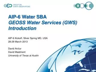
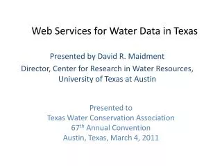
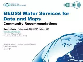
GEOSS Water Services for Data and Maps Community Recommendations. David K. Arctur , Project Lead, GEOSS AIP-6 Water SBA david.arctur@utexas.edu University of Texas at Austin Open Geospatial Consortium (OGC) Presented at GEO X Plenary & Ministerial Summit Geneva, Switzerland January 2014.

E N D
GEOSS Water Services for Data and MapsCommunity Recommendations David K. Arctur, Project Lead, GEOSS AIP-6 Water SBA david.arctur@utexas.edu University of Texas at AustinOpen Geospatial Consortium (OGC) Presented at GEO X Plenary & Ministerial Summit Geneva, Switzerland January 2014
Purpose In conducting AIP-6 Water SBA, we wished to identify the “best practices”, exchange standards, and other conventions needed for national and regional water agencies to effectively federate their data services.
This is a story about millions of small datasets:each with a time series of a variable at a point location Water Quantity Rainfall … continuing and extending work demonstrated at the GEO IX Plenary in Brazil, 2012
Step 1: Search for a specific web map of stream gauges Step 3: Follow the link to the web map Step 2: Examine the GEOSS registry metadata for the web map
Water Data Maps: Global Stream Gauges Not just seeing data providers’ bounding boxes, but actual locations of specific data… (Esri ArcGIS Online web map viewer) Click to add layers WMO GRDC (gauge descriptions only, no water data) Kisters GRDC (WaterML 2 data for OGC Surface Water IE) USGS NWIS (most have real-time data) Mexico (some with historical data, hosted by Univ of Texas) Dominican Republic (historical data hosted by BYU) Italy & New Zealand (real-time data, developed for AIP-6) http://bit.ly/19fUSPY
For quick overview Gauge descriptionand data links… For easy analysis WaterML for full details
Time series data, cont’d • WaterML 2.0 • Document metadata • Observation description • Phenomena time • Result time • Procedure • Observed property • Feature of interest • Result • Time series metadata • Time series data
Recommendation 1: Use OGC WaterML 2 • Federation of regional & national water data is much easier with community adoption and support for data exchange standards & practices • WMO and OGC are developing international standards for hydrologic information: WaterML 2 is the preferred encoding • Part 1: Time series (OGC adopted; WMO pending) • Part 2: Ratings, gaugings and cross-sections (for determining flow volume as function of stream depth and streambed conditions; in development) • TBD: Sampled observations; Forecast-time representations
Recommendation 2: Use OGC WFS for feature layer of water data sites GEOSS Search One WFS service per data layer and/or producer Mapping this feature layer enables direct visualization of the data to support interaction with it. WFS GRDC gauges (Kisters host) WFS Italy gauges (ISPRA host) Web Map Viewer WFS New Zealand gauges (HRC Hilltop host)
Recommendation 3: Water Map Service Guidelines There needs to be a consistent way of describing water data time series, that would be followed by data producers and software developers. With this project we are defining a core set of feature attributes which characterize time series: • WaterMLURLfor a REST call to a data service endpoint, that enables a time series to be queried from this location. • GraphURLand DownloadURL for graphing or downloading the data, if available. • BeginDateof the data (the time of first information, using ISO 8601 time format). • EndDateof the data (make Null if this is current time). • Descriptor– text descriptor of this feature (e.g. Site name for gaging station, COMID for NHDPlus, etc) • Source– text field that specifies the source of the data e.g. USGS, etc. • If the EndDate field is empty (null), this means the data service is a near-real-time feed, not just an historical dataset. • The WaterML time series data is served by OGC Sensor Observation Service (SOS). • WMO/OGC Hydrology Working Group is working on unambiguous conventions for data service REST calls – keep track of this
Recommendation 4: Use OGC SOS 2 as the web data service for WaterML 2 But be prepared for the many sites running CUAHSI WaterOneFlow (WOF) web service for WaterML 1.x data SOS GRDC WaterML2 (Kisters host) Web Map Viewer WOF Italy WaterML1.1 (ISPRA host) SOS New Zealand WaterML2 (HRC Hilltop host)
Summary of web services 6 Return time series data or graph (WaterML, CSV) (SOS) Data service for time series at one gauge 5 Request data service for time series of selected gauge Community Web Portal Discovery, Access and Visualization 1 Request data about [observed property] 4 Return gauge locations as a map layer (GML SF) 2 Return list of Data Providers’ map layers 3 Request map from each Data Provider about [observed property] (WFS) Map of gauges (one layer per observed property) for one Data Provider (CSW) Catalog of Data Providers’ gauge layers
Recommendation 5: Data providers should manage WFS time series descriptions in a catalog registry • Each data provider could install and manage a catalog registry of relevant time series descriptions (WFS feature layers) OR… • Use an established community catalog for that purpose (eg, CUAHSI HydroServer) • This catalog should itself be registered with GEOSS.
Example: Canadian Monitoring Network • This data provider has registered its Kisters precipitation feeds in a GIcat registry installed by the data provider. • This GIcat service’s CSW interface is registered in GEOSS. • This enables distributed search for a single known monitor site via GEOSS Portal…
Public Web Map Viewer (registered in GEOSS)for Global Precipitation Gauges http://bit.ly/19fV1Tz
Register with GEOSS to promote interdisciplinary discovery Community Web Portal Discovery, Access and Visualization www.geoportal.org GEOSS (SOS) Data service for time series at one gauge By registering the community portal and its catalog in GEOSS, interdisciplinary users can more easily discover these resources (WFS) Map of gauges (one layer per observed property) for one Data Provider (CSW) Catalog of Data Providers’ gauge layers
Summary of Recommendations • Use OGC WaterML 2 for water-variable time series data (streamflow, precipitation, runoff, etc). • Use OGC WFS for a feature layer of water data sites; one WFS service per data layer / producer. • Use consistent & minimal subset of time series description fields in the WFS data service. • Use OGC SOS 2 as the web data service for WaterML 2, but be prepared for the many sites running CUAHSI WaterOneFlow (WOF) web service for WaterML 1.x data, and even WFS for WaterML time series data. • Each data provider could install and manage a catalog registry of relevant time series descriptions (WFS feature layers), or use an established community catalog for that purpose (eg, CUAHSI HIS Central). This catalog should itself be registered in GEOSS.
Future Work: AIP-7 End-user focus • Develop more application-oriented scenarios around flood, drought, and water quality monitoring and prediction. Technological focus • Support discovery and access through GEOSS to additional water resource variables, such as stream depth, precipitation, water quality, soil moisture, evapotranspiration, total water storage. • Promote international conventions for the specific data exchange requests (i.e., allowed parameters and values) between clients & data servers. • Provide cloud-based data services to reduce equipment, software, and training needs for developing countries. Institutional focus • Coordinate with IGWCO and WMO so this development work will become institutionalized by the appropriate international authoritative agencies. • Work with developing countries to improve readiness to share national data
Thank you! David K. Arctur david.arctur@utexas.edu University of Texas at Austin Open Geospatial Consortium (OGC)