Download
1 / 19
190 likes | 215 Views
Comprehensive outline covering map scales, coordinate systems, datum, projections, ArcGIS Desktop software collection, and features of ArcGIS 9.0. Includes explanations of coordinate types, datums, file formats, and ArcGIS functionality.

E N D
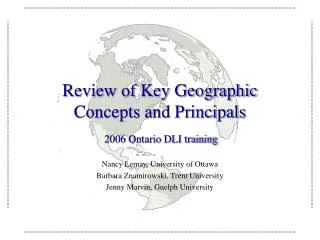
Review of Key Geographic Concepts and Principals Nancy Lemay, University of Ottawa Barbara Znamirowski, Trent University Jenny Marvin, Guelph University 2006 Ontario DLI training
Presentation Outline • Defining certain concepts and terms: Map scales, coordinate systems, datum and projections. • ArcGIS Desktop software collection: ArcReader, ArcView, ArcEditor and ArcInfo. • Review of the Main Features of ArcGIS 9.0 : ArcMap, ArcCatalogue and ArcToolbox.
Map Scales • A defined dimensional relationship between reality and the map (Robinson et al., 1995). • Scale is “unitless” because it is a ratio. Small scale: 1:250,000 Large scale: 1:50,000
Map Scales (cont’d) Maps are made to scale. In each case, the scale represents the ratio of a distance on the map to the actual distance on the ground. For example, if 2 cm on a map ... represents 1 km on the ground ... the scale would be 2 cm = 1 km, or...
Co-ordinate System A co-ordinate is a reference system based on mathematical rules for specifying positions ( locations) on the surface of the earth.The co-ordinate values can be spherical ( latitude and longitude) or planar ( such as the Universal Transverse Mercator)
Types of Coordinate Systems • Geographic coordinate system: • Uses latitude and longitude for locating positions on the uniformly curved surface of the earth. • Rectangular/plane coordinate systems: • Used to locate positions on a flat map. • For example: Lambert Conformal Conic
Example • Let’s project a “shapefile” of Canada….
Unprojected versus Projected Unprojected Projected
Geographic Coordinate System • The Equator (latitude) and Prime Meridian (longitude) are the reference points. • The Cartographic Boundary Files, the Road Network Files are disseminated in latitude/longitude coordinates. Prime meridian Equator
Datum: A Datum is a geodetic reference point that specifies the size and shape of the earth, and the base point from which the latitude and longitude of all other points on the earth’s surface are referenced
Datum • Geodetic reference system that specifies the size and shape of the earth. Types of datums: (1) Earth-centered (WGS84, NAD83), (2) Local (NAD27, ED50). • The spatial data disseminated for the 2001 Census are based on the North American Datum of 1983 (NAD83). http://www.geod.nrcan.gc.ca/index_e/geodesy_e/reference04_e.html
Different File Formats Shapefile “.shp” is used in ArcGIS and is accompanied by the following auxiliary files: • “.dbf” the dBASE file that stores the attribute information of features. Required. • “.shx” the file that stores the index of the feature geometry. • “.sbn & .sbx” the files that store the spatial index of the features. • “.prj” - the file that stores the coordinate system information. • “.xml” - metadata for ArcInfo 8.0, for using shapefiles on the Internet. Coverages are often published in a compacted form with the extension “.e00”: • Proprietary file format used to distribute Arc/Info datasets. Topology and attributes are properly maintained in this format.
Example • Let’s import a “.e00” file…. • For instructions on how to import an .e00 file: http://www2.lib.uoguelph.ca/resources/gis/HELP/e00.cfm
ArcGIS Desktop software collection Free viewer to view, print and query maps. Extensive mapping, data use, and analysis along with simple editing and geoprocessing capabilities. Advanced editing for shapefiles and geodatabases in addition to the full functionality of ArcView. Extends the functionality of both ArcView and ArcEditor.
Main Features of ArcGIS 9.0* • ArcCatalog: • To access and manage geographic data. Data can be copied, moved, deleted, and viewed before it is added to a map. In addition, metadata can be either read or created in FGDC or ISo19115 format. • ArcMap: • To display and query maps, create hardcopy maps and perform spatial analysis tasks. • ArcToolbox: • An environment for performing geoprocessing operations (i.e., operations that involve alteration or information extraction). ArcToolbox is embedded in both ArcCatalog and ArcMap. *http://libinfo.uark.edu/gis/tutorial_sec1.asp
Help with ArcGIS • http://webhelp.esri.com/arcgisdesktop/9.1/index.cfm?TopicName=welcome