Download
1 / 43
430 likes | 1.84k Views
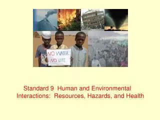
Standard 9 Human and Environmental Interactions: Resources, Hazards, and Health Human and Environmental Interactions: Resources, Hazards, and Health Geographic distribution of hazards in the form of natural disasters Regional resource Issues Role of technology in shaping our world

E N D
Standard 9 Human and Environmental Interactions: Resources, Hazards, and Health
Human and Environmental Interactions: Resources, Hazards, and Health • Geographic distribution of hazards in the form of natural disasters • Regional resource Issues • Role of technology in shaping our world • Diffusion of epidemics
9.1 Natural Disasters • Spatial distribution of natural disasters • Asia • South America • North America • Human and physical factors that contribute to disasters
9.1 Natural Disasters Major Fault Lines of the World library.thinkquest.org/.../faultlines.html
Area where 13 earthquakes have killed over 90,000 people between 1954-1989. www.forceborne.com/FBW/Tech/fault_line_chart.htm
9.1 Natural Disasters • Ten Deadliest Natural Disasters Rank; Date; Event; Location; Death Toll 1. 1931 Yellow River flood, Yellow River, China. 850,000 - 4,000,000 2. 1887 Yellow River flood, Yellow River, China. 900,000 - 2,000,000 3. 1970 Bhola cyclone, Ganges Delta, Pakistan. 500,000 - 1,000,000 3. 1201 Earthquake, Eastern Mediterranean. 1,000,000 5. 1938 Yellow River flood, Yellow River, China. 500,000 - 900,000 6. 1556 Earthquake, Shaanxi Province, China. 830,000 7. 2004 Indian Ocean earthquake/tsunami. 250,000 - 310,000 8. 1881 Tropical Cyclone, Haiphong, Vietnam. 300,000 9. 1642 Flood Kaifeng, Henan Province, China. 300,000 10. 1976 Earthquake, Tangshan, China. 242,000 * * Official Government figure. Estimated death toll as high as 655,000.
9.1 Natural Disasters • Japan • Earthquakes • Kobe 1995 (5,000) • Typhoons • "Louise" Oct. 9, 1945 Okinawa • Volcanoes
9.1 Natural Disasters • Japan
9.1 Natural Disasters • Japan • Physical Environment • Active faults of Kyushu and Kanto • Kanto Earthquake - 1923 (8.0). Killed over 140,000 people and destroyed a third of Tokyo and most of Yokohama. Region has historically experienced a major earthquake about every 70 years. • Hanshin Earthquake - 1995 (7.2). Killed 6,433 people in Kobe and nearby cities. Source: www.seinan-gu.ac.jp/~djohnson/natural/quakes.html • The Asia Pacific region, home to 53% of the world's population and 20% of its land area, experiences a disproportionate share of loss of life and impact to socio-economic processes. According to a recent United Nations' report, nearly 70% of all lives lost due to natural disasters occur within the Asia Pacific region (U.N. Living with Risk, 2002). • Human Environment • Densely populated urban areas • Structural advances
9.1 Natural Disasters • South Asia (Bangladesh, India) • Predominant types of natural disasters • Earthquakes • Hurricanes • Tsunamis • Floods • Physical factors • Fault line • Human factors • Densely populated urban areas • Large subsistent farming and fishing population exposed to tsunamis, floods, and typhoons • Structural materials/design ill-equipped for natural disasters • Poor population unable to leave vulnerable areas
9.1 Natural Disasters • South America (Colombia, Ecuador) • Predominant types of natural disasters • Volcanoes • Landslides/Mudflows
9.1 Natural Disasters • South America • Physical Factors • Major geological fault line along the western edge • Deforestation of hillsides leaves large areas of land vulnerable to erosion by water • Topography • Poor infrastructure not suited to resist hazards • Human Factors • Densely populated areas • Need for harvesting wood for fire
9.1 Natural Disasters • United States of America • Predominant types of disasters • Hurricanes • Gulf Coast • Katrina • Rita • Hugo • Earthquakes • West Coast (San Andreas Fault) • Los Angeles earthquake • Bay Area (1990?) • Midwest (New Madrid Fault) • Historic earthquakes at New Madrid • Tornadoes • Central/Midwest
9.1 Natural Disasters • United States - Physical and Human Factors • Climatic conditions unique to middle United States • Fault lines • Natural path of hurricane development • More affluent society with desirable coast lines • Unique in that wealthier population is regularly affected • Technological developments such as weather forecasting for hurricane warnings, as well as tornado sirens, and the emergency broadcast system
9.1 Natural Disasters • Pakistan • Primary types of disasters • Earthquakes • Landslides • Physical and Human Factors • Fault lines • Densely populated urban areas • Structural codes • Remote areas difficult to access due to poor infrastructure and political divide
9.1 Natural Disasters • China • Predominant types of disasters • Earthquakes • Floods • Physical and human factors • Fault lines • Alteration of natural landscape (dams, etc) cause flooding • Densely populated urban areas with restricted natural flow • Many areas with poor structures
9.1 Natural Disasters • Physical and human environments in these regions have been modified over time in response to environmental threats • In Japan, building reinforced skyscrapers, training for emergency in a disciplined society • United States (hurricanes): response between Florida and Louisiana, government aid, flood-prone areas in urban environment • Indian Ocean (earthquakes-tsunamis) lack of warning system in the third world countries, world-wide relief efforts, foreign-aid • Colombia (volcanoes) mud-flows, government response in remote areas of the world • Pakistan (earthquakes) remote areas, lack of building codes, terrorist activity • China (floods) deadly floods on the Hwang Ho River
9.1 Natural Disasters • International Disaster Relief Efforts • Types of Aid • Response (international community) • Effectiveness/Success of aid efforts • Hurricane Katrina • Indian Ocean Tsunami • Obstacles • Political challenges (terrorist activity, opposition group territory) • Poor infrastructure • Financial
9.2 Regional Resources • Spatial distribution of natural resources • Natural resources subject to local and global pressure • Climate and human stressors on resources • Regional resource issues that may impair sustainability, economic expansion, and/or diversification • The impact of these issues on the physical and human environments of specific regions
Sahel Region of Africa Map provided by: www.answers.com/topic/sahel
9.2 Regional Resources • African Sahel • Contains Ethiopia, Eritrea, Djibouti, and Somalia • Areas affected are: Senegal, Mauritania, Mali, Burkina Faso, Niger, Nigeria, Chad, Sudan, and the "Horn." • The climate is arid and unstable • Hard to operate agriculture with very little precipitation • Sparse savannah vegetation of grasses and shrubs • 4 – 8 inches of rainfall per year (between June and September) • A majority of the people are involved in nomadic herding • Large number of livestock have overgrazed causing excessive desertification • 1970's - drought that killed 300,000 people and five million livestock • Rapidly growing populations with very high rates of natural increase
9.2 Regional Resources • African Sahel • Grassland area south of the Sahara Desert • Forest and woodland areas are declining by an estimated 1% per year, while population grows at 2.8% per year (Sahel Regional Program/USAID, 1997). There is a growing lag between food production and food needs, and evidence of increasing environmental degradation • Almost 8 million people are currently threatened by severe food shortages in the Western Sahel region of Africa—including Niger, Mali, Mauritania and Burkina Faso. The famine, brought on by two years of low rainfalls and drought in the region, coupled with the worst locust infestation in 20 years, has led to widespread malnutrition.
9.2 Regional Resources • Europe • Dependence on fossil fuels from Persian Gulf • Gasoline production is declining in Britain, which became a net gas importer in 2004. The same will be true for oil before the decade is out. By 2020, Britain will be relying on Russian and Algerian gas for half of its electricity supply. • Spain is the most energy dependent in Europe. 80 percent of its energy needs are imported, with 99 percent of its oil and gas being imported. The government plans to end use of nuclear power (one-fifth of its electricity). • Politically volatile sources • Iraq, Saudi Arabia, Iran • Consumptive society
9.2 Regional Resources • Russia • Vast natural resource potential • Petroleum • Forests • Minerals • Poor infrastructure • Roadless areas with large amount of resources • Climate, terrain, and distance hinder exploitation of natural resources • “Fledgling Democracy” with a command economy • Government controlled natural resource companies • Gazprom takeover
9.2 Regional Resources • While the United States consumes roughly 19 million barrels of oil a day, mostly to power its 200 million automobiles, it produces only about 8 million barrels (or 42 percent) of that total domestically. The other 58 percent -- some 11 million barrels a day -- of our oil has to be imported from other countries.
9.3 Role of Technology • Humans have always developed and used technology to modify the physical environment in order to settle areas in different world regions. • Evaluate the impact of these technologies on the physical and human environments affected. [Human Environment Interactions, Spatial Interaction, Change Over Time, Physical Systems
9.3 Role of Technology • Human environment interaction • Modification of physical systems to suit human needs • Dams, levees, irrigation for example
9.3 Role of Technology • Technological Efforts • Netherlands (dams – to claim land for development and agriculture) • USA (New Orleans – levees and dams for urban development and growth) • China (Three Gorges Dam – Displace large population, but offer modernization) • Persian Gulf (Qatar, UAE – Develop desert into agricultural and urban centers)
9.3 Role of Technology • Three Gorges Dam Project, China • Located along the Yangtze River (3rd longest river in the world) • Proposed width of 1.5 miles, 600 feet high, 400 miles long • Hydropower equivalent to 18 nuclear plants • Offers greater access to interior region’s agricultural and • manufactured products. • Future source of energy in response to growing • consumption of population. • Dam will flood more than 100 towns • 1.2 million people will be resettled • More fertile soils will be flooded and people moved to less fertile • areas • Approximately 1,300 archaeological and historical sites gone • May provide up to 1/9 of China’s electrical production • Reduce extremely high use of coal in China • Expected completion in 2009
9.3 Role of Technology Model of proposed project provided by Wikipedia
9.3 Role of Technology View of Three Gorges Dam Project (at left) in 2000 Source: NASA Images
9.3 Role of Technology • Southwest Asia/Persian Gulf Region • Dubai, U.A.E. • Creation of islands for more space in response to demand for residential areas, as well as increased tourism (resorts). • Use of technology to shape urban landscape • Sensitive to natural forces • Qatar • Intensive irrigation projects for agriculture • The country has no rivers or lakes, and besides the rainfall received, the primary source of fresh water is the ground water
9.3 Role of Technology The Palm Jumeirah Resort Dubai, U.A.E.
9.4 Spread of Epidemics • Distinguish and assess the human and physical factors associated with the spread of selected epidemics over time • Describe the impact of this diffusion on countries and regions [Change Over Time, Diffusion]
9.4 Spread of Epidemics • Europe • Bubonic Plague • Spread from Central Asia during 14th Century via trade routes • Significant loss of life • North America • Europeans bringing smallpox and measles to Native American population (1500s) • World • Cholera (1700-1800s) • AIDS (1950s) • Bird Flu • Influenza epidemic (1918-1919)
9.4 Spread of Epidemics • Human Factors • Health care • Education • Ability of government to effectively combat • Physical Factors • Remote areas, lack of infrastructure • Difficult for populations to access suitable care • Diffusion • Densely populated regions • Accelerated spread • Emigration/Immigration • Tourism • Agricultural markets • Wildlife trade (exotic pets, etc)
9.4 Spread of Epidemics • Control Measures and Organizations • United States Centers for Disease Control • Efforts to stem spread of Bird Flu • Cambodia, Indonesia, Thailand, and Vietnam • August 2005, WHO provided recommended strategic actions • World Health Organization • Polio-free world within 18 months of Nov. 2005 • In 2003, Islamic clerics in Nigeria boycotted polio vaccine believing it was a western plot against muslims (BBC News) • Initially spread through 15 African states and to Yemen and Indonesia • WHO needs $200m for operations in 2006 Source: WHO, www.who.int/en/