Download
1 / 43
450 likes | 728 Views
Underground Railroad in New York State. A Geographer’s Perspective Timothy McDonnell New York Geographic Alliance. Route Map of the UGRR. What about New York State? It couldn’t be that simple!. ANOTHER VIEW…. This map by A.C. Flick shows more escape routes to Canada;

E N D
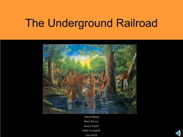
Underground Railroad in New York State A Geographer’s Perspective Timothy McDonnell New York Geographic Alliance
Route Map of the UGRR What about New York State? It couldn’t be that simple!
ANOTHER VIEW… • This map by A.C. Flick shows more escape routes to Canada; • Hudson-Mohawk-Niagara • Susquehanna River-Finger Lakes • Lake Erie-Niagara • Hudson-Champlain • What other possibilities are there?
Comparing the Physical Landscapes • Ohio (and other Mid-Western States) have a low-relief topography. • New York State has several mountain ranges, with narrow valleys in between. • This forces escape routes along a few distinct pathways, with a limited number of deviations possible. • Another challenge was crossing through Pennsylvania’s Appalachian Mts. New York Pennsylvania
New York’sGlacialLandscape • Like everywhere on Earth, New York’s landscape was carved by plate tectonics and millions of years of erosion. • In the last million years, New York was invaded several times by massive ice sheets. • This created a landscape “fit” for an Empire State.
There are probably thirty N-S troughs in New York State. If you travel eastward along US Route 20 (or 20A) between Albany and Buffalo, you cross many of them, as you go up and down steep hills. Some are filled with water…
The Great Lakes The Great Lakes form a natural boundary between the United States and British Canada.
Spillover Channels:Draining lakes formed by the melting glaciers
Natural Corridors • The flood waters from the melting glaciers carved an escape route to the sea. • At one point most of the drainage went to New York City. • This helped create three natural corridors: Hudson Fjord, Champlain Valley, and the Mohawk River.
Routes that make sense… From a Physical Geographic point of view!
The Susquehanna Corridor • The Susquehanna River (and its tributaries) have carved another break through the Appalachian barrier. • This was a third escape route that led into NY’s Southern Tier and beyond. • Glacial troughs in the Finger Lakes Region extend this pathway north and west toward Canada.
Two More Routes… Adirondacks Tug Hill Black River Valley
Underground Railroad Map 1 How is the fit?
The Human Factor • Where is New York in relationship to other “free” states and to the “slave” states? • Does this separation have an impact on the UGRR in New York State?
Other Questions? • What groups of people were involved in this very illegal activity? • What means of transportation were used? • Did all routes lead to Canada? Was it a two-way door?
The Quakers • The Society of Friends was the first organized religious group to ban slave-holding. • They soon aided Freedom Seekers in their escape from slavery. • The Quakers were especially active on Long Island and in eastern New York State.
The ComeouterChurches • Charles G. Finney led the Second Great Awakening in New York State. • These evangelicals considered slavery to be a sin, and they were committed abolitionists. • They separated from traditional churches to form their own comeouter places of worship.
Where were these churches? Source: Strong, Perfectionist Politics Can we assume that comeouterswere UGRR people, too?
African-Americans in NYS • Slavery was introduced into New Netherlands in the mid-1600s. • It remained an entrenched institution until after the Revolution. • Slavery was finally abolished in NYS in 1827. • New York had a substantial free-black population before the Civil War, especially in the downstate region.
The Distribution of African-American Communities Even tiny communities could be safe havens!
African-American Churches Michigan St., Buffalo Park Street, Peekskill St. James, Ithaca Zion Church, Binghamton Favor St. AME, Rochester
UGRR Map #2- Combined How is the fit?
Transportation Used on UGRR • Freedom Seekers certainly walked hundreds of miles on the quest for liberty. • By the 1800s, New York had a system of roads that led across the state. • There were those who assisted them (wagons, carriages).
Escape by Water • Another legacy of the Ice Age are the numerous waterways throughout New York State. • Freedom Seekers would follow streams to the next stations. • In 1807, Robert Fulton launched his steamboat, and soon there were many “stowaways.”
Crossing the Great Lakes • Lake Ontario and Lake Erie form a long border with Canada. • In the mid-1800s many steamboats carried passengers and “freight” over to “Canaan.” • The celebrated Jerry Rescueended with his boarding a steamer in Oswego.
The Grand Erie Canal • The construction of the Erie Canal revolutionized travel in New York. • It provided easy transportation for fugitives, and many people willing to help them. Many UGRR stations were close to the canal routes. • The canal brought “subversive” ideas - likeabolition and equal rights for all citizens.
The Fugitive Slave Law 1850 • With the passage of the Fugitive Slave Law, no African-American was safe south of Canada. • The law mandated that everyone help in the recapture of runaways. • Many free blacks fled north of the border. • But not everyone! How can this be explained?
A Hypothetical Escape • Freedom Seeker is sent to New York City by William Still in Philadelphia. • He is sent to Brooklyn (Lafayette Church) and to Queens with the Quakers. • A boat takes him across the Sound to Westchester County.
The Hudson Valley • The Quakers decide it is safest to send the Freedom Seeker to Tarrytown’s black community. • They direct him north to Peekskill. A tunnel leads him to the river and he stows away on a steamer toAlbany.
Into the Mohawk Valley… • Stephen and Harriet Myers home was a few blocks from the harbor. • They put him on a train bound west along the Mohawk. He gets off at Rome. • A conductor there takes him by wagon to Peterboro, home of famed abolitionist Gerrit Smith.
Canal Country • The escape route lead north to the Erie Canal in Wayne County. • Palmyra was an important crossroads with several safe houses. • This Freedom Seeker was sent north toward Lake Ontario.
The Last Leg of the Journey • Using drumlins as compasses, the Freedom Seeker walks north. • He receives shelter in Marion, and then is sent by wagon to Griffith Cooper’s home near Williamson. • Then he follows Salmon Creek to Pultneyville, where he is hidden by the Cuylers. Horatio Throop’s ship takes him to Kingston, Canada.
But did it end there? • Many Freedom Seekers embraced Canada as their new home. • But census records show that many returned to the free states near Canada, such as New York. • Our “fugitive” could have married a free-born woman, and then had children born in New York.
“Was my house on the UGRR?” • There is no substitute for doing the research from primary sources. • But also consider this: Does it make geographic sense? • Does the Abel Post Home meet this criteria? Does it fit in with any patterns discussed in this session today?
Thank You for Attending this Workshop! For more information visit my website at: http://nygeo.org/freedomtrl.html and for lessons on the UGRR in New York State (and this power point) at http://nygeo.org/ugrrlessons.html