Download
1 / 31
310 likes | 446 Views
Explore the WEELS model for wind erosion on light soils, a part of the EU Framework 5 Research Programme. Collaborative research from various European universities aims to develop a risk assessment system, monitor sand and dust, and analyze climate change scenarios. Discover components of the model like wind erosivity, soil erodibility, and land use dynamics, providing crucial insights for sustainable land management strategies and environmental preservation.

E N D
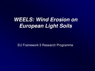
WEELS: Wind Erosion on European Light Soils EU Framework 5 Research Programme
Partners: University College London(co-ordination): Andrew Warren, Dave Gasca-Tucker and others - subcontract to Salford University: Adrian Chappell Soil Survey of Lower Saxony: Walther Schäfer, Jens Groß, Annette Thiermann, Jan Sbresny - subcontract to Göttingen University(research group geosystem-analysis): Jürgen Böhner, Olaf Conrad, Andre Ringeler, Anke Wehmeyer and others Wageningen University:Jan de Graaf, Wim Spaan, Dirk Goossens, Michel Riksen, Olga Vigiak and Floor Brouwer Lund University:Lars Bärring, Marie Ekström and others
Three Field Sites (“Supersites”) : All on glacial outwash sands, with similar mean annual rainfall; more snow and frost in the east
Main Elements:: • The WEELS model, running with data on wind, temperature, rainfall, soil erodibility and land use • Validation: • (a) against a few “event records” in Grönheim and Barnham (b) against estimates of erosion based on the use of 137Cs, for Barnham only • Development of a risk-assessment system, for use where there are fewer data, for Grönheim • Sand and dust monitoring • Climate change scenarios • Economic and policy analysis
The WEELS Model:: Jürgen Böhner, Walther Schäfer, Olaf Conrad, Jens Groß and Andre Ringeler Choices: Wind-Erosion Equation (WEQ) Revised Wind Erosion Equation (RWEQ) Wind Erosion Prediction System (WEPS) The WEELS Model - developed from EROKLI (Beinhauer and Kruse, 1994)
Components of the WEELS Model (1) WIND: WAsP (Wind Atlas Analysis and Application Program) used to convert hourly wind observations at a meteorological station to values across the supersite according to variation in topography and roughness. WIND EROSIVITY:Several elements, mainly shear velocity U* and mass transport SOIL MOISTURE: The water content of the top 2 cm of soil layer, calculated with a simple model using standard meteorological data
Components of the WEELS Model (2) SOIL ERODIBILITY: Essentially, the dimensionless soil erodibility factor‚ ‘K’, depending on aggregate structure and derived from wind tunnel studies, and regressions against soil factors, such as texture and organic matter content. SURFACE ROUGHNESS: soil roughness: aggregate size and tillage (from empirical data, with big assumptions) vegetation roughness: crop type and crop phenology
LAND USE: Coverage for 1985 (no data brown) Data + simulation for 1985 Components of the WEELS Model (3) Michel Riksen, David Gasca-Tucker, Olaf Conrad and others
Reduction of Friction Velocities Windbreak Modelling Olga Vigiak and Annette Thiermann
Output: • Hourly assessment of mean wind speed (10 m above ground) and friction velocity • Daily assessments of crop cover, tillage roughness and top soil moisture • Hourly duration of erosive conditions • Maximum sediment transport rate, calculated with and without top-soil moisture • A simplified daily erosion/accumulation balance.
Events: • Events recorded during field monitoring: about two at the monitoring site • Events recorded by farmers: mostly rather inaccurate, but one very well recorded event on video: see later
137Caesium Analysis Adrian Chappell • Direct measurement is difficult mainly because it is very episodic (as we found) • 137Cs is an artificial isotope created in nuclear reactions, as in bombs and nuclear power stations (cf Chernobyl) • Output to the atmosphere reached a peak in the mid 1960s, so that one is measuring net erosion over about 35 years • It is now widely used to measure erosion. It is simple, but time-consuming to measure
Caesium Mass-Balance Model • An existing model (Owens 1994) was modified to include the major factors controlling wind erosion: Land cover and phenology (including plough events) Rainfall to estimate daily 137Cs fallout Wind speed and a fuzzy threshold (5-7 m s-1) for erosion • Erosion and deposition models are for each field and each day
Sediment Transport Sampling Dirk Goossens and Jens Groß • Testing sediment samplers (the now widely used MWAC sampler found to be best by many criteria • Very detailed recording of one of the few events on 18 May 1999
Wind Erosion and Climate Change Lars Bärring, Marie Ekström and others
For Example: Benefits in €/ha Economics Michel Riksen, Jan de Graaf, and Floor Brouwer
Circulation Pattern over Europe 13.03.1994 Some Results: Event Modelling, Barnham
Wind Speed [10 m a.G.] Honington Some Results: Event Modelling - Barnham Erosion/Accumulation Balance (12.03. - 15.03.1994)
Erosion/Accumulation Balance: -1.5 to 1.8 Kg/m² Some Results: Longterm Estimation (1970-98)
Cs-derived estimates: soil flux(Adrian Chappell) Top of scale 0.45 gain; bottom of scale 0.35 erosion (g cm2yr -1) Some Results: Cs-derived Estimates • Net loss: • 0.6 t ha-1 yr-1 • Area of erosion • deposition • Rate of erosion • deposition
Model vs Measurements • Crude comparison of the distribution of “measured” as against “modelled” erosion shows similar patterns, with erosion concentrated in the north- east of the site, but • Model estimates: - 1.56 t ha-1 yr-1 vs • 137Cs Method: - 0.60 t ha-1 yr-1 • Most models overpredict, but • The disparity is even greater if we acknowledge removal on root crops (2.4 t ha-1 per crop).