Geocoding Web Service Example
Geocoding Web Service Example. Nancy Read Metropolitan Mosquito Control District. What is Geocoding?. Address string Location coordinates 2099 University Ave. W 44.959665 ° St. Paul, MN 55104 -93.187222 ° Coordinates used to put point on map:. How we started . . .

Geocoding Web Service Example
E N D
Presentation Transcript
Geocoding Web ServiceExample Nancy Read Metropolitan MosquitoControl District
What is Geocoding? Address string Location coordinates 2099 University Ave. W 44.959665 ° St. Paul, MN 55104 -93.187222 ° Coordinates used to put point on map:
How we started . . . • MMCD web map site • Address look-up
Searches Parcels • Gives Choices
Problems • Engine, method • Spelling or order errors (“West 5th” vs “5th West”) • Data • Some parcels not addressed • Maintenance • Load and process updates of parcel layer
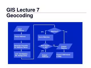
Identified Need • Robust geocoding engine • Usable with web site (service) • Cascading data sets • address points (when available) • parcels • streets (interpolation) • Host for service, data • Data maintenance plan
Internal resources available? • MMCD’s IT Department(note ½ people!) • Need to contract out
Who needs a Geocoder? • Web map applications • Map Quest • Local Government • King Maps • Other applications • Public Safety • Batch • State Government • Businesses
Find others with need, skills, interest • Dave Bitner (MAC) • Jim Maxwell (TLG) • Mark Kotz (Met.Co.) • Gordy Chinander (MESB) • Bob Basquez (St. Paul) • Chris Cialek & Jim Dickerson (LMIC) • Kent Treichel (MN Dept. of Revenue) • Nancy Read (MMCD)- Project Manager
Find resources • Data • Managers of streets, parcels involved • Hosting • MN Land Management Info. Center (LMIC) • Engine, web service • Possible MetroGIS project funding
MetroGIS Geocoder Project • Identified need • Applied for MetroGIS project funding,received $14,000 • Defined requirements • RFP
Existing Geocoding Services • Proprietary ($$) • ESRI • Envinsa • PxPoint Online • Open Source • Geocoder.us – uses Tiger datahttp://geocoder.us/demo.cgi?address=2099+University+Ave.+W.%2C+St.+Paul%2C+MN+55104
PAGC Geocoder engine • Used on large research tasks (e.g, geocoding all fast food retailers in Canada) • Matching routines very good, better than others commonly available “Handles the tough ones others can’t, doesn’t cascade too quickly to general layers like postal code” • Can handle problems with street ranges
PAGC geocoding engine Address Matching Algorithms • Match addresses with reference address-ranged streetnetwork shapefile • Starts with a rule-based Aho-Corasick driven standardization of both data sources. • Reference data indexed using • BerkeleyDB b-trees for exact key lookups and soundex lookups • pointerless trie indexing scheme for edit distance lookups, adapted from ideas of Shang and Merrett. • Match data records using standard Fellegi-Sunter method with modifications to permit similarity measures.
PAGC Geocoding engine • Written in ANSI C • Open Source, freely distributable (LGPL – Lesser General Public License) • Has supporting web site, documentation and community, see www.pagcgeo.org • Can be used on different resource data files (not just Tiger or proprietary)
MetroGIS Geocoder Project • Rework PAGC from command line to Service • Pre-process resource street or other data files to build index files with standardized addresses, location data • Handle concurrent requests • Run under Apache, on Linux or Windows • Input – Urlencode • Output - XML, JSON, CSV
MetroGIS Geocoder Project • Use applicable standards for parameter names, structures • OGC’s OpenLS Location Utility Service specification, supported by ArcWeb and Oracle (XML-based) • FGDC Street Address Data Standard for structuring data (note: “splits” more than OpenLS)
MetroGIS Geocoder Project • Geocoder engine returns location: • Latitude / Longitude • Decimal Degrees • Conversion to UTM or state plane etc. to be done by downstream utility
Capabilities • Cascading (points, parcels, streets) • Geocode to Intersections • will be part of this project • e.g., “University&Snelling” Not included, to be added later: • Landmarks • Reverse Geocoding (Location Address)
MetroGIS Geocoder Project • Set up service with Metro data • TLG Streets • 7-county Parcel Layer (centroids) • Address Points (as available) • Host • LMIC • TLG • Can also install locally – need to pre-process data • Expect demo by April 1
Testing planned • Engine • Accuracy and hit rate • Performance and speed • Reliability as web service • Hosting • Ease of set-up • Data • Maintenance
Challenges • Legal agreements • funding • licensing (engine, data) • Code maintenance – Open Source may help • Possible hosting issues if service is popular