Download
1 / 17
170 likes | 299 Views
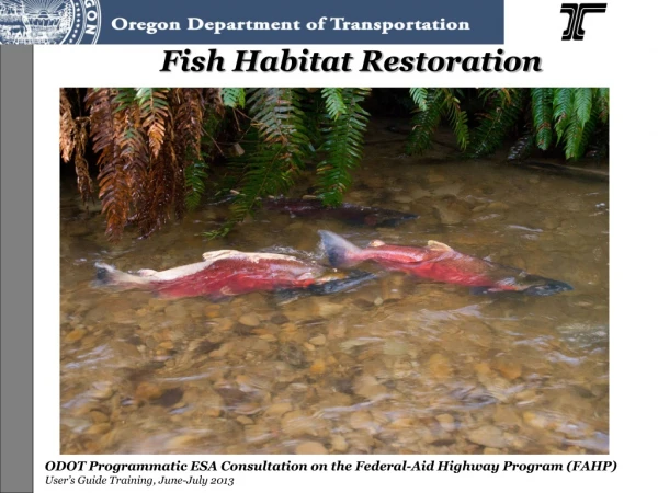
Learn about off- and side-channel habitat restoration strategies including sediment removal, excavation, wetland restoration, water control structure removal, and streambank restoration for enhanced ecological function.

E N D
Off- and side-channel habitat restoration. Reconnection of historical off- and side-channels habitats that have been blocked includes the removal of plugs, which impede water movement through off- and side-channels, and excavation within historical channels that does not exceed the thalweg depth in the main channel. The purpose of the additional sediment removal is to provide unimpeded flow through the side-channel to minimize fish entrapment. (Page 29)
Excavation depth may not exceed the maximum thalweg depth in the main channel. • Excavated material removed from off- or side-channels shall be hauled to an upland site or spread across the adjacent floodplain in a manner that does not restrict floodplain capacity. (Page 29)
Data requirements and analysis that must be submitted to NMFS with a request for approval of off- and side-channel habitat restoration include evidence of historical channel location, such as land use surveys, historical photographs, topographic maps, and remote sensing information.
Set-back existing berm, dike, or levee. • To the greatest degree possible, non-native fill material, originating from outside the floodplain of the action area will be removed from the floodplain to an upland site. (Page 29-30)
Breaches • > active channel width. • Downstream end of the project and/or at the lowest elevation of the floodplain to ensure the flows will naturally recede back into the main channel, thus minimizing fish entrapment. • Overburden or fill comprised of native materials, which originated from the project area, may be used within the floodplain to create set-back dikes and fill anthropogenic holes provided that does not impede floodplain function. (Page 29-30)
Wetland Restoration Degraded wetlands may be restored by excavation and removal of fill materials, contouring to reestablish more natural topography, setting back existing dikes, berms and levees, reconnecting historical tidal and fluvial channels, or planting native wetland species. (Page 31)
Water control structure removal. This includes removal of small dams that are less than 16.4-feet high, do not impound contaminated sediments, and are not likely to initiate head-cutting; channel-spanning weirs; subsurface drainage features; tide gates; or instream flow redirection structures. (Page 30-31)
Data requirements and analysis for structure removal include: • A longitudinal profile of the stream channel thalweg for 20 channel widths upstream and downstream of the structure shall be used to determine the potential for channel degradation. • A minimum of three cross-sections – one downstream of the structure, one through the reservoir area upstream of the structure, and one upstream of the reservoir area outside of the influence of the structure) to characterize the channel morphology and quantify the stored sediment. (Page 30-31)
Data requirements (Cont.) • Sediment characterization to determine the proportion of coarse sediment (>2mm) in the reservoir area. • A survey of any downstream spawning areas that may be affected by sediment released by removal of the water control structure. Reservoirs with a d35 greater than 2 mm (i.e., 65% of the sediment by weight exceeds 2 mm in diameter) may be removed without excavation of stored material, if the sediment contains no contaminants; reservoirs with a d35 less than 2 mm (i.e., 65% of the sediment by weight is less than 2 mm in diameter) will require partial removal of the fine sediment to create a pilot channel, in conjunction with stabilization of the newly exposed streambanks with native vegetation. (Page 30-31)
Streambank Restoration • Primary Goal: Restore ecological function in riparian and floodplain habitats • Planting or installing large wood, trees, shrubs, and herbaceous cover. • Include large wood in each streambank restoration action when appropriate to the system, and to the maximum extent feasible. • •Large wood must be intact, hard, and undecayed with intact rootwads
Streambank Restoration. (Cont.) • Rock will not be used for streambank restoration, except as ballast to stabilize large wood. • Use a diverse assemblage of species native to the action area or region and appropriate to the project area, including trees, shrubs, and herbaceous species. • Do not use noxious or invasive species. • Do not apply surface fertilizer within 50-feet of any stream channel. • Install fencing as necessary to prevent access to revegetated sites by livestock or unauthorized persons. (Page 30-31)
Other covered restoration actions • Large wood and boulder placement • Floodplain restoration • Fish passage restoration • Pile removal, removal of treated wood • Removal of artificial structure or fill from the functional floodplain. • Stormwater retrofits • Riparian restoration
Invasive and Non-native Plant Control (includes use of herbicides.) • Non-herbicide methods. Limit vegetation removal and soil disturbance within the riparian zone by limiting the number of workers there to the minimum necessary to complete manual and mechanical plant control (e.g., hand pulling, clipping, stabbing, digging, brush-cutting, mulching or heating with radiant heat, pressurized hot water, or heated foam). • Herbicide Label. Herbicide applicators must comply with all label instructions. • Power equipment. Gas-powered equipment with tanks larger than 5 gallons will be refueled in a vehicle staging area placed 150-feet or more from any natural waterbody, or in an isolated hazard zone such as a paved parking lot. (Page 40-42)
Maximum herbicide treatment area. The total area treated with herbicides within riparian areas will not exceed 10-acres above bankfull elevation and 2 acres below bankfull elevation, per 1.6-mile reach of a stream, per year. • Herbicide applicator qualifications. Herbicides will be applied only by an appropriately licensed applicator using an herbicide specifically targeted for a particular plant species that will cause the least impact. The applicator will be responsible for preparing and carrying out and the herbicide transportation and safely plan, as follows. • Herbicide transportation and safety plan. The applicator will prepare and carry out an herbicide safety/spill response plan to reduce the likelihood of spills or misapplication, to take remedial actions in the event of spills, and to fully report the event. (Page 40-42)
Herbicides. The only herbicides proposed for use under this opinion are: i. aquatic imazapyr (e.g., Habitat) ii. aquatic glyphosate (e.g., AquaMaster, AquaPro, Rodeo) iii. aquatic triclopyr-TEA (e.g., Renovate 3) iv. chlorsulfuron (e.g., Telar, Glean, Corsair) v. clopyralid (e.g., Transline) vi. imazapic (e.g., Plateau) vii. imazapyr (e.g., Arsenal, Chopper) viii. metsulfuron-methyl (e.g., Escort) ix. picloram (e.g., Tordon) x. sethoxydim (e.g., Poast, Vantage) xi. sulfometuron-methyl (e.g., Oust, Oust XP) Table 5 in the FAHP outlines application methods and buffers for all of the above herbicides (Table 8 in the FAHP Guidance document). (Page 40-42)