Download
1 / 14
160 likes | 187 Views
The LandScan Population Research Program develops a population distribution model, database, and tool to accurately locate populations using spatial data on a uniform grid. Learn how LandScan improves the understanding of population distribution worldwide.

E N D
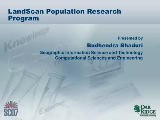
LandScan Population Research Program Budhendra Bhaduri Geographic Information Science and Technology Computational Sciences and Engineering
What is LandScan? Population distribution model, database, and tool developed from census and other spatial data using a uniform regular grid Improving knowledge of where people are located
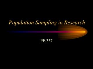
325 63 112 0 3250 630 Total PopulationBlock PCBlock= n∑ 1 WCell i,j 1120 0 How is LandScan developed? • Dasymetric spatial modeling. • Distribute best available census counts to LandScan cells based on a likelihood coefficient calculated by spatial models. • Model structure is the same everywhere, but weights for each variable are tailored to each country. • Similar operations performed for each data layer and outputs are mathematically combined. • Population is allocated to each cell. H: High-density residential L: Low-density residential F: Evergreen forest W: Water PopulationCell i,j= PCBlock Wcell i,j Aggregated to coefficient cell size WCell i,j = LCi,j PRi,j Si,jLMi,j Product of additional data types (e.g. distance from roads, slope)
1998 Kosovo Refugee Crisis LandScan Global Population Project Oak Ridge National Laboratory May 25, 1999
LandScan data resolutions: Global USA Interim USA LandScan spatial resolutions
LandScan USA Harris County and the city of Houston
Day Night
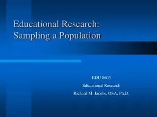
SAN DIEGO, CA - RESIDENTIAL SAN DIEGO, CA DAYTIME n
Hurricane preparedness and response FEMA Impacted Areas Source: FEMA Impacted Areas, August 31, 2005
Contact • Budhendra Bhaduri • Geographic Information Science and Technology • Computational Sciences and Engineering • (865) 241-9272 • bhaduribl@ornl.gov 14 Bhaduri_LandScan_SC07