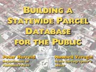
Building a Statewide Parcel Database for the Public
240 likes | 390 Views
Building a Statewide Parcel Database for the Public. Peter Herreid Department of A dministration. Howard Veregin State Cartographer’s Office. Goals of Presentation. Peter Outline Statewide Parcel Initiative and its linkages to Act 20 Howard

Building a Statewide Parcel Database for the Public
E N D
Presentation Transcript
Buildinga • StatewideParcel • Database • for the Public Peter Herreid Department of Administration Howard Veregin State Cartographer’s Office
Goals of Presentation Peter Outline Statewide Parcel Initiative and its linkages to Act 20 Howard Describe “Version 1 Parcel Map Database Project” and its relationship to the Parcel Initiative
Statewide Parcel Initiative
“Version 1” Parcel Map Project
Overview • Part of Statewide Parcel Initiative • Partnership between DOA and SCO • Collaboration with local governments • Goal is to create Wisconsin’s first public statewide digital parcel map • Project will: • Help counties achieve statutory requirements for parcel info • Assist DOA advance Statewide Parcel Initiative • Provide benefits to users and a path for future projects
Project Deliverables • Statewide parcel database • Aggregated from county and municipal data • To include attributes required by statute • Assessment data • Zoning • Addresses • Acreage • Set of final reports • Methods used • Recommendations for standards • Benchmarking
Final Report Topics • Describe tools used to standardize data • Recommend export standard for statewide integration • Recommend searchable format for parcel attributes • Identify benchmarks to assess how well individual parcel datasets meet statutory requirements • Assess county parcel datasets on these benchmarks • Analyze longer-term benchmarks (beyond Act 20)
Benchmarks • Quantitative measures of data quality • Completeness, currentness, positional accuracy, topological consistency, etc. • May be applied to parcels or other layers • A “report card” for source datasets • Helps identify actions needed to improve data • Quantitative comparisons between jurisdictions • Track improvements over time • Prioritize funding decisions, use funding strategically
Technical Implementation A “conventional” data integration approach Source datasets are physically integrated based on a common data model Resulting database is a snapshot in time
Input formats are variable. No change required to source data formats or local government workflows. Distribution formats are varied. Meet Act 20 requirements and needs of community. Outside of scope of SCO project. Updating is necessary. Source data must be reingested. Integration is complex. Stored, repeatable procedures. Common data model. Ultimately, data standards.
Not in V1 Scope • Actual hosting of data; interactive web search interface • Updates to data; filling gaps in data • Prioritization of investments to improve local data; allocation of WLIP funds • Creating a governance structure to implement standards
Data Sharing: Experience from LinkWISCONSIN EBM Project Precursor to “Version1” project Statewide parcel and address layers for WI Public Service Commission SCO/DOA collaboration Sept 2014, ends Sept 2015 http://broadbandmap.sco.wisc.edu/
Data Sharing: “Version 1” Project Extent of data sharing by local governments for public-facing data remains to be seen Excellent response for EBM project! Believe that many local govt’s will freely participate, and that we will reach data sharing agreements with the others
Benefits • Help counties achieve Act 20 requirements • Help DOA advance Statewide Parcel Initiative • Create a publically available, statewide, digital parcel map for the first time in Wisconsin • Meet diverse business needs for statewide parcels from gov’t, academia, private sector, non-profits • Enhance ROI for GIS infrastructure and WLIP funding by putting data to work • Develop standards to improve data exchange
Benefits • Develop benchmarks to enable prioritization of improvement efforts and funding • Enhance working relationships between locals and state gov’t • Model a successful statewide integration effort as a framework for future projects
Benefits • Improve Wisconsin’s position nationwide • 15 states have a statewide parcel layer > 95% complete • 14 states make the layer available to the public • 21 states have a program in place to collect local parcel data • 25 states have a designated parcel steward • http://www.nsgic.org/gma-2013/
Questions? Peter Herreid peter.herreid@wisconsin.gov (608) 267-3369 Howard Veregin veregin@wisc.edu (608) 262-6852 http://www.doa.state.wi.us/Divisions/ Intergovernmental-Relations/ Land-Information-Program www.sco.wisc.edu