Download
1 / 50
1.03k likes | 3.06k Views
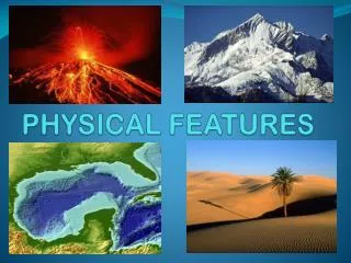
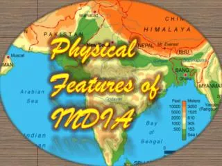
Physical Features of INDIA . Mountains. Mount Everest Karakoram Kanchenjunga Nanga Parbat Annapurna Manaslu Dhaulagiri Mountain Lhotse. Mount Everest.

E N D
Mountains • Mount Everest • Karakoram • Kanchenjunga • Nanga Parbat • Annapurna • Manaslu • Dhaulagiri Mountain • Lhotse
Mount Everest Mount Everest is the highest peak in the world. It rises to a height of 8,850m (29,035) above sea level. It is one of the mountains in the Himalayan range. Covering the frontiers of Tibet and Nepal, north of India. The mountain is named after Sir George Everest, who was a British surveyor-general of India. It is known by different names in different regions like Sagarmatha in Nepal and Quomolongma in Tibet. The latitude of Mount Everest is 27 59 17 N and Longitude is 86 55 31 E. In Sanskrit Himalayas mean, "abode of snow". The mountain is totally covered with snow. The height of the mountain varies depending on the amount of snowfall on its peak.
Karakoram K2 is also known as Austin Godwin, named after an English photographer who explored the region. Locally it is known as "Chogo Ri", meaning "The Great Mountain". It is the second highest mountain peak in the world with a height of 8,611m or 28,250ft.
Kanchenjunga Kanchenjunga is the third highest mountain peak of the world. It covers around 7000 sq km on the Sikkim and Nepal border. The word Kanchenjunga means "The Five Treasures of the Snow" in the local language, referring to its five summits, which are all over 8,000 meters. It is located at Latitude 27° 42' 9'' and Longitude 88° 9' 1 '. Kanchenjunga has an altitude of 8, 586m or 28, 169 feet, making it the world's third highest peak. It has five peaks of which the highest peak is 8,586m or 28,169 feet. It has still remained unexplored in spite of several attempts. According to Sir John Hunt, who climbed the peak of Everest with Sir edmund Hillary and Tenzing Norkey, has said Kanchenjunga is a more dangerous and hard to explore, than the Mount Everest itself. It is also known by different names like "Kachendzonga", "Kangchen Dzö-nga", and "Kangchanfanga
Nanga Parbat Nanga Parbat or naked mountain is another important peak of the Himalayan range. According to sources it is the ninth highest mountain in the world. It is located in regions of Baldistan, Korakoram Range, Gilgit, Pakistan. Nanga Parbat has a height of 8,126m or 26,660 ft. The mountain has such sharp edges that it cannot hold much of snow. That's the reason the mountain peaks have an unclad appearance. It has three faces, the Rahikot, Diamir and rupal. It is considered a very dangerous mountain because of the tragedies, which took place earlier. It is located at Longitude 74.35 and Latitude 35.10.
Annapurna Among the other famous peaks of the Himalayas the Annapurna range is a very important Himalayan range. It is located in central Nepal Himalayas with an altitude of 8,091m. It ranks 10th highest mountain in the world. The Annapurna range stretches from west to east consisting of the following major peaks of the range:Annapurna South Face: altitude: 7,219m,Gang: altitude: 7,647m, Gangapurna: altitude: 7,455m,Annapurna III: altitude: 7,555m,Annapurna IV: altitude: 7,525m and Annapurna II: altitude: 7,937m.Annapurna I altitude: 8,091 m.It is located to the east of a great gorge that cuts through the Himalayas by the Kali Gandaki river, on its western and northwestern slopes it has glaciers, which drain into this gorge. Annapurna has many high peaks but the two highest peaks are Annapurna I and Annapurna II, at the western and eastern ends.
Manaslu Manaslu, is located in Nepal about forty miles east of Annapurna with an altitude of 8,156m. It is the 8th highest mountain in the world. Manaslu is the highest peak of the Gurkha plateau. The name Manaslu is taken from a Sanskrit word "Manasa" which means "Mountain of the Spirit". It is located at longitude 84.33 and latitude 28.33. Other than the Manaslu the other high peaks of the Gurkha plateau are as follows:Manaslu North altitude: 7,154 m.Dakura altitude: 7,837 m. Himal Chuli altitude: 7,864 m.Manaslu East altitude: 7,894 m.
Dhaulagiri MountainIt is located in the Eastern Nepal, Nepal and Tibet border with an altitude of 8,201m, is the 7th highest mountain in the world. Dhaulagiri means "white mountain". It is the highest mountain located entirely within Nepal. The peak stretches for 30 miles consisting of sharp ridges, icefalls, and glaciers. Along the main peak, several other pyramid-shaped peaks rise. Four of these peaks, from east to west, rise above 25,000 feet. It is located at longitude 83.30 and latitude 28.42.
LhotseLhotse is the fourth highest peak in the Himalayan range. It is located in the China and Nepal border with an altitude of 8,516m. The peak stretches from east to west, which is located south of Mount Everest. South Col, a vertical ridge connects the peaks of the two mountains, which is never below 8, 000m. Other than the main peak of the Lhotse there are two other peaks like Lhotse Shar, which is located east of the main peak, and Nuptse, which is on the mountain's west ridge. It is located at longitude 86.56.03 and latitude 27.57.45.
Plains • Malwa (Punjab) • Eastern coastal plains • Utkal Plains • Indo-Gangetic Plain • Punjab Plain • Western Coastal Plains • Terai
Malwa (Punjab) Malwa (Punjabi: ਮਾਲਵਾ) is a region of Punjab and parts of Haryana between the Sutlej and Yamuna rivers. It makes up the majority of the Punjab region, consisting of 11 districts or parts of districts. The people of the region are called Malwais, and the dialect of Punjabi spoken is called Malwai.
Eastern coastal plains The Eastern Coastal Plains refer to a wide stretch of landmass of Indialying between the Eastern Ghatsand the Bay of Bengal. It stretches from Tamil Nadu in the south to West Bengalin the north. Deltas of many of India's rivers form a major portion of these plains. The Mahanadi, Godavari, KaveriandKrishna rivers drain these plains. The region receives both the Northeast and Southwestmonsoon rains with its annual rainfall averaging between 1,000 mm (40 in) and 3,000 mm (120 in). The width of the plains varies between 100 to 130 km (62 to 80 miles) [1]. It is locally known as Northern Circars between Mahanadi and Krishna rivers and Carnatic between Krishna and Kaveri rivers.
Utkal Plains The Utkal Plains are coastal plains in the Orissa state of eastern India. They include the delta of the Mahanadi River, Brahmani River, Baitarani River. Ranges from Swarnarekha Riverin north toChilika in south
Indo-Gangetic Plain The northern Plains also known as the Indo - Gangetic Plain and The North Indian River Plain is a large and fertile plain encompassing most of northern and eastern India, the most populous parts of Pakistan, parts of southern Nepal and virtually all of Bangladesh.The region is named after the Indus and the Ganges, the twin river systems that drain it. The plain's population density is very high due to the fertile soil for farming. The Indo-Gangetic plain is bound on the north by the abruptly rising Himalayas, which feed its numerous rivers and are the source of the fertile alluvium deposited across the region by the two river systems. The southern edge of the plain is marked by the Vindhya- and Satpura Range, and the Chota Nagpur Plateau. On the west rises the Iranian Plateau.
Punjab Plain The Punjab Plain is an alluvial plain in Pakistan and the north-west of India. The plain includes the Pakistani province of Punjab and Indian states of Punjab and Haryana and is around 35,000 square miles (91,000 km2) in area. The plain is extensively farmed for cereals and cotton. The plain is the western part of the Northern Plain in Pakistan formed by the Indus River and its tributaries.
Western Coastal Plains The Western Coastal Plains is a thin strip of coastal plain 50 kilometres (31 mi) in width between the west coast of India and the Western Ghats hills which starts near the south of river Tapi. They are sandwiched between the Western Ghats and the Arabian Sea. The plains begin at Gujarat in the north and end at Kerala in the south. It also includes the states of Maharashtra, Goa and Karnataka. It consists of three sections. The Northern part of the coast is called the Konkan while the southern stretch is referred to as the Malabar Coast. On its northern side there are two gulfs: the gulf of Khambat and the gulf of Kachch .It is known as Konkan in north (goa - maharashtra) region.
Terai The Terai is a belt of marshy grasslands, savannas, and forests located south of the outer foothills of the Himalaya, the Siwalik Hills, and north of the Indo-Gangetic Plain of the Ganges, Brahmaputra and their tributaries. The Terai belongs to the Terai-Duar savanna and grasslands ecoregion. In northern India, the Terai spreads eastward from the Yamuna RiveracrossHimachal Pradesh, Haryana, Uttaranchal, Uttar Pradesh and Bihar. Corresponding parts ofWest Bengal, Bangladesh, Bhutan and Assam east to the Brahmaputra River are called Dooars.The lowland plains of the Terai lie at an altitude of between 67 and 300 m (220 and 980 ft). North of the Terai rises the Bhabhar, a narrow but continuous belt of forest about 8–12 km (5.0–7.5 mi) wide.
Plateaus • Bhander Platea • Chota Nagpur Plateau • Deccan Plateau • Malwa • Mysore Plateau • Shillong Plateau • Tibetan Plateau
Bhander Plateau The Bhander Plateau is a plateau in the state of Madhya Pradesh in India. It has an area of 10,000 km². (4,000 sq mi). It links the Deccan Plateau to the south with the Indo-Gangetic Plains and the Chota Nagpur Plateau to the north and east respectively. The plateau is part of the Vindhya Range in central India A series of plateaux runs along the Kaimur Range. These fluvial plateaux, consists of a series of descending plateaux, starting with the Panna Plateau in the west, followed by Bhander Plateau and Rewa Plateau and ending with Rohtas Plateau in the east.
Chota Nagpur Plateau The Chota Nagpur Plateau (Hindi: छोटा नागपुर पठार) is a plateau in eastern India, which covers much of Jharkhandstate as well as adjacent parts of Orissa, West Bengal, Bihar and Chhattisgarh. The Indo-Gangetic plain lies to the north and east of the plateau, and the basin of the Mahanadi River lies to the south. The total area of the Chota Plateau is approximately 65,000 square kilometres (25,000 sq mi)
Deccan Plateau The Deccan Plateau is a large plateau in India, making up most of the southern part of the country. It rises a hundred meters high in the north, and more than a kilometer high in the south, forming a raised triangle within the familiar downward-pointing triangle of the Indian subcontinent's coastline. It is located between three mountain ranges: the Western Ghats form its western boundary, and the Eastern Ghats its eastern boundary. Each rises from their respective nearby coastal plains and nearly meet at the southern tip of India. It is separated from the Gangetic plain to the north by the Satpura and Vindhya Ranges, which form its northern boundary
Malwa Agriculture is the main occupation of the people of Malwa. The region has been one of the important producers of opium in the world. Cotton and soybeans are other important cash crops, and textiles are a major industry. The Malwa Plateau generally refers to the volcanic upland south of the Vindhya Range. Politically and administratively, the historical Malwa region includes districts of western Madhya Pradesh and parts of south-eastern Rajasthan. The definition of Malwa is sometimes extended to include the Nimar region north of the Vindhyas.
Mysore Plateau arnataka Plateau, plateau in Karnataka state, southern India. The name of the plateau is derived from Karnad (“Land of Black Soil”). The plateau has an area of about 73,000 square miles (189,000 square km) and an average elevation of about 2,600 feet (800 metres). It consists of the Dharwar system of volcanic rocks, crystalline schists, and granites. The major rivers include the Godavari, Krishna, Kaveri (Cauvery), Tungabhadra, Sharavati, and Bhima. The Sharavati has the highest waterfall in India, known as Jog Falls (830 feet [253 metres)] . These falls are one of the most important sources of hydroelectric power in the country and are also a major tourist attraction. The plateau merges with the Nilgiri Hills in the south. Rainfall varies from 80 inches (2,030 mm) in the southern hills to 28 inches (710 mm) in the northern region.
Shillong Plateau The Shillong Plateau is a plateau in eastern Meghalaya state, northeastern India. The plateau's southern, northern, and western ridges form the Garo, Khasi, and Jaintia Hills respectively. The plateau shows numerous fracture lineaments in satellite images and has been subjected to extensive compressive forces in the N-S and E-W direction. Several deep earthquakes point to tectonic activity in the mantle, such as from the 1897 Assam earthquake along the blind Oldham Fault.
Tibetan Plateau The Tibetan Plateau (Tibetan: བོད་ས་མཐོ།, Wylie: bod sa mtho), also known as the Qinghai-Tibetan (Qingzang) Plateau (Chinese: 青藏高原; pinyin:Qīngzàng Gāoyuán) is a vast, elevated plateau in Central Asia or East Asia covering most of the Tibet Autonomous Region and Qinghai Province in western China, as well as part of Ladakh in Jammu and Kashmir, India. It stretches approximately 1,000 kilometres (620 mi) north to south and 2,500 kilometres (1,600 mi) east to west. With an average elevation exceeding 4,500 metres (14,800 ft), the Tibetan Plateau is sometimes called "the Roof of the World" and is the world's highest and largest plateau, with an area of 2.5 million km2 (0.97 million sq. mi., or about four times the size ofFrance)