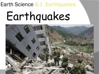
The Earth’s Surface: Earthquakes
60 likes | 198 Views
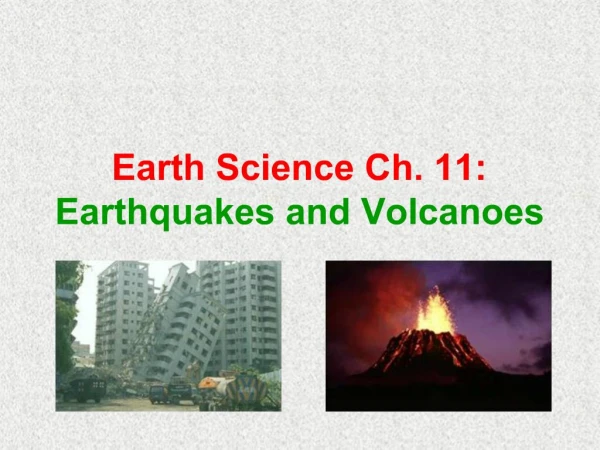
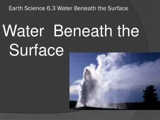
Earthquakes are powerful vibrations caused by intense pressure in the Earth's crust, leading to destructive seismic waves. They often strike populated areas with devastating effects, causing massive damage and loss of life. Scientists measure earthquake strength with seismographs, which provide crucial data on magnitudes. The 1906 San Francisco earthquake exemplifies the catastrophic impacts: over 28,000 buildings destroyed, 3,000+ fatalities, and extensive homelessness. Understanding earthquakes is vital for disaster management and improving structures to withstand future seismic events.

The Earth’s Surface: Earthquakes
E N D
Presentation Transcript
The Earth’s Surface: Earthquakes http://environment.nationalgeographic.com/environment/photos/earthquake-general/ The Earth’s Surface: Earthquakes
Earthquakes: Why they are so scary! Earthquakes: they are vibrations deep into the Earth’s crust caused by high pressure build up causing the Earth to buckle, break and burst open under immense stresses. The Earth reveals it’s awesome destructiveness as it shakes and rumbles demonstrating the power of its seismic wave motions, resulting in devastating and catastrophic impacts. It does not discriminate as it releases a massive amount of energy to fuel its destructive power. The damage caused by earthquakes is far greater in populated areas. Massively over populated areas create an even greater concern for authorities due to over building increasing chances of a higher death toll. Features: loud noise, shaking ground often violent, buildings swaying or crumbling, grounds opening up, wave motions of ground and an epicentre. http://geot.civil.ues.tmu.ac.jp/archives/eq/04niigata/M/277.jpg
How do scientists know the strength of an Earthquake? Measuring an earthquake is done by an instrument called a Seismograph. Scientists are able to determine how strong an earthquake is by converting data received into a strength number using mathematical formulas. This “strength number” is called a Magnitude with the strongest magnitude being a 10. The first seismograph was invented by a Chinese mathematician in 132AD. Today the instruments are more sophisticated enabling scientists to ensure the accuracy of information. http://www.geo.mtu.edu/UPSeis/studying.html http://earthquake.usgs.gov/learn/glossary/?term=seismograph
Date: 18th of April 1906 Location: California Economic Loss” $400million Death Toll: 3000+ Homeless: 225,000 28000 buildings destroyed The San Franciscan earthquake was the catalyst for future improvements to Disaster Management Plans. Geologists learnt a great deal for ways on improving the building structures and the types of materials to be used for construction. San Francisco is located along the San Andreas fault, a fault line with an enormous amount of movement and energy in the Earth’s crust that some predict that another earthquake will be even more catastrophic. The sheer scale of this earthquake for its time, triggered fires through ruptured gaslines, electrical wiring and oil lamps that were situated in restaurants. The magnitude was recorded in Germany 9100kms away. San Francisco Earthquake - 1906 http://www.eas.slu.edu/eqc/eqc_photos/1906EQ/sanfran/010.html
Plus, Minus, Interesting Earthquakes