Download
1 / 49
490 likes | 513 Views
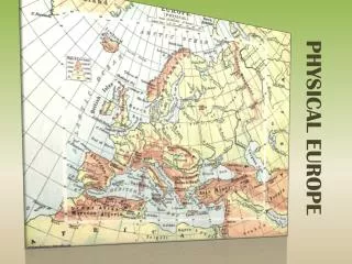
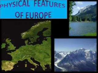
Explore Europe's diverse geography, from peninsulas to mountains, rivers to plains. Learn why understanding these features is essential for a broader perspective on the region's history and significance. Watch now!

E N D
Why should we learn about geography, anyway?! https://www.youtube.com/watch?v=7_pw8duzGUg Jay Leno clip
European Physical Features • https://www.youtube.com/watch?v=Z8brpoU_HNI
Region One: Peninsulas
Peninsula A peninsula is a body of land nearly surrounded by water
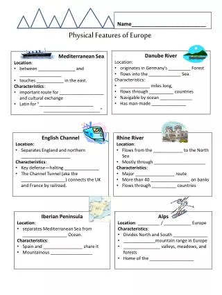
Portugal and Spain make up the Iberian Peninsula. Iberian Peninsula
Region Two: Plains
Plain A large area of flat or nearly flat land.
Begins in Germany and stretches through almost to the Ural Mts.
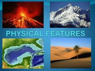
Region Three: Mountains
mountain Is a high, rounded or pointed landform with steep sides.
The Alps They cover most of Switzerland, Austria, and parts of Italy and France.
Mt. Blanc in the Alps Highest mountain in the Alps: 15,771 feet
Ural Mountains: “The Great Divide” Divide” 1500 miles The Ural Mountains divide Russia into 2 parts: European and Asian part of Russia
The Pyrenees Mountains form the border between France and Spain.
Region Four: Waterways
Danube River • Begins in Germany’s Black Forest and ends in the Black Sea • It’s 1,771 miles long.
It flows through 10 different European countries. • It is one of the most significant commercial waterways on the continent and the 2nd longest river in Europe.
RHINE A L P S
Rhine River • The Rhine flows Northward (like a rhino’s nose) from the Swiss Alps to Germany. • It is nearly 766 miles long and is the busiest shipping route in the world!
The Rhine and the Danube formed most of the northern frontier of the Roman Empire, and since those days the Rhine has been a vital navigable waterway, carrying trade and goods deep inland.
Vocabulary: • Navigable means water routes are deep enough and wide enough to be used by ships.
The English Channel is an “arm” of the Atlantic Ocean that separates England from northern France. • It joins the North Sea to the Atlantic. • It is about 350 miles long.
Chunnel • The “Chunnel” is a 31.4 mile long undersea rail tunnel linking the United Kingdom to France and the rest of Europe. • The Chunnel was opened in 1994. • It has 2 single tracked rail lines and 1 service track rail line.
The Mediterranean is a sea of the Atlantic Ocean surrounded by the Mediterranean region and almost completely enclosed by land. • It is approx. 965,000 sqare miles.
The Mediterranean Sea was an important route for merchants and travelers of ancient times, allowing for trade and cultural exchange between the peoples of the region.