Download
1 / 21
210 likes | 390 Views
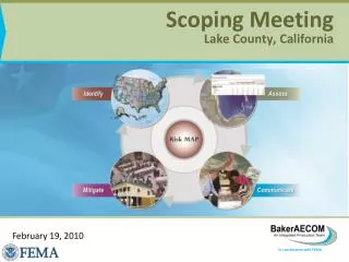
Scoping Meeting Lake County, California. February 19, 2010. Agenda. Introductions/Sign-In National Flood Insurance Program Overview FEMA Mapping Goals Community and Partner Agreement Discussion Scope of Study Study Process/Timeline Levees and Other Flood Control Structures

E N D
Scoping MeetingLake County, California February 19, 2010
Agenda • Introductions/Sign-In • National Flood Insurance Program Overview • FEMA Mapping Goals • Community and Partner Agreement Discussion • Scope of Study • Study Process/Timeline • Levees and Other Flood Control Structures • Base Map and Topographic Data • Community Mapping Needs and Requests • Summary of Action Items
NFIP Overview • U.S. Congress established the Nation Flood Insurance Program (NFIP) with the passage of the National Flood Insurance Act of 1968 • Federal Program enabling property owners in participating communities to purchase insurance • Participation in NFIP is based on an agreement between communities and the Federal Government • Community must adopt and enforce a floodplain management ordinance to reduce future flood risk to new construction in floodplains • Provides an alternative to disaster assistance • Three aspects of the NFIP • Floodplain Identification and mapping • Floodplain Management • Flood Insurance
FEMA Mapping Goals • Risk Mapping, Assessment and Planning • Identify Flood Hazards • Reduce loss of life and property through effective local mitigation activities • Provide digital flood hazard data in accessible formats
FEMA Mapping Goals, cont… • Address gaps in flood hazard data • Increase public awareness and understanding of risk • Assist and support local entities engaging in risk-based mitigation planning • Provide digital data
FEMA Mapping Study Priorities • FY09 • Expiring PALs and other levee issues • Coastal studies • Other engineering needs (such as datum conversions) • FY10 + • Coastal studies • Watershed-based hazard identification
COMMUNITY AGREEMENT • Acts as an acknowledgement of the Flood Study Project and an agreement to work together toward a common goal • Documents good faith efforts to collaboratively assess the community’s need • Develop an appropriate Scope of Project • Develop and Publicize the updated map that results from the Flood Map Project • Lake County has entered into a Cooperating Technical Partner (CTP) agreement with FEMA RIX
SCOPE for Lake Co, CA Project • Apply Datum Conversion to effective DFIRM • Conversion factor(s) TBD • Address Levee Accreditation through PAL process if applicable • Update base map information • Correct mistakes from previous mapping effort • FW not containing stream • Incorrect profile for Adobe Creek
Scoping/Kickoff Data Development Engineering Analysis Floodplain Mapping DFIRM Production Post-preliminary Processing STUDY REVISIONPROCESS
STUDYREVISIONPROCESS Preliminary Post-Preliminary Processing Preliminary Issuance Community Review and Final Meeting Preparation of Final Map Products DFIRM becomes effective Issue Letter of Final Determination Compliance Period (DFIRM Is adopted by ordinance) Dec 2010 Feb-May 2011 6 Months Dec 2011 Jan-Feb 2011 June 2011
LEVEES AND OTHER FLOOD CONTROL STRUCTURES • Middle Creek • Maintenance: Lake County • USACE-built • Clover Creek • Maintenance: Lake County • USASE-built • Adobe Creek • Maintenance: Lake County • USACE-built
LEVEES: PROTECTION WITH RISK • Levees are designed to provide specific level of protection • They can be overtopped or fail in larger flood events • They require regular maintenance and periodic upgrades to retain their level of protection • FEMA urges people to understand their flooding risk involving levees
LEVEE OWNERSHIP • FEMA does not own, operate, maintain or certify any levees • FEMA can accredit a levee certification provided by others • The levee owner can certify the design, construction, operation and maintenance of a levee • Community is benefiting from the levee
FEMA ACCREDITATION AND CERTIFICATION • If adequate certification is provided and accepted, FEMA will accredit the levee as providing protection • If levee is certifiable, but community needs time to gather documentation required in CFR65.10, a Provisional Accreditation status is available through the Provisionally Accredited Levee (PAL) process. • If levee certification is not attainable, the area will be mapped with the levee not providing protection per direction in PM52
BASE MAP AND TOPOGRAPHIC DATA • See Map Provided • Data gathered for this meeting from the following sources: • Midterm Levee Inventory • Tiger Data • Effective DFIRM Data
MAPPING NEEDS & REQUESTS • Previously unstudied areas • Existing studies need to be updated • Topographic changes • Hydrologic changes • Existing or Anticipated Development • FEMA-funded studies prioritized based on: • Community need • Level of risk • Availability of topographic data
ACTION ITEMS • Populate CNMS with Needs and Requests collected during scoping meeting • Acquire Base Map and Topographic products