Download
1 / 36
360 likes | 384 Views
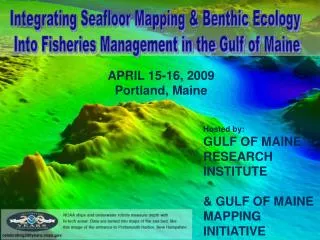
Discover the depths of the Gulf of Maine and its seafloor characteristics, including topography, geology, and biology. Learn about the history of seafloor mapping techniques and the importance of mapping for various stakeholders. Explore the Gulf of Maine Mapping Initiative's mission, objectives, and ongoing activities to map the entire basin.

E N D
Seafloor Mapping Basics: How deep is the water? What are the seafloor’s characteristics? -topography, geology, biology
1930s A.D. Direct Depth Measurements Lead line 1800 B.C. .
Indirect Measurements using Sound 1920s Echo sounder (single beam) 1950s Multibeam sonar systems Fullcoverage Discrete points
Traditional Nautical Charting 1960 Echo sounders (with supplementary sounding poles and lead line) 1860 Lead lines
Charting andModern MappingCombined 2001 Charting
Benthic Habitat Maps Habitat maps interpret biological and geological data to show types of sediment and animals in a particular area Geological Survey of Canada
Applications of Seafloor Mapping Important tools for • Managers • Scientists • Industry (oil & gas, shipping, mining, etc.) • Fishermen • Other stakeholders
Stellwagen Bank National Marine Sanctuary Using seafloor maps, cable was routed through soft sediment US Geological Survey Management Success Story: Routing a Fiber-Optic Cable
Superimposing A.F. Pierce’s tracks on a seafloor map reveals that the vessel had dragged its fishing gear through mixed habitat: sand, gravel, and rocky outcrops. Fisheries Success Story Before Mapping This image shows some tracks of scallop vessel A.F. Pierce. These tracks were planned using only a traditional nautical chart.
They caught just as many scallops by dragging over only 25% as much area. Savings in towing time and distance led to lower costs for fuel and crew. After Mapping By using seafloor maps to plan their tracks, scallopers avoided rocky outcrops, reducing damage to fishing gear and bottom habitat.
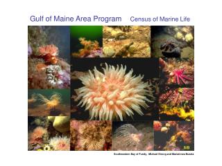
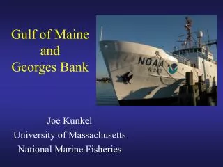
Gulf of Maine • One of the world’s most productive and important ocean systems • Bi-national jurisdiction • Diverse topography • Supports a wide range of human uses
Gulf of Maine activities that could benefit from mapping • LNG terminals • Electric power cables • Offshore wind farms • Sand and gravel mining • Petroleum exploration and production • National security • Aquaculture leases
However… • Only ~20% of the Gulf of Maine has been mapped using multibeam • Benthic habitat mapping: much lower percentage GOMMI
Gulf of Maine Mapping Initiative What is GOMMI? • A partnership of governmental and NGOs in the US and Canada • Subcommittee of • Led by 11-member Steering Committee (volunteers) • Federal: US & Canada • State: MA, NH, ME • Academia: UNH CCOM/JHC
GOMMI’s Mission • To promote mapping of the entire Gulf of Maine basin
GOMMI’s Objectives • Facilitate communication and collaboration within the mapping community • Build logistical and financial support for new projects • Make maps and data widely available
Four-phased strategic approach • Phase 1: Assess the need for GOM seafloor mapping • Phase 2: Strategic Plan • Phase 3: User Needs Assessment • Phase 4: • Secure partnerships and funding • Implement: • Fieldwork • Data management and interpretation, and • Product distribution
In 2005 GOMMI helped direct $1.5 M NOAA funds to an acoustic survey in the Western Gulf of Maine 50 Nmi 71 Nmi Area Surveyed by The NOAA Ship Thomas Jefferson Provincetown, MA Platts Bank N Jeffreys Ledge
2005 2005 survey built on existing coverage of Western GOM NEXT: needs groundtruthing; geological and biological data Also Surveyed In 2005
2006 GOMMI ACTIVITIES • Two-year work plan • Interactive multibeam coverage map • Pilot groundtruthing project on Cashes Ledge: GOM Research Institute and University of Ulster • Outreach and education: • Semi-annual e-newsletter • Seafloor mapping kiosk
Challenges Ahead • Mapping in Canadian GOM is progressing well (Geological Survey of Canada) • National Priority, Oceans Action Plan; • Line item in federal budget • No similar investment in US GOM • No single US entity mandated to map US seafloor • No dedicated federal funds
GOMMI’s Next Big Step • Raise financial and logistical support to set up and run a significant regional ocean mapping program in the Gulf of Maine
GoM Mapping Program • Where? University of New Hampshire • Why there? Center for Coastal and Ocean Mapping /Joint Hydrographic Center • national center of ocean mapping expertise • located in the GOM • employs and collaborates many mapping experts • excellent student training program • largely NOAA-supported • already gathered and processed data for GOMMI • long-term Cooperative Agreement with USGS’s Coastal and Marine Geology Program • much of the infrastructure already exists
GoM Mapping Program at UNH Why? more formal association with UNH’s CCOM would provide sound infrastructure including: • technical expertise • administrative support • strategically located headquarters
What Next? • Identify and secure funding • legislative outreach • inter-agency partnerships • private/public partnerships • Work with UNH/CCOM to establish program requirements “to hit the ground running”
But Wait, There’s More… • Continue benthic habitat mapping on Cashes Ledge • proof of concept of regional mapping collaboration • Continue outreach and education efforts via web site, newsletters, public presentations, workshops
GOMMI’s Success Will Require creative collaborations between researchers and managers representing • Government • Academia, and • Private sector
Take Home Message • Benthic habitat maps are vital tools to help managers visualize • distribution • diversity, and • extent of marine communities under their jurisdiction • By establishing a Gulf of Maine habitat mapping program, GOMMI will contribute to the comprehensive planning and management of ocean resources
Gulf of Maine Mapping Initiative www.gulfofmaine.org/gommi