Overview
Measuring Snowfall Intensity using LWE (Liquid Water Equivalent) - Randy Baker representing A4A Meteorology Work Group 08 AUG 2012. Overview. Difficulties with current reporting of snowfall intensity based on visibility Visibility is a poor proxy for water content of the snow

Overview
E N D
Presentation Transcript
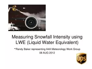
Measuring Snowfall Intensity using LWE (Liquid Water Equivalent)-Randy Baker representing A4A Meteorology Work Group08 AUG 2012
Overview • Difficulties with current reporting of snowfall intensity based on visibility • Visibility is a poor proxy for water content of the snow • Visibility may be restricted by other obscurations (fog, etc.) • Snowfall Intensity using LWE is much more accurate. • LWE is the basis of existing Holdover Tables for aircraft anti-icing. • Data needed is available now
Snowfall Intensity Table • Intended to improve assessment of snowfall intensity based on visibility • First developed by Dr. Roy Rasmussen in 2003 • Made more restrictive by FAA in 2005 • Made mandatory for U.S. carriers in 2010
Recent Events • ANC 1/5/2012 • PTOCC accomplished • Aircraft departed 1+30 late • STN 2/09/2012 1800 – 2400z • 2 Aircraft delayed • 2 hours (CGN) / 5 hours (SDF) • 8280 express packages missed service • $1.5 million • SDF 2/14/2012 0600 – 1200z • Nearly put into PTOCC situation
SNOWFALL INTENSITIES AS a FUNCTION OF PREVAILING VISIBILITY Winter 2012-2013
More difficulties… • Some international airports don’t use visibility to determine snowfall intensity • CAP746 United Kingdom - In the absence of an internationally agreed scale, intensity is assessed from the rate of accumulation: Light: up to 0.5 cm/hr; Moderate: more than 0.5 to 4 cm/hr; Heavy: over 4 cm/hr.
One further difficulty… Snowfall intensity table adds complexity to a pilot’s pre-flight duties during snow events
Snowfall Intensity Table – Decision Matrix Snow is reported in METAR ---------------------------------------------------------------- Determine operating limitations Is snow reported as HEAVY? No Yes Use METAR-reported snowfall intensity, and refer to appropriate Holdover Table to determine allowable holdover time. DO NOT USE the Snowfall Intensity Table. Yes Is FG, FZFG, BR, HZ or FU also reported? No Refer to Snowfall Intensity Table. Using visibility, temperature and time of day, is the snowfall intensity HEAVY? Yes WARNING: Do Not Depart unless PTOCC inspection is accomplished within 5 minutes of takeoff. No Refer to appropriate Holdover Table to determine allowable holdover time
If Snowfall Intensity Table, as currently configured, often gives inaccurate guidance… - is there a better alternative?
Liquid Water Equivalent • LWE data exists today to provide the Observer with accurate measure of snowfall intensity • With minimal training Observers can use LWE data to provide more accurate snowfall intensity in the METAR
Use ASOS LWE for METAR Snow Intensity • Change FAA 7900.5B definition of Snow intensity based on LWE: • Heavy – Greater than 0.10”/hour LWE (2.5mm/hr) • Moderate – Greater than 0.04”/hour (1mm/hr) up to 0.10”/hour (2.5mm/hr) LWE • Light – Up to 0.04”/hour (1mm/hr) LWE • When LWE is not available, the observer shall use the standard visibility thresholds (assuming snow is the only restriction to visibility): • Heavy - Visibility less than or equal to ¼ mile (400m) • Moderate – Visibility greater than ¼ mile (400m) but less than or equal to ½ mile (800m) • Light – Visibility greater than ½ mile (800m)
Augmenter Monitors Precipitation Type and Intensity • Augmenter currently modifies the ASOS snow intensity when the value is not representative. • PANC freezing fog… • augmenter over-rides the ASOS +SN code with –SN. • If ASOS shows –SN based on visibility, but the augmenter sees LWE rates supporting moderate, the augmenter simply over-rides the ASOS by putting in SN.
Snow Intensity Rate Using LWE Minutes Between 2 Consecutive 0.01” increases This process can be automated for ASOS
Correction for Wind Undercatch • Double Alter Shield undercatch can be corrected based on wind speed. From “NOAA/FAA/NCAR Winter Precipitation Test Bed: How Well Are We Measuring Snow?” (Rasmussen, et al. 2010)
LWE Wind Factor • Observer multiplies previous LWE rate by the factor in this table to correct for snow undercatch due to wind. • Example: LWE 0.04”/hr and average wind 7 knots 0.04 x 1.5 = 0.06 (Moderate Snow)
ASOS LWE Advantages • Simplifies the pilot decision-making process • Use intensity as reported by ATIS and the METAR
Recommendations • FAA/NWS change to LWE-based reporting of Snowfall Intensity for use in METAR • Eliminate mandatory use of the Snowfall Intensity Table

