Download
1 / 28
280 likes | 422 Views
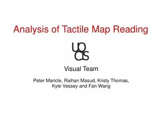
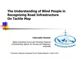
The Understanding of Blind People in Recognizing Road Infrastructure On Tactile Map. F akhruddin Mustofa Badan Koordinasi Survei dan Pemetaan Nasional ( Coordinanting Agency for Surveys and Mapping ) , Indonesia. Presented: Malaysia Geospasial Forum Melaka,Malaysia 7 March 2012.

E N D
The Understanding of Blind People in Recognizing Road Infrastructure On Tactile Map Fakhruddin Mustofa Badan Koordinasi Survei dan Pemetaan Nasional (Coordinanting Agency for Surveys and Mapping), Indonesia Presented: Malaysia Geospasial Forum Melaka,Malaysia 7 March 2012
“Pantun” for All Beda negara tuk saling kenal Agar tumbuh rasa cinta Ayo kita belajar geospatial Di kota bersejarah Melaka Tepian Selat Melaka 7 March 2012, Fakhruddin M
Introduction The need of information including spatial information or geospatial is a human right. Geospatial information plays a role to enhance human knowledge in relation with region and its supporting infrastructures. The knowledge itself is important especially to strengthen orientation ability which influences mobility’s level. The higher the human ability in recognizing the transportation facilities represents the higher their mobile ability. This mobile ability contributes human activity in fulfilling their need and resolving their problems.
Introduction Data and geospatial information are commonly available in the form of map both digital and paper sheet. Generally, those maps are intended to normal people with good sight How the Map for Blind People ? I Care or I Don’t Care?
Map of Spatial Planning in Indonesia Map for good sight Clearly Visible (red, blue, green etc, shape, grid)
Tactual Map Map forBlind People Braille Words Embossing the Map
Objective and Goal Objective: Introduce road infrastructure displayed on tactile map to blind people Examine the ability to read tactile map with theme of land transportation Goal: Blind people consist of teacher and student at junior high school and senior high school in Bandung, Makassar, and Surakarta. The total is 90 people. Final goal is intended to the other special schools in another province in Indonesia
Methods Tools: Readable test instrument, i.e. 30 questions related to road infrastructure. Tactile map with theme of land transportation. The dimension of the map is A3-paper size. The map covers several regions in Indonesia, i.e. Sumatra Island, Java Island, South Sumatra Island, West Java Island, Special Region of Jakarta, Central Java Province, Yogyakarta Special Province, and East Java Province. Method: Recognizing several variables used on tactile map Answering the questions Evaluating the result
Methods Tools: Readable test instrument, i.e. 30 questions related to road infrastructure. Tactile map with theme of land transportation. The dimension of the map is A3-paper size. The map covers several regions in Indonesia, i.e. Sumatra Island, Java Island, South Sumatra Island, West Java Island, Special Region of Jakarta, Central Java Province, Yogyakarta Special Province, and East Java Province. Method: Recognizing several variables used on tactile map Answering the questions Evaluating the result
Legend Area Line Point/dot
Example of Questions Type of area orientation Malaysia is located in……. Northern part of Sulawesi Island Northern part of Kalimantan Island Northeastern part of Timor Island Eastern part of Papua Island Malaysia State (Serawak) Kalimantan/Borneo Sulawesi Papua Timor
Example of Questions Type of line shape Rail way in Sumatra Island connects ……..citywith……..city Bandar Lampung - Bengkulu Palembang - Padang Bandar Lampung - Padang Bandar Lampung - Palembang
Result Symbol introduction held in the first day of the test gave a result that most participants did not fully understand the symbols. This situation was caused by less experience in reading the map. To cope with this condition, instructor helped them by explaining related material to the symbols.
After introducing the symbols, the test was continued by touching the symbols on the map. Participants made some simple spatial analyses. Those simple analyzes were intended to develop thought and perception about regions and connectivity among them. Participants touched all road network (high way, main, secondary, and rail way) and tried to find the correlation among them, particularly starting point and end of the road. The points themselves were associated with the first city in the beginning of the road, the last city in the end of the road, and several cities passed by such road.
Jakarta Cirebon This Figure shows rail way network in West Java Province. Generally, all participants are able to understand rail way network between Jakarta - Cirebon and Jakarta - Bandung - Tasikmalaya. This connectivity represents the relationship among places and spaces. Based on this relationship, blind people can choose their alternative way and transportation mode to get into the intended place Bandung Tasikmalaya
Answer The Question and Evaluation At least 30 questions were given to the participants in order to find out the ability to read and to understand the tactile map. Based on this method, the participants were expected to be able recognizing line shape, area shape, line dimension, area dimension, point orientation, area orientation, and area texture The Participants Filled the Answer Sheet
Answer The Question and Evaluation Evaluation was conducted to analyze the answer of the participants. Commonly, the answer represents the comprehension of participants to decipher the tactile map with theme of land transportation. If participants could answer more than 60% of questions, it assumed that they were able to understand variables and symbols. However, less than 60% stands for the condition in which they could not well understand the variables and symbols.
Can You Help me???? OK This is a Riau
Table 2. The Comparison and Evaluation of Participant’s Answer EVALUATION RESULT
Conclusion • Generally, the main symbol used on tactile map with theme of land transportation (rail way, high way, main road, and secondary road) can be identified by the participants. It can be shown from the percentage of correct answers. • Less comprehension in recognizing the symbols is influenced by less experience and knowledge to read the map. • Specification of main symbol on current tactile map (rail way, high way, main road, and secondary road) is proposed to be standardized and utilized as a guidance to develop tactual map with theme of land transportation.