Download
1 / 26
300 likes | 634 Views
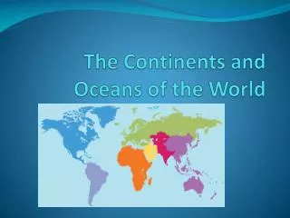
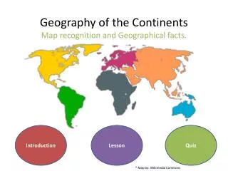
Geography of the Continents Map recognition and Geographical facts. . Introduction. Lesson. Quiz. * Map by: Wikimedia Commons. INTRODUCTION. Level: Grade 4 Subject: Geography Objective: To introduce students to the seven continents of the world.

E N D
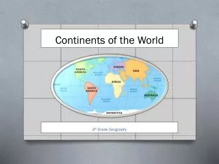
Geography of the ContinentsMap recognition and Geographical facts. Introduction Lesson Quiz * Map by: Wikimedia Commons
INTRODUCTION Level: Grade 4 Subject: Geography Objective: To introduce students to the seven continents of the world. Directions: Students will interactively learn about the continents and their location on Earth. Then they will be quizzed on the information they have learned. HOME NAVIGATION DIRECTIONS
NAVIGATION TUTORIAL Use the icon buttons to navigate through the lesson Use the icon buttons to navigate your way through this project. The buttons will either take you to the next slide or can take you to the homepage. They will serve as your guide through this assignment. The homepage has three icons. The introduction button will give you information on the topic. The lesson button will begin teaching you the assignment. Lastly the quiz button will test your knowledge on the learned information. Good luck! HOME NEXT SLIDE START LESSON
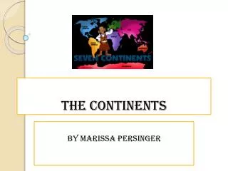
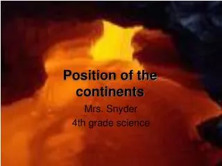
LESSON • The Earth’s surface is covered by 70% water and only 30% land. The land then is broken into seven areas. These areas are called continents. The Seven Continents: ASIAAUSTRAILIAAFRICA ANTARTICA NORTH AMERICA SOUTH AMERICA EUROPE NEXT SLIDE
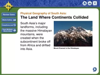
ASIA • Asia is the largest continent. • It covers 1/3 of the worlds total land area • Includes 44 countries • Fun Fact: Asia has the worlds tallest mountain, Mt. Everest in China.
AUSTRAILIA • Australia is the smallest continent. • This area is known for it’s vast wildlife and collection of rare species. • It is known as the land of the kangaroos. • Fun Fact: Australia is home to the largest coral reef, the “Great Barrier Reef”.
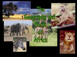
AFRICA • Africa is the second largest continent. • The equator intersects this landmass. • It is home to the Sahara, the worlds largest desert. Also the Nile, the worlds longest river. • Many large exotic animals live on this continent, such as the elephant. • Fun Fact: It is famous for diamond mining.
ANTARTICA • Antarctica is ice bound throughout the entire year. • This continent is a true desert due to the extreme climate. Making is the coldest, windiest, and driest continent. • Animals like seals and penguins live in this area. • Fun Fact: The average temperate is -58 degrees
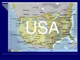
NORTH AMERICA • North America is the third largest continent. • YOU LIVE HERE! • It contains all Caribbean and Central America countries, Canada, Mexico, Greenland and the USA. • Fun Fact: The world’s greatest deposits of Petroleum and Natural Gas are found in Mexico.
SOUTH AMERICA • South America contains less than 12% of the world’s population. • The Andes, the second largest mountain range is seen in South America. • Has the largest tropical rain forest in the world and a tropical climate • Fun Fact: The Amazon runs through South America.
EUROPE • Europe is the second smallest continent. • Includes 47 countries. • Europe geographically separates Asia by the Ural Mountains. • Fun Fact: Russia is the largest country in Europe.
CONGRADULATIONS You have completed the necessary lesson for taking the quiz!
COMPLETED LESSON REDO THE LESSON Want to refresh your memory? Look over the lesson by pressing this icon. HOME Head back to the homepage! READY FOR QUIZ Ready to test your knowledge on the continents? Click on this Icon.
QUESTION #1 Which Continent is in this picture? A. North America B. Europe C. Asia D. Africa
CORRECT! NEXT QUESTION
WRONG ANSWER! TRY AGAIN BACK TO QUESTION 1
QUESTION # 2 What continent is the smallest? A. North America B. Antarctica C. South America D. Australia
CORRECT! NEXT QUESTION
WRONG ANSWER! TRY AGAIN BACK TO QUESTION 2
QUESTION # 3 What continent is home to the Sahara, the worlds largest desert? A. North America B. Africa C. South America D. Australia
CORRECT! NEXT QUESTION
WRONG ANSWER! TRY AGAIN BACK TO QUESTION 3
QUESTION #4 Which continent is in this picture? A. Asia B. North America C. Africa D. South America
WRONG ANSWER! TRY AGAIN BACK TO QUESTION 4
Citations • http://www.wisedude.com/misc/continents.htm • http://www.worldatlas.com/webimage/countrys/as.htm • Microsoft word Clip Art and Microsoft Sound.