Download
1 / 17
170 likes | 434 Views
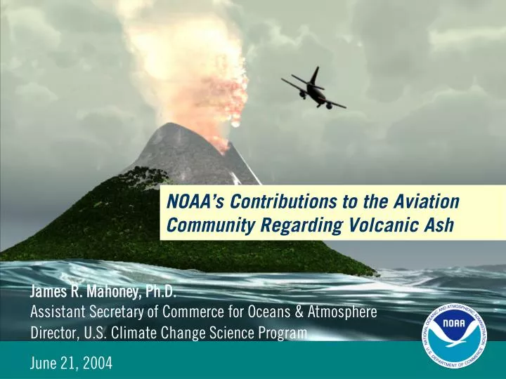
NOAA’s Contributions to the Aviation Community Regarding Volcanic Ash. James R. Mahoney, Ph.D. Assistant Secretary of Commerce for Oceans & Atmosphere Director, U.S. Climate Change Science Program June 21, 2004. NOAA’s Role in Volcanic Ash Hazards Mitigation.

E N D
NOAA’s Contributions to the Aviation Community Regarding Volcanic Ash James R. Mahoney, Ph.D.Assistant Secretary of Commerce for Oceans & Atmosphere Director, U.S. Climate Change Science Program June 21, 2004
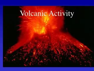
NOAA’s Role in Volcanic Ash Hazards Mitigation • Birth of the Volcanic Ash Advisory Centers (VAACs) • VAAC Information Sources (Satellite & Non-Satellite) • Volcanic Ash Information Dissemination • Reventador Eruption: Imagery & Sample Ash Products • Example: Washington VAAC Activity in 2003 • Future Challenges “Classic” example of volcanic ash detection from AVHRR, evidence of a hazardous ash cloud thousands of kilometers downwind from the volcano. The cloud was “intact” several days after the main eruption
International VAAC Boundaries London 90 Anchorage Montreal 75 60 45 Tokyo Washington 30 15 Toulouse 0 15 Buenos Aires 30 45 Darwin Wellington 60 75 105 120 135 150 165 180 165 150 135 120 105 90 75 60 45 30 15 15 30 45 60 0
Washington & Anchorage VAAC Customers MWOs Other VAACs Pacific NW WFOs Airlines, Aviation community VAACs ACCs FAA Other U.S. government agencies including AWC, DoD (AFWA), FEMA Abbreviations: VAAC = Volcanic Ash Advisory Center MWO = Meteorological Watch Office WFO = Weather Forecast Office AWC = Aviation Weather Center FAA = Federal Aviation Administration DoD = Department of Defense AFWA = Air Force Weather Agency FEMA = Federal Emergency Management Agency ACC = Area Control Center
Satellite-Derived Sources of Information Overlays Boundaries – Countries, Airspaces Winds – Cloud motion, models, & soundings Volcano locations GOES, POES & Meteosat thermal IR GOES, POES, Meteosat & MODIS shortwave IR GOES, POES Multi-spectral Products VAACs GOES, POES Meteosat & MODIS Visible TOMS SO2 (NASA) GOES & POES PCI (Principle Component Imagery) Abbreviations: GOES=Geostationary Operational Environmental Satellite POES=Polar Operational Environmental Satellite TOMS=Total Ozone Mapping Spectrometer CIRA=Cooperative Institute for Research in the Atmosphere MODIS=Moderate Resolution Imaging Spectroradiometer
Non-Satellite Sources of Information Airlines Cable TV Weather Observations Forecast Models GTS, FOS Phone calls, Faxes News reports Volcanologists (Observatories, USGS, Smithsonian) VAACs PIREPs FAA AFTN to GTS, FOS E-mail, Phone calls GTS, FOS,Phone calls • Other VAACs GTS, Phone calls SIGMETs, MWOs Internet Abbreviations: AFTN=Aeronautical Fixed Telecommunications Network ATC=Air Traffic Control FOS=Family of Services GTS=Global Telecommunication System PIREPS=Pilot Reports SIGMETs= Significant Meteorological Statements
Dissemination of Volcanic Ash Advisories (VAAs) GTS WAFs AFTN (FAA circuits) AWIPS & N-AWIPS (NWS systems) VAACs FOS Listserv • Internet site • http://www.ssd.noaa.gov/VAAC/messages.html Abbreviations: AFTN=Aeronautical Fixed Telecommunications Network FAA=Federal Aviation Administration FOS=Family of Services GTS=Global Telecommunication System WAFs=World Area Forecast Satellite Broadcast System NWS=National Weather Service AWIPS=Advanced Weather Interactive Processing System
Case Study: Eruption in Equador Dormant since 1976, El Reventador in northeast Ecuador erupted violently on November 3, 2002 sending ash as high as 60,000 feet above sea level. Ash was observed spreading in two directions due to sheering at different levels, threatening aviation routes for thousands of square miles around the volcano. Pacific Ocean Reventador Quito Ecuador In the above GOES-8 visible imagery loop, ash can be distinguished from weather clouds due to the dark color of the ash.
Visible & Multi-spectral Signatures for Reventador Eruption • Satellite imagery showing ash from the Reventador eruption. • Figure A shows ash (appearing as a smoky whitish area) in visible imagery at 1615Z. • Figure B is a multi-spectral infrared satellite image taken half an hour later (1645Z). The northeast edge of the ash (which appears in this multi-spectral algorithm as a dark gray/black area) has now extended into Colombia.
Washington VAAC Volcanic Ash Support • 1863 Volcanic Ash Advisories (VAA) & 814 graphical ash analyses were issued in the Year of 2003. • In 2003, the number of VAA almost doubled (195%) & the number of graphics almost tripled (292%) compared to last year (2002). • This year, VAA were issued for 11 volcanoes: • Anatahan in the Mariana Islands, • Soufriere Hills in the Caribbean, • Tungurahua & Guagua Pichincha in Ecuador, • Popocatepetl & Colima in Mexico, • Masaya in Nicaragua, • Chikurachki in the Russian Kurile Islands as well as, • Fuego, Pacaya & Santa Maria in Guatemala. 2003 VAAs 2003 Graphics
Future Challenges • Meet the increasing requirements of aviation community through continued research & interagency collaboration in satellite-based volcanic ash detection including: • Accurate ash height assignments • Detection & tracking of SO2 emissions • Enhanced ash cloud forecasts • Improved timeliness of eruption notification • Graphical products for realtime cockpit use • Leverage off future satellite data streams with improved capabilities for enhanced volcanic ash detection & monitoring (e.g. NPOESS)
A B “Three channel product” or “Ellrod product” (channels 2, 4 & 5) Infrared (channel 4) C D “Reflectivity product” or “CIRA product”(channels 2 & 4) Channel Differencing (channels 4 & 5)
Eruption ASH ASH Satellite imagery of volcanic ash cloud at all heights. Satellite technique showing only high level thick ash. Volcanic ash in the Caribbean impacted holiday air traffic from Trinidad to Puerto Rico. Washington VAAC www.ssd.noaa.gov