Download
1 / 29
290 likes | 450 Views
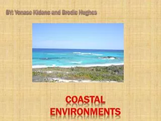
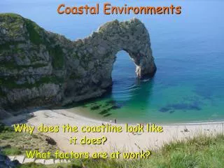
Using Scenarios to Estimate the Condition and Trend of Coastal Environments. Daniel Rutledge, Craig Briggs, and Robbie Price Manaaki Wheuna Landcare Research, Hamilton Feathers to Fur New Zealand Ecological Society Annual Conference Christchurch, 22 November 2007. Acknowledgements.

E N D
Using Scenarios to Estimate the Condition and Trend of Coastal Environments Daniel Rutledge, Craig Briggs, and Robbie Price Manaaki Wheuna Landcare Research, Hamilton Feathers to Fur New Zealand Ecological Society Annual Conference Christchurch, 22 November 2007
Acknowledgements • Co-funded by the Department of Conservation as part of the National Coastal Policy Statement review • DOC • Theo Stephens • Vicki Carruthers • Landcare Research • James Barringer • Ian Lynn • Malcolm McLeod • Gary Barker • Deb Wilson • Susan Walker
Introduction • RMA mandates protection of coastal environments under Section 6 – “matters of national importance” • National Coastal Policy Statement – preserve natural character of the coastal environment including but not limited to • Significant vegetation & habitats • Landscapes, seascapes, & landforms • Integrity, functioning, and resilience • Coastal Policy Statement Review: Should biodiversity be considered separately and distinctively from natural character? • Neither the RMA or National Coastal Policy Statement provide an explicit definition of “coastal environment” • Regional coastal policy statements vary widely in their interpretation & definition of coastal environments, with some advocating a case-by-case definition given the complex nature of such environments
Objectives • Develop 3–5 scenarios delineating the extent of terrestrial coastal environments in New Zealand • Evaluate condition and trends based on • Condition – Land Cover Database (LCDB) • Protection – Protected Areas Network Database (PAN-NZ) • Representativeness – LENZ Environments • Trend – LCDB 1 to LCDB 2 • Report by New Zealand, regions, and districts • Estimate risk to coastal environments from continued urban development
Methods • Generated 5 scenarios using different combinations of input data • Combinatorial Analysis • Combined • Coastal Environment Scenarios • LCDB • PAN-NZ • LENZ • Region & District boundaries • Produced a combined spatial data layer and accompanying database with records of all unique combinations of input data • Analysed condition and trend for each of the 5 scenarios using the resulting combinatorial data layer and associated database. LRI Coastal Soils LINZCoastline ElevationLCR DEM LCDB2 Coastline Coastal Unit
LRI CoastalSoils • Soils scientists identified soils in LRI formed wholly or partly by coastal processes • Unsupervised search found both coastal and inland soils • Refined search by only including soils with specified distances to the coast
Scenario 1 LINZ Coastline ≤100 m
and LINZ Coastline ≤ 500 m Elevation ≤ 10 m Scenario 2
or LRICoastal Soils LRI Coastal Soils LINZ Coastline≤ 100 m and and LINZ Coastline≤ 2 km LCDB2 Coastline≤ 2 km Scenario 3
Elevation ≤ 10 m Elevation ≤ 10 m Elevation ≤ 50 m and and and LINZ Coastline ≤ 2 km LCDB2 Coastline ≤ 2 km LINZ Coastline≤ 500 m or Scenario 4
LINZ Coastline≤ 100 m Elevation ≤ 100 m Elevation ≤ 10 m and and LINZ Coastline ≤ 1 km LCDB2 Coastline Coastal Unit and LRI Coastal Soils LINZ Coastline ≤ 250 m ID or Scenario 5
Combinatorial Analysis Coastal Scenarios + LCDB + PAN-NZ + LENZ + Regional & District Boundaries
National Results (con’t) • In all five scenarios at least half of remaining indigenous land cover not legally protected (INP) occurred in threatened environments • INP in coastal environments was 1.5 to 3.2 times more likely to occur in threatened environments than less reduced and/or better protected environments compared with a 1:1 ratio nationally • Five indigenous land cover classes dominated INP in coastal environments: • broadleaved indigenous hardwoods • coastal sands and gravel • herbaceous saline vegetation • indigenous forest • manuka and/or kanuka • None of the five scenarios showed significant change (gain or loss) in INP from LCDB1c to LCBD2
Regional Results (con’t) • Total area of INP in a scenario by region was generally proportional to the size of the total scenario area • Remaining INP in threatened environments tended to occur more in Acutely and Chronically Threatened environments.
District Results • Total area of INP by district ranged from 0 ha (not part of coastal environment)to 20 243 (Far North District, Scenario 4) • 15 districts had no area in INP across all five scenarios: Central Otago, Gore, Hamilton City, Kawerau, Mackenzie, Matamata-Piako, Palmerston North, Queenstown Lakes, Rotorua, Ruapehu, South Waikato, Stratford, Taupo,Upper Hutt, Waipa • Most districts had less than 1 000 ha total area in INP remaining (59 - Scenario 1;61 -Scenario 2; 54 - Scenario 3; 51 - Scenario 4; and 54 - Scenario 5) • Percent of total area in INP remaining in threatened environments varied from 0% including the 15 districts mentioned above with no INP to 100% • Remaining INP in threatened environments tended to occur more in Acutely Threatened environments and then divided evenly between Chronically Threatened and At Risk environments • Total area of INP was unusually high in At Risk Environments in Far North(3495–10 565 ha), Kaipara (1134–37 650 ha), and Rodney districts (1328–3330 ha) compared with other districts across all five scenarios.
Conclusions • Scenario generation was a useful method for evaluating a range of possible coastal environments but was more technically challenging than anticipated • Condition of coastal environments based on LCDB appeared to be sensitive to the definition/delineation of the coastal environment • Coastal environments had relatively high percentages of land recovering from past disturbance based on the amount of early successional land cover (i.e. broadleaved indigenous hardwoods and manuka and/or kanuka) reported • A more complete analysis of condition than provided by LCDB would likely result in the overall condition of coastal environments being lower than reported
Conclusions • Protection status of coastal environments appeared to be insensitive to the definition/delineation of the coastal environment • Coastal environments were overall more poorly protected compared to non-coastal environments nationally • Risk and consequences of further loss to remaining indigenous vegetation (protected or unprotected) is higher in coastal environments than nationally • LCDB1c to LCDB2 in its current form appear incapable of detecting the types of change (e.g., low density urban development) occurring in many coastal environments • Scenarios and the broad-scale datasets used to generate them provide the ability to undertake broad-scale analyses that can help inform conservation management and call attention to data gaps