Download
1 / 10
100 likes | 297 Views
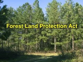
Forest density stratification with Ecognition& Worldview-2 24/06/2014. Jonas van Duijvenbode - GIZ. G oals. Forest inventory through object-based image analysis of very high resolution satellite imagery . Use of Worldview-2 data 0.5m pan-sharpened resolution 8 multispectral bands

E N D
Forest density stratification with Ecognition& Worldview-224/06/2014 Jonas van Duijvenbode - GIZ
Goals • Forest inventory through object-based image analysis of very high resolution satellite imagery. • Use of Worldview-2 data • 0.5m pan-sharpened resolution • 8 multispectral bands • Forest density mapping • Closed forest (>40% canopy cover) • Open forest (>10% canopy cover) • Non-forest • Minimal mapping unit of 0.5 ha
Canopy - other • Everything that can visually be determined as trees is used as samples • Trees show • a certain texture • a certain color • shadowed surroundings • Knowledge has been gathered on confusing land use classes in: • Dogotuki (February 2014) • Sigatoka (March 2014)
Open, closed and non-forest • Closed forest is an area with trees that are connected through canopy or shadowing and larger than 0.5 ha or canopy and surroundings with >40% canopy cover • Non-forest is all land use classes beside canopy and all canopy-containing areas that are not classified as open- or closed-forest (<10% canopy cover) • Open forest is canopy and surroundings with more than 10% canopy cover and area larger than 0.5 ha
Delineation of forest without connected canopy Radius of area of 0.5 ha = 39.89m (max) Radius of tree(stand) with area of 0.05 ha (10% of 0.5 ha) = 12.62 m Radius of buffer around tree(stand) of 0.5 ha=39.89-12.62=27.29 There is an almost linear relationship between canopy area and maximum distance from canopy The end result is a buffer around treestands depending on the size of the treestand. This connects trees with not-connected canopy and determines the delineation and area of open forest. x x 2 3 1
Sigatoka area • One satellite image • Little cloud cover • Lowland and highland areas • Dry and wet areas • Close-by enough to visit for ground validation and orientation The result of the findings in this area is a toolbox. This toolbox can be applied to any Worldview-2 image of Fiji for automatic classification.
Results • Knowledge for the people of Forestry on forest stratification • A Ruleset to automatically classify a Worldview-2 image into forest density classes • Insights into the expected accuracy of the stratification • Insights into the transferability to other areas in Fiji • Recommendations for good classification and accuracy assessment habits • Recommendations for future work
Other activities • Workshop on forest density classification with ecognition 17-18 April. • Workshop on Ecognition and nearest neighbour classification 26-27 May. • Instructing Forestry MSD remote sensers on Ecognition