Download
1 / 36
380 likes | 482 Views
Learn about Precision Agriculture in Turkey and its role in enhancing agricultural practices with advanced technologies like GPS and GNSS. Discover the TARSEY project and the potential impact on sustainable agricultural practices.

E N D
Precision agriculture in Turkey Assoc.Prof.Ufuk Türker Ankara University, AgriculturalFaculty, AgriculturalMachinery andTechnologyEngineeringDept.uturker@agri.ankara.edu.tr Today I'll be speaking about
Whatthefarmmarket means in Turkey • Considering climatic characteristics, soil characteristics and other geographical characteristics, Turkey is one of the rare countries providing optimum conditions for agricultural activities. Turkey which has an important potential in meeting the food requirements on a global scale has become a significant actor in world agriculture andtakes place at the top among European countries.
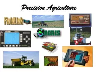
Precision Agriculture (PA) technologiescircle Precision Agricultural practices which require the use of advanced technologies is composed of various elements working in an integrated way.
DGPS var mı ? EGNOS was not availableforwholeTurkey
CORS-TR (TUSAGA-Aktif) GNSS NETWORK 146 constant GNSS Station wereestablished. Data is availablethrough TTVPN and 3G Subscription is possiblefor cm level of accuracywithCors-Tr
CreatingParalelllines in Cornfield is essential - Solution? In sugarbeet 13% input loss and 7% more fuel loss and also more lines can be created as happens in corn field
Agriculture Integrated Management Information System (TARSEY) project. This giant project which will be a milestone behalf of agricultural sustainability, when the full realization of Precision Agriculture (PA) happens, the transition process will be completed. TARSEY project is conceived as a system that covers all sustainable agricultural practices of Turkey in 2015 and it is planned to include all applications that have been realized so far. The project is based according to agricultural practices which intend to collect them under one roof. TARSEY project transmits the measurements that they made on the field and other evaluations to the system momentarily. In this way, spatial data about the field are collected in common information repository which is also called ‘Agriculture Informatics Cloud’. These data can be used by all shareholders. Through tablets which were distributed within the scope of the project, data entrance can be made simultaneously over the field. Supportive mechanisms for PA under rural development subsidies programme. WhatMinistry of Agricultureproposed Agriculture Integrated Management Information System (TARSEY) as projected, supportive of all sustainable agricultural practices and all its complements, it consisted decision support mechanism of the latest technology that use in of the whole. This system will be evaluated by study which is a milestone for Turkey.
Not yet reacheditsgoal • As a result of the studies of TARBİL project which is one of the two basic elements of TARSEY project, establishment of 301 smart measurement stations has been completed by year of 2014 and are used actively. Of the active stations 291 of them are in the form of Agricultural-Meteorological-Phenological station. Plantdevelopmental stages are monitored constantly. • Moreover, meteorological measurements are made in these stations. In order to form cadastres database of our country, geographic information systems based studies were conducted and cadastres database was formed by digitizing totally 48.500.000 cadastres parcels. Thus, an important inventory study was completed. Thereby, data belonging to 81 cities and 900 counties were taken into Geographic Information Systems based inventory by realizing the digitizing of each parcel on which agriculture is done. With the study, identity number was given to each parcel. Thus, data belonging to the parcels which were given identification numbers and of whom were entered all kinds of features (such as altitude, slope, aspect, soil structure, reared products, irrigated-dry farming, cultivated, productiveness state) about agricultural activities can be achieved on request.
Project Example Three Phasesfor PA • 1. Variabilityassessmentworks • Implementation of yieldmapping • Georeferencedsoilsamplingandgeostatisticalinvestigation • 2. Application+EvaluationandDissemination(Implementation of the PA amongstfarmerworks) • 3. Hardware and software developmentforagriculturalmachineryindustry
Regionalprojects • First yieldmappinghavecarriedout in 1999 in Turkey. • First phasecontinued in threedifferentwinterwheatfieldswhich has over 50 ha in 2000-2004 • Second Phasewas done in irrigatedcorn in 400 ha in Adana province in 2006-2010 • Third Phasewasextendedtoover 3000 ha in thesameregion 2013-2015
Crop lodging 2007 2008 2009 2006 You see everything on the yield map Experiment setup area
Adaptation to the FarmData Fusion • Combineharvester (New Holland, PLM, CX840) 2006’dan itibaren 2007,2008,2009,2010,2011, 2012, 2013 yıllarında kullanıldı. • Paralel trackingsystemadaptationwith RTK- 5cm accuracywasobtained • Soilsampling (50 m). • Plantsampling. • EMI – 38 ScanningECa haritası 2007, 2008, 2009. • Remote sensingimages (Astel) 2007,2008,2009 alındı. • VRT adaptationtothefarmingequipments
Low yield area (Top soil is removed with laser earthing) Management zone 3 Medium yield zone (Heavy clay area due to soil texture) Managemnt zone -1 High yield zone good soil texture support crop well. Managemnt zone-2
PHASE II IMPEMENTATION AND APPLICATION in FARMING OPERATIONS
A multi-row corn planter which was used for traditional fertilizer application was adopted and implemented with variable rate hardware and software for the map-based fertilizer application (First example of this kind of machine in the world). A double precise application with this machine was achieved. For the top side-dress application, traditional multi-row fertilizer application was adopted and implemented fort he sensor-based application which turn the machine into a new variable rate (precise) fertilizer machine. A multispectral proximate sensor was mounted on top of a tractor to determine corn crop N status as it varies across the field by measuring the reflectance from crop canopies.
CreatedMapwasappliedforVariablepre-plant P applicationwith a modifiedmachine
Sensor basedapplicationfor N 4 reflektans, 1 irradyans
RESULTS Aftervariable rate P application in 3 yearsstudyaverage 35 % of P wassaved 20 % of N wassavedfrom sensor basedapplication of N Farmer is obtainingyieldmaps since 2006 andstill he is using it. 2 machinewasadoptedtothe VRA with VRT Variable rate applicationswereenabledfarmertosaveconsiderableamount of fertilizer Paybackperiodwasestimated as 3 yeartocovertheinvestmentexcyieldmapping Thiswork has provedthat PA can be succesfullyimplemented in realfarmingenvironment.
Conclusions • Small scaleversus PA • Actuallythere is a misconceptionthat PA is designedforbigscalefarmingenterprises (horticulturalandvegetable is not supportedfor PA). High valuecropspresentsmorepotential. • Precision Agriculture Service helps farmers gather and cross-correlatea wide range of criticaldata to make meaningful andtimelyoperatingdecisionsthat can enhance yield andprofitability. There is noservicesavailable. EspeciallyWeb-basedsolutionsforfarmbusinessmanagement software program is lacking • But smallholderfarmers can be supportedandthishelpwillenablefarmerstoimprovetheiryieldsbyprovidingfertilizer, pesticide, andseedrecommendationspersonalizedfor each farmer’s land and needs.