Download
1 / 13
130 likes | 196 Views
NOAA’s NWS and the USGS: Partnering to Meet America’s Water Information Needs. Dr. Thomas Graziano Chief, Hydrologic Services Division NOAA National Weather Service April 15, 2011. Long History of Collaboration.

E N D
NOAA’s NWS and the USGS: Partnering to Meet America’s Water Information Needs Dr. Thomas Graziano Chief, Hydrologic Services Division NOAA National Weather Service April 15, 2011
Long History of Collaboration • NOAA and USGS held their 132nd quarterly coordination meeting on 10 February 2011 • First interagency coordination meeting over 35 years ago • NOAA values partnership and the USGS’ long history of responsiveness and professionalism
Complimentary Missions • NOAA's NWS provides weather, hydrologic, and climate forecasts and warnings… for the protection of life and property… • The USGS… provides reliable scientific information to describe and understand the Earth, minimize loss of life and property from natural disasters, manage water…
USGS Data Vital to NWS Operations • USGS data critical to the NWS river forecast and warning mission include: • Real-time and historical stream gage observations • Real-time supplementary stream observations during flood events • River/stream channel cross-sections
USGS Data Vital to NWS Operations • USGS data critical to the NWS river forecast and warning mission include: • Rating curves relating flow to stage • High resolution topographic data • Post-flood assessments (high water marks)
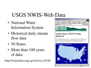
Serving America Together NWS Advanced Hydrologic Prediction Service (AHPS) Products rely on USGS data http://weather.gov/ USGS Streamgage Observations
http://weather.gov/ Serving America Together USGS Streamgage observations serve as foundation for NWS river forecasts and warnings
Flash Flood Decision AssistanceAHPS Flash Flood Monitoring and Prediction (FFMP) • Continuous monitoring of rainfall with comparison to flash flood guidance for high resolution stream basins • Basin data set developed by NOAA in collaboration with USGS • Alerts forecasters when a dangerous flash flood situation may be developing • 30 minute increase in flash flood warning lead time over past seven years
Enhancing the Communication of Flood Risk Partnered Flood Inundation Mapping • Methodology developed by USGS and NWS • Display spatial extent and depth of flood water • Maps for levels ranging from minor flooding through record flood • Better mitigate the impacts of flooding and build more resilient communities • Libraries include NWS flood severity categories and regulatory FEMA flood frequency events water.weather.gov
Growing Water IssuesToo Much, Too Little, Poor Quality Growing need for water resource forecasts: Population growth and economic development are stressing water supplies and increasing vulnerability A changing climate is impacting water availability and quality Socio-economic risks of floods and droughts are escalating Decision-makers in water management sectors need: Expanded/new high resolution information in space and time Quantification of uncertainty to manage risk Enhanced communication of flood risk Blue Gold “The New Oil”
Expanding our Partnership Integrated Water Resources Science and Services (IWRSS) • Framework to align and leverage multiple agencies with complimentary water-related missions to: • Integrate services and service delivery • Improve river and flood forecasts • Provide new summit-to-sea water resources analyses and forecasts ROADMAP DOCUMENT (2009) 11
New Digital Information Products IWRSS Dynamic Flood Inundation Forecast Conventional Flood Forecast
National Water Center Addressing IWRSS Objectives • Combine hydrologic forecasting operations and research to fill several critical gaps: • Provide new high-resolution forecasts of water resource variables to help decision makers better manage water • Extend river and flood forecasting to provide maps showing forecasted spatial extent and depth of flooding • Integrate water resources information to provide one-stop shopping for stakeholders (Federal Toolbox) • Establish multi-agency proving ground to leverage capabilities and accelerate R2O • Establish Common Operating Picture University of Alabama IOC Spring 2014 13