Download
1 / 31
310 likes | 378 Views
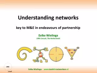
Understanding Networks. IT4GIS Keith T. Weber, GISP GIS Director. Why is Networking Important?. GIS has always been cursed with the need to use large files GIS’ers have always acted as a community Sharing is normal. How to Facilitate Sharing…. Floppy disks Bernouli disks Zip disks

E N D
Understanding Networks IT4GIS Keith T. Weber, GISP GIS Director
Why is Networking Important? • GIS has always been cursed with the need to use large files • GIS’ers have always acted as a community • Sharing is normal
How to Facilitate Sharing… • Floppy disks • Bernouli disks • Zip disks • Jazz disks
In the beginning… • There were floppy disks • And the “Sneaker Net”
Then along came… • Networks • Cabling that allowed computers to connect to one another • Token ring • Developed by IBM • Using coaxial cable • And then…
Ethernet • Developed by Xerox • Uses Star-topology • And twisted pair cabling
Cabling • Twisted pair cabling can be either unshielded (UTP) or, • Shielded • IT4GIS will focus on UTP
Capabilities • Ethernet is described by its data rate and range • For instance: • 10Base-2 • 10 (data rate, 10Mb/s) • Base (base band) • 2 (range, 200 meter runs)
Ethernet and GIS • Data rates are 10, 100, and 1000 • 10 = 10 Mb/s • Uses Cat 3 cabling • 100 = 100 Mb/s, called Fast Ethernet • Uses Cat 5 • 1000 = 1 Gb/s • Uses Cat 5E
Gigabit Ethernet • Data rates of 1, 10, or 100 Gb/s • 1 Gb/s is supported by Cat5E cabling • A good GIS workstation option • Gigabit to the desktop • 10 Gb/s requires copper cabling • 100 Gb/s requires fiber optic cabling
Ethernet and GIS • Ranges are 2, 5, T • 2 = ~ 200 m • 5 = ~ 500 m • T = well… • It stands for twisted pair. Cable testing tools will determine how long a run can be and still pass “characteristics” test (based on standards) • Runs as long as 150 m can be used.
What’s Next… • Wi-Fi (wireless-fidelity) • Developed by Cisco, 3Com, Lucent, Nokia, and others • Specs are described under the IEEE 802.11 group.
Brain-storm Advantages No cabling Fairly inexpensive Disadvantages Security Traffic can congest at the 2.4 Ghz frequency Size of transmission (bandwidth) Advantages and Limitations of Wi-Fi for GIS
A Look at 802.11 • B=11 Mb/s • G=54.0 Mb/s • N=200 Mb/s (2007), approved for 300 Mb/s • Operates at the 2.4Ghz or 5Ghz freq. • Wireless broadband LightSquared and GPS • How do these compare for GIS???
Getting Data from Here to There • Recap… • We know something about the history of networks • We know about current Ethernet, Fast Ethernet, and Gigabit Ethernet technologies • We know about Wi-Fi capabilities • These are the Data Link and Physical Layers, referred to as the Network Access Layer. • But, how does the GIS Data get from here to there on the network…regardless of the type of network
Good Question! • Packets and Protocols • TCP-IP is most common protocol 4. Application 3. Transport 1. Network Access 2. InterNetworking 1. Network Access
InterNetworking Layer • Internet Protocol addressing • Currently IP v4 is in use. This is a 32bit system allowing 4.2B addresses. • Example: 134.50.74.10 • IP v 6 is new, 128-bit addressing. Allowing 2128 addresses. • Example: 00-B0-D0-86-BB-F7
Transport Layer • TCP • Transmission Control Protocol • Phases of operation • Establish connection • Transfer data • Terminate connection
Application Layer • You know these well… • HTTP • SMTP • FTP
Where’s the Network • Recap • We have now learned how the data moves in packets from our computer through the layers of the TCP-IP model onto the Internet • But, where’s the Internet
The Internet Highway • From your workstation • LAN • Backbone at the Point of Presence • AKA…ISP • AKA…PoP
Various Backbones • Reduncy through • ARPANet • NSFNet • Abilene (I2) • National LambaRail
How Fast is Our Network Infrastructure? • Globally? • US Average is 11 Mbps • Nationally • Idaho is below average at 9.0 Mbps Visit http://www.netindex.com/to keep track
We could go on forever… • For IT4GIS, we have gone far enough… • But today’s discussion of networks would not be complete without mention of the second-generation Internet, Web2.0
Web2.0 • Is not Internet2 • Is not hardware • Is not software • Is…a whole new way that the Internet is used. • Participatory • Users are now “prosumers” instead of “consumers”
Participatory Web • Examples: • Wikipedia • MySpace • Innocentive • What will this mean for GIS?
Web 3.0 • We will cover this in greater detail later in the semester • For now, what is it?
Key Concepts • Understand how data moves over a network • Understand the importance of data rate for GIS applications. • Watch the potential of wireless for GIS • Understand the roles of the various layers within the TCP-IP model • Understand new terminology like PoP and GigaPoP • The network is typically the bottleneck for GIS • Contemplate the affect of Web2.0
Questions… Get ready for the 2-minute write