Download
1 / 30
300 likes | 483 Views
A Program for Research and Systems Integration to Help Mitigate the Volcanic Ash Hazard to Aviation. Tenny Lindholm,. David Johnson & Cathy Kessinger. Federal Aviation Administration (FAA) Aviation Weather Research Program. ► Oceanic Weather Product Development Team (OWPDT).

E N D
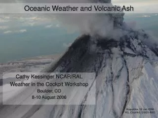
A Program for Research and Systems Integration to Help Mitigate the Volcanic Ash Hazard to Aviation Tenny Lindholm, David Johnson & Cathy Kessinger
Federal Aviation Administration (FAA)Aviation Weather Research Program ►Oceanic Weather Product Development Team (OWPDT) Core Scientific Membership: NCAR, NOAA/AWC,NRL-Monterey, & MIT/Lincoln Labs
National Aeronautics and Space Administration ►Advanced Satellite Aviation-Weather Products Program (ASAP) Key Participants: NCAR and OWPDT members, University of Wisconsin/CIMSS, NASA/Langley
Heavy deposits of resolidified ash on nozzle guide, Rolls-Royce RB211 (BA 747)
FAA Volcanic Ash: User Needs Analysis Summary • Need better integration of the agencies responsible for generating information on volcanic eruptions and ash clouds, with a collaborative approach that (a) provides all stakeholders the most current information and (b) permits all stakeholders to participate in updating information. • Need a common database of text and graphic products that all users can access to facilitate collaborative decision-making. • Stakeholders include airlines, air traffic management and control, weather providers & geological surveys. Global cooperation, collaborative decision-making!
Volcanic Ash User Needs:Specifics • Improved detection of volcanic eruptions globally, to include characterization of the initial ash cloud. • Better characterization of the ash cloud as the event progresses: • Location, horizontal & vertical extent of hazard • Ash density and chemistry (hazard assessment) • Differentiate volcanic ash from meteorological cloud • More frequent product updates.
Volcanic Ash User Needs:Specifics (continued) • Improved timeliness of updates (from observation or product generation to user access). • Better forecasts: • Location, horizontal & vertical extent of hazard • Changes to ash density and chemistry • Longer valid time • Improved dissemination for flight planning • Training. • Ready access to all information for all users (AOC’s, flight crews, and ATC specialists) • Higher resolution graphical products, including vertical cross-sections.
Volcanic Ash User Needs:Research • Global detection of eruptions and volcanic ash plumes. • Global high resolution wind fields. • Improved plume dispersion models. • Methods to characterize ash plume density and chemistry. • Aviation hazard definition based on plume density and chemistry. Maximize benefit from current satellite systems & define needed technologies for the future!
Volcanic Ash User Needs:Collateral Objectives • Common database. • Display concepts and graphics. • Networked collaborative workstations. • Internet dissemination and data link to aircraft.
Oceanic Weather PDT • Hazardous Convection • Turbulence • In-flight Icing • Flight-level winds • SIGMETS • Volcanic Ash
Graphical Cockpit Display
OWPDT Activities & Progress • Collaborative product generation and dissemination • Networked and interactive display capabilitiesNOAA-FSL Volcanic Ash Collaborative Tool (VACT) • Automated SIGMET decoder and web-based global display system • Improved, global, high-resolution wind field that is compatible with dispersion models, such as HYSPLIT and VAFTAD • Monitor DoD funded dispersion model research at NCAR 1
OWPDT Activities & Progress • Collaboration with the USGS on volcanic eruptions (in progress) • Global volcano database—eruption history, characterization, location, plume type • Extensive seismic sensing network • Expertise on identifying high risk areas based on geoseismic data • NCEP collaboration on detection and plume cloud detection and display 2
OWPDT Activities & Progress • New partnership established with NASA through ASAP Program. • Research channel differencing techniques available with current satellite sensing capabilities (GOES & AVHRR) • Explore other existing technologies such as TOMS • Research and test new sensing technologies for future satellites (e.g., GIFTS and MODIS) 3
Gulf of Mexico Volcano Mexico Pacific Ocean Popocatepetl, Mexico 14 February 2003 • 1045-1815 UTC Algorithm output at 30 min intervals Ash cloud is extrapolated • Purple = current position • Orange = 60 minute extrapolated position
Washington VAAC Warning Popocatepetl, Mexico 14 February 2003 1302 UTC 1315 UTC • Algorithm results compare well with VAAC verification data • Highest values within “thick ash around FL250” +
Colombia Pacific Ocean Volcano Ecuador Peru Reventador, Ecuador 4 November 2002 • 0046-1545 UTC Algorithm output at 30 min intervals Ash cloud is extrapolated • Purple = current position • Orange = 60 minute extrapolated position
Washington VAAC Warning Reventador, Ecuador 3-4 November 2002 4 November 0046 UTC + 3 November 2315 UTC
Washington VAAC Warning Reventador, Ecuador 4 November 2002 0515 UTC + 0515 UTC
OWPDT Activities & Progress • Naval Research Laboratory – Monterey • Image enhancing techniques for dust clouds and aerosols • Investigation of automated feature detectors for global monitoring, detection & reporting 4
Ongoing Mt. Etna Eruption: 10/30/02 SeaWIFS True Color NRL Dust Enhancement
OWPDT:Possible Operational Products • Graphical Eruption Flag● Rapid display and dissemination • Graphical SIGMET Product● Currently in development (extracted from text SIGMET) • Graphical Depiction of Ash Cloud● Either a new custom (computer-generated) product or a pass through of a collaboratively produced graphical metafile • Advection and Dispersion of Ash Cloud● Short term forecast (1-3 hours) for ATC planning • Hazard Assessment● Difficult problem!
Anticipated Milestones: • FY04—automated global depiction of VA SIGMET areas • FY04—collaboration established with Cooperative Institute for Meteorological Satellite Studies, USGS, NOAA • FY05—some collaborative tool capability with integrated wind fields and dispersion model output • FY05—intelligent dispersion nowcast capability that integrates wind fields with several dispersion model outputs for plume characteristics (density, chemistry, particle size) • FY08(?)—launch of GIFTS satellite, shakedown, testing of new sensing technologies The most difficult part of the problem is likely to be identifying the relationships between plume characteristics and hazards to aircraft systems!