Using Terrain Navigator Pro
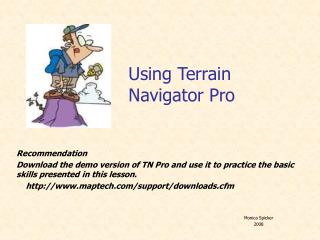
Using Terrain Navigator Pro. Recommendation Download the demo version of TN Pro and use it to practice the basic skills presented in this lesson. http://www.maptech.com/support/downloads.cfm. Monica Spicker 2008. Start Up – First Choice. Start Up – Second Choice.

Using Terrain Navigator Pro
E N D
Presentation Transcript
Using Terrain Navigator Pro Recommendation Download the demo version of TN Pro and use it to practice the basic skills presented in this lesson. http://www.maptech.com/support/downloads.cfm Monica Spicker 2008
Start Up – Second Choice • Find a place name within a category.
Start Up – Third Choice New Map CD • MUST have registration number!
Help F1 key will bring up index to Help at any time. Type in key word if you get stuck.
Set up • Check each time! • Unless changed, setup will automatically saved.
Set up • UTM • NAD83 or WGS84
Set Up • GPS • Select manufacturer • Select model • Select port • Test connection! • Some GPS need drivers installed beforehand! Check each person’s GPS
Set up Custom Grid • Will be printed, if with gridlines is selected!
Layer Visibility • All markers, tracks, custom grids are termed as layers. • Can be turned on and off. • Will print only if visibility is on! Turns all layers on and off
Select marker tool, then click on spot to mark. Put pan hand over marker and right click to generate options menu. Edit name, symbol, color, etc. as needed. Setting and Editing Markers
Drawing Tracks • Select track tool. • Click on starting point, click at each turning point (do not trace). • If the track is to be a closed area, stop just short of the beginning. • Right click, select finish track. • If the track is a closed area, point to it, right click and toggle loop to automatically close it. • Track length is always displayed.
Edit: name, color, font, label, etc. Information: will give you area Delete Profile: side view to see amount of elevation gain and loss. Line of Sight: shows obstructions between the endpoints of a track. Draw a line between team locations or to command and finish track. If the distance is greater than 2 to 3 miles, FRS may not not reach. If a hill is on the line of sight, FRS radio use will be hampered. Send to GPS: GPS must be connected and turned on before using this feature. Track Editing & Information
Bookmarks • A specific map view, including scale, can be saved as a bookmark. Go to View, • Can edit the name, etc. • Find will then relocate that view as needed. • Good for large area & multiple teams
Printing Set Scale (not %), Print Quality, turn on Layers, Rulers, With gridlines, and Scale Bar. Only visible layers will be printed. Make sure the blue box is centered over what you want to print!
Export • Save (archive) current set of layers - .tpa • Multiple markers, tracks and routes as separate files. • Pay attention where you are storing them!!!
Export Tips • If you are creating tracks and routes on one computer but may have to switch to another, it is a good idea to save your work as separate layers (safest) or as a project archive. • The saved files can then be imported to another computer that has TN Pro. • The other types of export formats are for importing into other software packages. • Pay attention where you are storing them!!! • Keep everything related to a project in one folder. • Easy to transfer to a flashdrive or disk.
Import • Open previously saved (exported or archived) projects, tracks, routes, markers, etc. • Base map must first be loaded. • Will only import .txf (Track Export File) and .mxf (Marker Export File) and .tpa (Terrain Project Archive) formats. • Exported track and marker files can be read by older versions of Terrain Navigator. • When importing a project, you will have to give it a new name. • Need to know where they have been stored!
GPS Some of these features are for using TN Pro real time with a receiver. Most often will use Send, Receive and Setup 1. Connect GPS receiver to port via its cable 2. Turn on Receiver 3. Select Receive or Send and with what you are working (waypoints [markers], tracks or routes.)
GPS files • Downloaded files are treated by TN Pro like drawn markers or tracks. • Can be exported (saved) • Can be uploaded to other GPS units. • Drawn markers and tracks can be uploaded • Change set up if using a variety of receivers. • May want to work with all of one type of receiver before switching to another.