HydroInformatics Thematic Centers: Mapping and Modeling Hydrologic Systems
160 likes | 183 Views
Explore hydrologic data integration in the CUAHSI Hydrologic Information Systems pilot projects, focusing on data analysis, modeling, and hypotheses testing using diverse environmental sources. Collaborate on spatially defined modeling to understand water fluxes and store distribution in the region.

HydroInformatics Thematic Centers: Mapping and Modeling Hydrologic Systems
E N D
Presentation Transcript
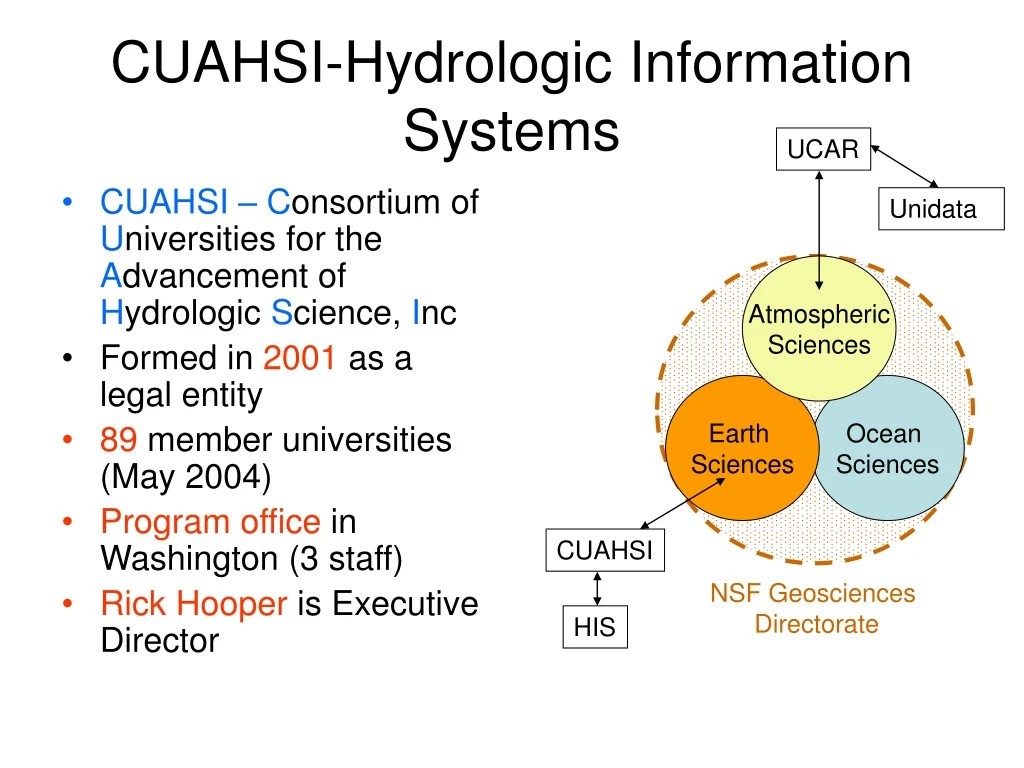
CUAHSI-Hydrologic Information Systems UCAR • CUAHSI –Consortium of Universities for the Advancement of Hydrologic Science, Inc • Formed in 2001 as a legal entity • 89 member universities (May 2004) • Program office in Washington (3 staff) • Rick Hooper is Executive Director Unidata Atmospheric Sciences Earth Sciences Ocean Sciences CUAHSI NSF Geosciences Directorate HIS
Environmental Cyberinfrastructure • Part of NSF Cyberinfrastructure program • Special emphasis on environmental sciences fostered by Margaret Leinen • CUAHSI Hydrologic Information Systems is one of several pilot projects
CUAHSI Hydrologic Information System (HIS) Project • This a 2-year project to develop an RFP for the Center for Hydrologic Information (CHI) and perform preliminary research and prototyping for HIS • For years 3 and onwards, all funding will be competitively awarded by NSF/CUAHSI • Center for Hydrologic Information • HydroInformatics Thematic Centers • Project started 1 April 2004
Hydrologic Information Partners Institutions of participants in the CUAHSI HIS Proposal
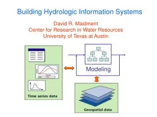
Hydrologic Information System Analysis, Modeling, Hypothesis testing Hydrologic Database
Arc Hydro An ArcGIS data model for water resources Arc Hydro toolset for implementation Framework for linking hydrologic simulation models Arc Hydro: GIS for Water Resources The Arc Hydro data model and application tools are in the public domain
CUAHSI Hydrologic Information System Experiments Monitoring 1. Assemble data from many sources Information Sources Remote sensing GIS Climate models 2. Integrate data into a coherent structure Hydrologic Information Data Model Hypothesis testing Analysis and Visualization 3. Do science Statistics Data Assimilation Simulation
Digital Watershed:An implementation of the CUAHSI Hydrologic Information Data Model for a particular region Created first for the Neuse basin and then for each of the following CUAHSI Observatory Planning basins
3D Control Volume of Neuse Basin Fluxes Extrude watershed boundary 15 km up into atmosphere and 1 km down into subsurface
Hydrologic Characterizationat Observatories • Three properties: • Residence time distribution within “stores” • Fluxes across interfaces/stores • Flowpaths between stores • Conceptual model • Include atmosphere as part of model • Elaboration of stores (boxes) and structure must be reconciled among disciplines Need for spatial definition of “stores”, perhaps as control volumes
Fluxes of greatest interest • Water • Vertical water flux • Precipitation (Nexrad) • Evaporation • Water vapor flux (with atmospheric circulation) • Energy • Net radiation • Sensible and latent heat • Atmospheric quality • Nitrogen, Mercury, contaminant transport
E P Qs D Ss Qg D Sg Ig HIS will facilitate Model Integration Watershed Models Coupled Ocean-Atmosphere Models Mesoscale Models Groundwater Models SVATs
Unidata Focused on the present Mostly “push” technology Issue is rapid data dissemination Operates mainly in Linux and Unix Uses mainly public domain and institutional software 3D, time varying data continuously over the earth CUAHSI – HIS Focused on the past Mostly “pull” technology Issue is data capture and archiving Operates mainly in Windows Mixture of commercial and public domain software Monitoring gage and GIS data Challenges: Unidata and HIS
Integration of data systems and tools • IDV • Very useful cross-platform application for allowing hydrologists to view atmospheric information. • How can this be used for data selection and acquisition? • THREDDS and netCDF • Integrating atmospheric sciencedata systems and hydrologic data systems • Integrating data models (netCDF and GIS data models) • NCAR SCD and NCDC • How to access historical data?
Where do we go from here? • Some pilot projects? • Educational activities? • Data viewing via IDV? • Joint CUAHSI-UCAR proposal for atmosphere-hydrology data integration? • ………………….