Download
1 / 10
100 likes | 204 Views
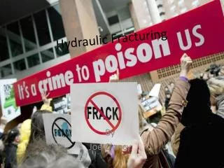
The final project, CE385K.4 by Nick Kuzmyak, focuses on the expanding hydraulic fracturing practices in the US. It delves into water treatment, microseismic imaging, and the impact on aquifers and population density. The goal is to identify at-risk counties and legislation availability. The project involves calculating well and population density, creating intrapolygon rasters, and quantifying risks nationwide.

E N D
County Level Determination of Fracturing Risk Final project, CE385K.4 Nick Kuzmyak
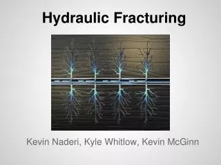
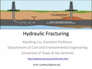
Fracturing in the US • Hydraulic fracturing continuing to expand • Practices steadily getting more refined • Water treatment/recycling • Non-traditional water sources • Microseismic imaging
Given the background info… • So, what should we be concerned about regarding hydraulic fracturing activity? • Proximity to large/dense population centers • Concurrence with aquifers • Shale plays with high fracking activity • Current goal of project: • Figure out which counties are the most at-risk • Determine what legislation is available there • Be able to target action
Most At-Risk Counties • A function of weighted factors: • Aquifer depletion • Fracturing activity level • Proximity to densely populated areas • Others to be added
Still To Do • Calculate true areas of polygons to get accurate measures of density • Wells per square mile • People per square mile • Create intrapolygonrasters: • Well density over a shale play • Well drawdown over an aquifer • Quantified risk over entire US • Expand “risk equation,” weight factors • Cross-reference at-risk counties with current laws