Download

1 / 44
440 likes | 577 Views
This presentation by Dr. David W. Rich focuses on the complexities of managing environmental data for investigation and remediation projects. It highlights the evolution of data from traditional lab analyses to higher-resolution field data, which are critical for informed decision-making. Automated tools facilitate data management and improve site interpretation models, leading to enhanced site understanding and project outcomes. Key topics include site characterization, data integration, and enabling effective modeling with continuous and discrete data inputs.

E N D
www.geotech.com Managing Environmental Data for Conceptual Site Models Dr. David W. Rich drdave@geotech.com Indianapolis, IN February 26, 2014 2:45 – 3:30
2/44 Summary of Presentation • Investigation and remediation projects have complex requirements • Automated tools can help the process • Previously the main tool for characterization was lab analyses • Now higher resolution field data is becoming more important • Use of field data is evolving from screening only, to directly impacting decision making • Data management and displays must adjust to this • So must site interpretation models • The result should be better site understanding and project decisions www.geotech.com
3/44 Overview of the Process • Site issues • Identify concerns • Prepare a preliminary model with available data • Identify gaps in the data • Data management issues • Gather data for detailed site characterization • Discrete data • Continuous data • Import, QC and manage data • Generate useful output • Modeling issues • Scale of model vs. scale of data • Integration of geology and chemistry • Making and implementing decisions www.geotech.com
4/44 Site Issues • Identify concerns • What are the matrices - soil, water, air, etc.? • Determine constituents of concern • Identify impacts - type, severity • Prepare a preliminary model with available data • Gather and organize existing data - geology, chemistry, GIS data • Present data so it can be analyzed • Identify gaps in the data • Where is the site well characterized, and where not? • What new information is needed where? • Fill the gaps and revise the model www.geotech.com
5/44 Preliminary Model - Geology www.geotech.com
6/44 Managing and DisplayingSite Geology • You might want to assign geology and lithology to each physical sample • This makes it easy to tie the geology to field and lab data • Or store formation “tops” by location independent of the samples • This probably better represents the actual site geology www.geotech.com
Introduction www.geotech.com
Crosstab Callouts From the Database www.geotech.com
Soil Borings with Values from the Database Benzene (mg/kg) Lithology Benzene (ppm) www.geotech.com
10/44 Voxler Example www.geotech.com
11/44 Data Management Issues • High level view of the process • Modern systems can manage more of the process • Planning for sample events • Gathering field data and taking samples • Obtaining lab and field data • Importing and storing data • Discrete data • Continuous data • Addressing data issues - duplicates, non-detects, flagged data, dilutions, etc. • Locations of software and data • Data selection and formatting of results • Output content and formats www.geotech.com
High Level View of the Data Management Process Plan your sample events Store in a robust repository Analyze and display data Manage field and lab activities Manage data and quality It’s all in one location www.geotech.com
13/44 Planning Your Sample Events Entering stations www.geotech.com
14/44 Container Labels www.geotech.com
Planning the sample event www.geotech.com
16/44 Gathering Field Results www.geotech.com
17/44 Gathering Soil Samples www.geotech.com
18/44 Cloud-based log data entry Gathering Boring Log Data Images courtesy of LogItEasy.com www.geotech.com
19/44 Gathering Continuous Data Gathering continuous downhole data Images courtesy of www.geotech.com
20/44 Environmental Data and the “Cloud” www.geotech.com
Environmental Data and the “Cloud” 21/44 www.geotech.com
22/44 Specifying Import Options Import Wizard www.geotech.com
23/44 Quality Control - Consistency Checking www.geotech.com
24/44 Quality Control - Validation www.geotech.com
25/44 Quality Control - Validation Summary www.geotech.com
26/44 Bulk Data www.geotech.com
27/44 Selection and Display www.geotech.com
28/44 Display Options Determine How Your Results Are Displayed • Example options: • Regulatory limits • Values and flags • Unit conversion • Date display • Calculated parameters • Non-detects • Significant figures • Graph display options • Custom queries www.geotech.com
Generating Output www.geotech.com
30/44 Typical Data Presentation www.geotech.com
31/44 Modeling Issues • Be sure to clearly state the problem to be solved • Gather and organize all the different data components • Maps and other GIS data • Geology, hydrogeology • Discrete data such as lab data • Continuous data, such as direct push data • We want to characterize three main things: rock properties, fluid properties, and concentrations • Have a good understanding of your tools • Use an appropriate process for the specific problem • Present results clearly and succinctly www.geotech.com
Modeling Issues Source: Mapping Research at the USGS Toxic Substances Hydrology Program Research Site to investigate Recalcitrant Contamination in Fractured Bedrock, by Pierre Lacomb and Rachel Dearden www.geotech.com
33/44 Modeling Issues www.geotech.com
Modeling Issues www.geotech.com
Modeling Issues www.geotech.com
Modeling Issues www.geotech.com
37/44 Modeling Issues Source: Environmental Visualization: Applications to Site Characterization, Remedial Programs, and Litigation Support, Meng Ling and Jian Chen, Workshop on Visualisation in Environmental Sciences (EnvirVis) (2013) Source: Techniques for 3D Geological and Hydrogeological Modeling. A Case Study of Conawapa Generating Station, Sharif, S., Mann, J.D., & Smith, J.B., KGS Acres, Winnipeg, Manitoba, Canada, and Cook, G.N. , Manitoba Hydro, Winnipeg, Manitoba, Canada. www.geotech.com
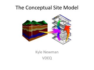
38/44 Characterizing a Site Traditional conceptual site model www.geotech.com
39/44 Characterizing a Site Gather contaminant data Grid and model Traditional result www.geotech.com
40/44 Characterizing a Site Here’s a different way Build a hi-res geological model Grid and model each unit www.geotech.com
41/44 Characterizing a Site Stack the models Traditional result The results can be very different www.geotech.com
Making and Implementing Decisions • Gather as much data as practical • Use the right tools to manage and present the data • Present it clearly and succinctly • Tailor the presentation to the problem to be solved • Determine alternative solutions • Enumerate advantages and disadvantages • Select from among these and implement • Review results regularly www.geotech.com
43/44 Conclusions • Investigation and remediation projects have complex requirements • Automated tools can help the process • The industry is seeing more use of field data relative to lab data • Data management and displays must adjust to this • So must site interpretation models • Use of high-resolution geology and concentration can lead to better site models • The result should be better site understanding and project decisions www.geotech.com
www.geotech.com Managing Environmental Data for Conceptual Site Models Dr. David W. Rich drdave@geotech.com Indianapolis, IN February 26, 2014 2:45 – 3:30