EDINA Geoservices: 24/7 Online Geo-data and Mapping Solutions for Education and Beyond
120 likes | 242 Views
EDINA Geoservices offers round-the-clock online geo-data, mapping, and gazetteer services tailored for higher and further education institutions and beyond. Our highly skilled team provides national and international expertise, contributes to standards development, and engages in the GI community. With over ten years in spatial data management, we're at the forefront of GI service innovation in the UK. We support interoperability projects, develop digital gazetteers, and offer essential services like geo-parsing to enhance geographical metadata searchability.

EDINA Geoservices: 24/7 Online Geo-data and Mapping Solutions for Education and Beyond
E N D
Presentation Transcript
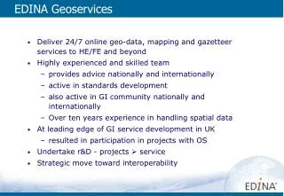
EDINA Geoservices • Deliver 24/7 online geo-data, mapping and gazetteer services to HE/FE and beyond • Highly experienced and skilled team • provides advice nationally and internationally • active in standards development • also active in GI community nationally and internationally • Over ten years experience in handling spatial data • At leading edge of GI service development in UK • resulted in participation in projects with OS • Undertake r&D - projects service • Strategic move toward interoperability
Undertake development projects and hosting…for BL… • BL gazetteer hosting (Collect Britain) • NOF Vision of Britain : … and others… • GIGateway (www.gigateway.org) • AGI Tech SIG
National Services… • Digimap : • UKBORDERS : … and pre-service development projects… • Go-Geo! (www.gogeo.ac.uk) • Agricultural Census : • OGS Web Services (e.g OS Pathfinder) • geoXwalk (www.geoXwalk.ac.uk)
Making geography matter Aims • Create a placename ‘authority’ file • Make variations in definitions of ‘geography’ transparent • Provide a means to ‘crosswalk’ geographies i.e. translate one geography into another - hence the name • ‘Geographic agnosticism’ • How? • Create a digital gazetteer that stores the different geographies and can implicitly resolve the relationships between them • Provision as a service to service other services
Supporting service searching: Place name - River Tweed Feature Type: River Relation: ‘near’ Distance: 1/2 km Target type: towns (Images indexed on place names) Image finder server “Photographs of towns along the River Tweed” Places... Peebles Innerleithen Melrose Kelso Coldstream Berwick upon Tweed
As online facility to assist metadata creation • Most extant resources have some form of spatial reference e.g. placename, county name, postcode • A ‘geoparser’ has been developed which will assist in the semi-automatic indexing of these resources by using the gazetteer as reference. • The results of the geoparsing can be used to update the documents metadata, making it directly geographically searchable.
Contact details • James.Reid@ed.ac.uk • EDINA, Data Library, University of Edinburgh • telephone +44 (0)131 650 3302 • For information on geoXwalk project: • www.geoXwalk.ac.uk
External Service examples (return)
Internal Service examples: Digimap (return)
Internal Service examples: UKBORDERS (return)
Geoparser (return)