Download
1 / 45
450 likes | 568 Views
Dive into Plate Tectonics to understand earthquake mechanisms, including seismic moment and magnitude calculations. Follow lectures to unravel the Earth's dynamics.

E N D
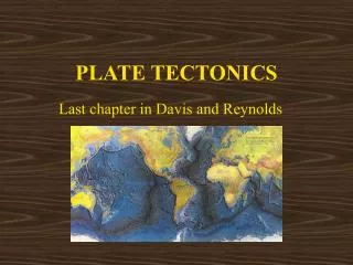
Earthquake EngineeringGE / CEE - 479/679Lecture 2. Plate TectonicsJanuary 24, 2008 John G. Anderson Professor of Geophysics
Handout Today • Chapter 2. Plate Tectonics • Students are advised to read this as your textbook on this topic. • Solve exercises 3, 4, 5, 6, and 8. • For extra credit, solve exercises 9, 11. • Exercises are due Jan. 31.
Source: Geological Society of America web: http://www.geosociety.org/science/timescale/timescl.htm
Source: Geological Society of America web: http://www.geosociety.org/science/timescale/timescl.htm
Crust - rocks (granite, basalt); density ~ 3 g/cm3 Lithosphere - "rock-sphere" - rigid layer (includes crust) Asthenosphere - "weak-sphere" (lower v seismic waves) Convection currents flow in the 'plastic' asthenosphere, and the plates of the lithosphere ride on these. Mantle - iron-rich, mainly solid rock Outer core - liquid iron and nickel Inner core - solid iron, nickel Distances are in kilometers. http://www.physics.mcgill.ca/~crawford/PSG/PSG12/204_97_L12.2_earthxn.html
The radii for the tops of the major layers are more accurate on this plot.
http://topex.ucsd.edu/marine_topo/gif_images/global_topo_small.gifhttp://topex.ucsd.edu/marine_topo/gif_images/global_topo_small.gif
Why believe plate tectonics? • Geography - matching continental boundaries. • Geology - units match where continental boundaries match. • Paleomagnetism • Characteristics of the magnetic field • Polar wander • Mid-ocean ridge magnetic anomalies. • Past and future Earth.
Why believe plate tectonics? • Ocean drilling results. • Hot spots • Earthquakes • Direct measurements
Engineering applications • Context to understand seismicity • Quantitative estimate of earthquake rates • Seismic gaps
Distance between two points on the Earth’s surface Where: (φ, ψ) = (latitude, longitude) of selected point on plate boundary (φ1, ψ1) = (latitude, longitude) of pole of relative rotation
u = relative rate of plate motion a = radius of Earth, 6370 km Δ = distance from pole of rotation, in degrees ω = rotation rate of plates about their pole (a different use of the symbol ω)
Seismic Moment • Definition of Seismic Moment • M0=μAD • μ is the shear modulus of the rock • A is the area of the fault on which slip takes place • D is the average slip on the fault
Application to Japan • Accept for the time that the plates in Japan converge at u=10.6 cm/yr. • This is a horizontal convergence rate. • . • The last large earthquake at Tokyo was 1923. • Time past is (2005-1923)=84 years. • Then accumulated slip is: • 10.6 cm/yr*82 yr=890 cm.
Application to Japan (cont.) • Then accumulated slip is: • 10.6 cm/yr*82 yr=890 cm. • Suppose the fault is 200 km long and the seismogenic zone is from 0 to 30 km depth. • The subduction zone dips, lets say at 40o • Width = 30 km/cos(dip)=40 km • M0=μAD = 4*1011 dyne/cm2 * 200 km * 40 km * (105 cm/km)2 * 890 cm = 2.8 * 1028 dyne-cm
Moment Magnitude • MW=(2/3) log M0-10.73 • This is the preferred magnitude scale in the seismological community.
Application to Japan (cont.) • M0=μAD =2.8 * 1028 dyne-cm MW=(2/3) log M0-10.73 =8.24 Conclusion, by these assumptions, there is enough strain accumulated to cause a MW=8.2 earthquake under Tokyo.