Download
1 / 41
410 likes | 439 Views
Learn about plate tectonics, development of the concept, and magnetization patterns in this comprehensive guide. Explore how Earth's lithosphere shapes tectonic cycles, earthquakes, and more.

E N D
Lecture OutlinesNatural Disasters, 5th edition Patrick L. Abbott
Plate Tectonics and EarthquakesNatural Disasters, 5th edition, Chapter 3 Christiane Stidham, Stonybrook University
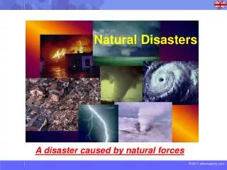
Plate Tectonics and Earthquakes Gujarat, India, January 26, 2001: • Major earthquake great natural disaster • Event so destructive that outside help is needed • 20,103 people killed • Deadliest natural disaster of 2001
Plate Tectonics Tectonic cycle: • Melted asthenosphere flows upward as magma • Cools to form new ocean floor (lithosphere) • New oceanic lithosphere (slab) diverges from zone of formation atop asthenosphere (seafloor spreading) • When slab of oceanic lithosphere collides with another slab, older, colder, denser slab subducts under younger, hotter, less dense slab • Subducted slab is reabsorbed into the mantle • Cycle takes on order of 250 million years
Plate Tectonics • Lithosphere of Earth is broken into plates • Study of movement and interaction of plates: Plate Tectonics • Zones of plate-edge interactions are responsible for most earthquakes, volcanoes and mountains • Divergence zones • Plates pull apart during seafloor spreading • Transform faults • Plates slide past one another • Convergence zones • Plates collide with one another
Plate Tectonics Lithosphere of Earth is broken into plates separated by: divergence zones, transform faults, convergence zones
Development of the Plate Tectonics Concept • 1620: Francis Bacon noted parallelism of Atlantic coastlines of Africa and South America • Late 1800s: Eduard Suess suggests ancient supercontinent Gondwanaland (South America, Africa, Antarctica, Australia, India and New Zealand) • 1915: Alfred Wegener’s book supports theory of continental drift – all the continents had once been supercontinent Pangaea, and had since drifted apart • Theory of continental drift was rejected because mechanism for movement of continents could not, at the time, be visualized
Development of the Plate Tectonics Concept • 20th century: study of ocean floors provided wealth of new data and breakthroughs in understanding • Lithosphere moves laterally • Continents are set within oceanic crust and ride along plates • Theory of plate tectonics was developed and widely accepted
Magnetization of Volcanic Rocks • Magnetic patterns of ocean floor first observed in mid 20th century – very important to theory of plate tectonics • Why does the ocean floor have a magnetic pattern? • When lava cools to below 550oC (Curie point), atoms in iron-bearing minerals line up in direction (polarity) of Earth’s magnetic field • Polarity of Earth’s magnetic field can be either to the north or to the south and depends on time in Earth’s history
Magnetization of Volcanic Rocks • Successive lava flows stack up one on top of another, each lava flow recording the Earth’s polarity at the time at which it formed • Each lava flow can also be dated using radioactive elements in the rock to give its age
Magnetization of Volcanic Rocks • Magnetic patterns of ocean floor • What does magnetic polarity of lava flows tell us? • Plotting the polarity of different lava flows against their ages gives us a record of the Earth’s polarity at different times in the past • Timing of polarity reversals (north to south; south to north) seems random • Reversals probably caused by changes in the flow of iron-rich liquid in the Earth’s outer core
Earth’s Magnetic Field • Earth’s magnetic field acts like giant bar magnet, with north end near the North Pole and south end near the South Pole • Magnetic field axis is now tilted 11o from vertical (tilt has varied with time) so that magnetic poles do not coincide with geographic poles (but are always near each other) • Inclination of magnetic lines can also be used to determine at what latitude the rock formed • Magnetic field is caused by dynamo in outer core: • Movements of iron-rich fluid create electric currents that generate magnetic field
Magnetization Patterns on the Seafloors • Atlantic Ocean floor isstriped by parallel bands of magnetized rock with alternating polarities • Stripes are parallel to mid ocean ridges, and pattern of stripes is symmetrical across mid ocean ridges (pattern on one side of ridge has mirror opposite on other side) • Pattern of alternating polarity stripes is same as pattern of length of time between successive reversals of Earth’s magnetic field
Magnetization Patterns on the Seafloors • Magma is injected into the ocean ridges to cool and form new rock imprinted with the Earth’s magnetic field • Seafloor is then pulled away from ocean ridge like two large conveyor belts going in opposite directions – seafloor spreading
Other Evidence of Plate Tectonics • Earthquake epicenters outline plate boundaries • Map of earthquake epicenters around the world shows not random pattern, but lines of earthquake activity that define the edges of the tectonic plates
Other Evidence of Plate Tectonics • Oceanic mountain ranges and deep trenches • Ocean bottom is mostly about 3.7 km deep, with two areas of exception: • Continuous mountain ranges extend more than 65,000 km along the ocean floors • Volcanic mountains that form at spreading centers, where plates pull apart and magma rises to fill the gaps • Narrow trenches extend to depths of more than 11 km • Tops of subducting plates turning downward to enter the mantle
Other Evidence of Plate Tectonics • Deep earthquakes • Most earthquakes occur at depths less than 25 km • Next to deep-ocean trenches, earthquakes occur along inclined planes to depths up to 700 km • These earthquakes are occurring in subducting plates
Other Evidence of Plate Tectonics • Ages from ocean basins • The oldest rocks on ocean floor are about 200 million years old (less than 5% of Earth’s 4.5 billion year age) • Ocean basins are young features – continually being formed (at mid ocean ridges) and destroyed (at subduction zones) • Hot spots in the mantle cause volcanoes on the plate above, which form in a line as the plate moves over the hot spot in the mantle, getting older in the direction of plate movement • Sediment on the seafloor is very thin at mid ocean ridges (where seafloor is very young) and thicker near trenches (where seafloor is oldest)
Other Evidence of Plate Tectonics • Systematic increases in seafloor depth • Ocean floor depths increase systematically with seafloor age, moving away from the mid ocean ridges • As oceanic crust gets older, it cools and becomes denser, therefore sinking a little lower into the mantle • Weight of sediments on plate also cause it to sink a little into mantle
Other Evidence of Plate Tectonics • The Fit of the Continents • If continents on either side of the Atlantic used to be adjacent, their outlines should match up • Outlines of continents at the 1,800 m water depth line match up very well • 1,800 m water depth line marks boundary between lower-density continental rocks and higher-density oceanic rocks
Other Evidence of Plate Tectonics • Changing Positions of the Continents • 220 million years ago, supercontinent Pangaea covered 40% of Earth (60% was Panthalassa, massive ocean)
Other Evidence of Plate Tectonics • Changing Positions of the Continents • 180 million years ago: Pangaea had broken up into Laurasia and Gondwanaland • 135 million years ago: north Atlantic Ocean was opening; India was moving toward Asia • 65 million years ago: south Atlantic Ocean was opening; Africa and Europe had collided • Present: India has collided with Asia; Eurasia and North America are separate; Australia and Antarctica are far apart
The Grand Unifying Theory • Tectonic cycle: • Rising hot rock in the mantle melts and rises to surface as liquid magma • Buildup of magma causes overlying lithosphere to uplift and fracture; fractured lithosphere is then pulled outward and downward by gravity, aided by convection in mantle • Asthenosphere melts and rises to fill fractures, creating new oceanic lithosphere • New oceanic lithosphere becomes colder and denser as it gets older and farther from the ridge where it formed • Eventually oceanic lithosphere collides with another plate; whichever is colder and denser will be forced underneath and pulled back down into the mantle
The Grand Unifying Theory Tectonic cycle
Plate Tectonics and Earthquakes Most earthquakes can be explained by plate tectonics: • Divergent plate boundaries • Divergent motion and high temperatures cause rocks to fail easily in tension • Earthquakes are small and generally non-threatening • Transform plate boundaries • Plates slide past each other in horizontal movement, retarded at irregularities in plate boundaries • Energy required to move plates is released as large earthquakes • Convergent plate boundaries • Great amounts of energy are required to pull a plate back into the mantle or push continents together • Largest earthquakes are generated at convergent boundaries
Plate Tectonics and Earthquakes Examine example of Pacific plate: • Created at spreading centers on eastern and southern edges, producing small earthquakes • Slides past other plates on transform faults (Queen Charlotte fault, Canada; San Andreas fault, California; Alpine fault, New Zealand), generating large earthquakes • Subducts along northern and western edges, generating enormous earthquakes
Spreading Centers and Earthquakes • Iceland: • Volcanic island fed by hot spot along the mid-Atlantic ridge • Swarms of moderate earthquakes too small to destroy buildings or kill people
Spreading Centers and Earthquakes Red Sea and Gulf of Aden • Young spreading center and new ocean basin • Hot upper mantle under Africa melts and uplifts crust, which gravity then pulls apart and downward, creating pull-apart basins (or rift valleys) • As down-dropped pull-apart basins widen, become flooded by ocean to form new arm • At south end of Red Sea, three pull-apart basins meet at triple junction • Spreading has split Arabian plate from Africa • East African Rift Valley may someday split ‘Somali’ plate from African plate
Convergent Zones and Earthquakes • Largest earthquakes • Three types of convergence: • Ocean-ocean: older, denser oceanic plate is subducted • Ocean-continent: oceanic plate is subducted • Continent-continent: both plates are too buoyant to be subducted; continental upheaval results
Subduction Zones • Sites of great earthquakes • Shallow earthquakes: • Compressive movements of overriding plate and subducting plate • Pull-apart movements where subducting plate bends downward • Most damaging earthquakes • Inclined plane of deep earthquakes, defining descending slab of oceanic lithosphere • Rigid interior of slab can stay cold enough to generate earthquakes down to depths of 700 km • Most seismic energy is dissipated before reaching surface
Seismic Gap Method • If some segments of a fault have moved recently, it is reasonable to expect that unmoved portions will move next, to fill the gaps • Yields expectations, not guarantees • Segments may move in two or more earthquakes before adjacent unmoved segments move once
Subduction Zones • Tokyo, Japan, 1923 – one of world’s most deadly disasters (probably about 144,000 people killed) • Series of earthquakes, with principal one worst of year globally • Tsunami 11 m high hit city • Fires raced through city for 2½ days, destroying 71% of Tokyo and all of Yokohama • 38,000 people were killed by fire, crowded into a park that was consumed by fire from three sides
Continent-Continent Collisions • Collision of India into Asia • India has moved 2,000 km north into Asia from initial contact • Pre-collision, Indian and Asian crusts were 35 km thick • Now crust under area of Tibetan plateau is 70 km thick and highest-standing continental area on Earth • India continues to move 5 cm/year into Asia, along a 2,000 km front, affecting India, Pakistan, Afghanistan, Tibetan Plateau, eastern Russia, Mongolia and China with great earthquakes, and pushing parts of China to the east and southeastern Asia farther to the southeast
Continent-Continent Collisions • Shaanxi province, China, 1556 • Deadliest earthquake in history: about 830,000 people killed • Soft soil made caves practical homes for many • Shaking caused ground and caves to collapse • Tangshan, China, 1976 • Deadliest earthquake in recent history: more than 240,000 people killed • Dense mining city of 2 million, with most buildings of mud-brick built under lenient building codes • 93% of residential buildings collapsed
Earthquake Weather • No connection between fault movements many kilometers underground and weather above the surface • Earthquakes in Shaanxi and Tangshan occurred during opposite kinds of weather
Transform Faults and Earthquakes • Horizontal movements cause major earthquakes • Turkey, 1999: • Segment of North Anatolian fault ruptured for 120 km in magnitude 7.4 earthquakenear Izmit, followed weeks later by rupture to the east in magnitude 7.1 earthquake • Residential buildings onsoft ground, adding sand to concreteresulted in buildings collapsing during shaking
Transform Faults and Earthquakes • Turkey, 1999: • Turkey is pushed westward along the North Anatolian fault, which runs for 1,400 km along the Black Sea • Since 1939, the North Anatolian fault has ruptured in 11 earthquakes, from east end of fault to west • Unique, semi-regular pattern • Next event? Probably to west of Izmit, closer to Istanbul • Probably withinnext 30 years
The Arabian Plate Continent-continent collision earthquakes: • Spreading in Red Sea and Gulf of Aden pushes Arabian plate into Eurasia, uplifting mountains and creating large earthquakes
The Arabian Plate Continent-continent collision earthquakes: • Armenia, 1988 • Magnitude 6.9 earthquake followed minutes later by magnitude 5.9 aftershock • 25,000 people killed, 31,000 injured and 500,000 homeless • Comparison of similar-sized earthquakes: • 1988 Armenian earthquake killed 25,000 of 700,000 residents • 1989 Loma Prieta earthquake killed 25 of 1.5 million residents • “Earthquakes don’t kill people, buildings do”
The Arabian Plate Transform fault earthquakes: • On western side, Arabian plate slides past African plate at edge of Mediterranean Sea along Dead Sea fault zone • Runs through Holy Land • Steps in fault zone have created pull-apart basins that hold Dead Sea, Sea of Galilee • Dead Sea fault zone generates magnitude 6-7 earthquakes about every 100-200 years