Download
1 / 50
500 likes | 644 Views
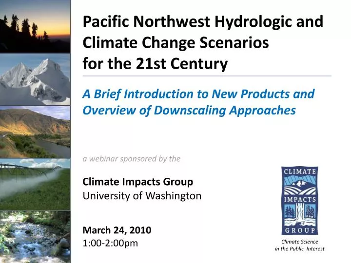
Pacific Northwest Hydrologic and Climate Change Scenarios for the 21st Century A Brief Introduction to New Products and Overview of Downscaling Approaches. a webinar sponsored by the Climate Impacts Group University of Washington March 24, 2010 1:00-2:00pm.

E N D
Pacific Northwest Hydrologic and Climate Change Scenarios for the 21st Century A Brief Introduction to New Products and Overview of Downscaling Approaches a webinar sponsored by the Climate Impacts Group University of Washington March 24, 2010 1:00-2:00pm Climate Science in the Public Interest
Webinar Tips • Mute phones to reduce background noise (*6 or “mute” button). Do not put call on “hold” if your organization has hold music. • Type questions in the chat box (lower left). We will track the questions and answer as time permits at the end of the presentation. • Additional opportunities for Q&A: • Post-webinar survey • Email CIG: cig@uw.edu • Presentation will be posted on the webinar meeting page on the CIG web page (www.cses.uw.edu/cig)
Purpose • Who is the Climate Impacts Group? • Part 1: Introduction to the Columbia Basin Climate Change Scenarios Project products and statistical downscaling methods • Part 2: A broader look at the role of dynamical regional climate modeling in scenario development at the CIG • Future workshops, webinar opportunities
The Climate Impacts Group An integrated research team studying the impacts of climate variability and climate change in the PNW and western US
Part 1 Responding to Evolving Stakeholder Needs for 21st Century Hydrologic Scenarios: An Overview of the Columbia Basin Climate Change Scenarios Project Alan F. Hamlet Marketa McGuire Elsner CSES Climate Impacts Group Department of Civil & Environmental EngineeringUniversity of Washington Climate Science in the Public Interest
Climate Change Planning Needs are Evolving Stakeholder requests: • Address diverse stakeholder planning needs (terrestrial and aquatic ecosystems, water management, human health, energy, etc.) • Provide comprehensive coverage over large geographic areas using consistent methods • Increase spatial resolution -- address both large-scale and small-scale planning efforts in a consistent manner • Increase temporal resolution -- address changes at daily timescales and assess changes in hydrologic extremes • Quantify uncertainties in future projections
The Columbia Basin Climate Change Scenarios Project This 2-year research project (finalizing Spring 2010) is designed to provide a comprehensive suite of 21st century hydroclimatological scenarios for the Columbia River basin and coastal drainages in OR and WA Collaborative Partners: • WA State Dept. of Ecology (via HB 2860) • Bonneville Power Administration • Northwest Power and Conservation Council • Oregon Water Resources Department • BC Ministry of the Environment
Project Goals and Objectives • Provide a wide range of products to address multiple stakeholder needs • Increase spatial and temporal resolution • Provide a large ensemble of climate scenarios to assess uncertainties • Address hydrologic extremes (e.g. Q100 and 7Q10) 297 streamflow sites
Draft http://www.hydro.washington.edu/2860/
Overview of Methods
Primary Meteorological Stations Used to Create Spatial Dataset* (1915-2006) *1/16 spatial resolution & daily timestep
Climate Change Scenarios Projected change in mean annual T IPCC AR 4 Emissions Scenarios: A1B Medium High B1 Low Projected change in mean annual P Figure shows change compared with 1970 -1999 average Climate Impacts Group 2009, WA Assessment, Ch. 1 http://cses.washington.edu/cig/res/ia/waccia.shtml
Downscaling Relates the “Large” to the “Small” ~200 km (~125 mi) resolution ~5 km (~3 mi) resolution
Statistical Downscaling Approaches Composite Delta Method • Simple, easy to explain “snapshot” of average future conditions • Incorporates realistic historical daily time series and spatial variability • Provides 91 years of historical variability combined with changes in T and P for each future time frame and emissions scenario • Projections are easily relate to stakeholder knowledge of historical impacts Strengths: Limitations: • Incorporates only average changes in mean monthly T and P, not extremes • Changes are assumed to be the same throughout the region
Statistical Downscaling Approaches Bias Corrected and Spatially Downscaled (BCSD) Strengths: Limitations: • Quality of downscaled realizations is dependent on GCM performance – What you get out is only as good as what you put in! • Ensemble analysis needed to account for decadal P variability due to relatively small sample size in future time slices (~30 years) • Daily time series characteristics are not suitable for some kinds of analyses (e.g. analysis of hydrologic extremes) • Incorporates more information from the monthly GCMs, including altered monthly T and P variability in space and time • Produces a transient (i.e. continually varying) daily time series for 150 years (1950-2098+) • Simulates rates of change in hydrologic variables • Offers flexible time period of analysis (one run gives all future time periods)
Statistical Downscaling Approaches Hybrid Delta Method Strengths: Limitations: • Quality of downscaled realizations is dependent on GCM performance (spatial patterns only) • Constrained by the time series behavior in the historic record • Combines the strengths of the Composite Delta and BCSD methods, while avoiding most of the weaknesses of both • Incorporates more information from the monthly GCMs, including altered spatial patterns of T and P changes • Incorporates realistic historical daily time series and spatial variability • Provides 91 years of historical variability combined with changes in T and P for each future time frame and emissions scenario • Arguably the best method for evaluating hydrologic extremes (floods and low flows)
Available PNW Scenarios 2020s – mean 2010-2039; 2040s – mean 2030-2059; 2080s – mean 2070-2099
Schematic of VIC Hydrologic Model • Sophisticated, fully distributed, physically based hydrologic model • Widely used globally in climate change applications • 1/16 Degree Resolution (~5km x 6km or ~ 3mi x 4mi) General Model Schematic Snow Model
Sample Results Using Different Statistical Downscaling Approaches
Draft Hydrologic Products http://www.hydro.washington.edu/2860/
Changing Watershed Classifications: Transformation From Snow to Rain • Based on Composite Delta Method scenarios (multimodel average change in T & P) • Historical period includes 1916-2006 water years (Oct-Sep) Map: Rob Norheim
Trends in Date of Peak SWE Linear trend for the ECHAM 5 A1B Scenario downscaled using the transient BCSD Downscaling Method * 50mm SWE Plotting Threshold Trend (Days per Decade)
http://www.hydro.washington.edu/2860/products/sites/?site=6092http://www.hydro.washington.edu/2860/products/sites/?site=6092
Snow and Runoff Summary (Cispus River near Randle) Scenario Ensembles Ensemble Mean Historical Mean
Who’s Using the Data? Draft study results (to be finalized Spring 2010) are already being used and evaluated by a wide range of stakeholders including: • USGS • Bonneville Power Administration • U.S. Bureau of Reclamation • U.S. Army Corps of Engineers • U.S. Forest Service • U.S. Fish and Wildlife Service • Boise Aquatic Research Laboratory • National Marine Fisheries Science Center
Next steps… Extending the approach to additional western U.S. watersheds in partnership with: • US Forest Service • US Fish and Wildlife Service • Boise Aquatic Sciences Lab • Trout Unlimited
Part 2 Regional Climate Modeling for Impacts Applications in the US Pacific Northwest Eric Salathé JISAO Climate Impacts GroupUniversity of Washington Ruby Leung & Qian Fu PNNLYongxin Zhang CIG, NCAR Cliff Mass UW
Downscaling and Regional Climate Modeling • Statistical Downscaling • Maps the climate change signal from a global model onto the observed patterns • Computationally efficient • Can tune to observed climate • Preserves uncertainty in Global Climate Models • Cannot represent fine-scale patterns of climate change • Regional Climate Models (“Dynamic Downscaling”) • Extend the physical modeling of the climate system to finer spatial scales • Computationally demanding • Cannot correct bias in global model • Adds to uncertainty from Global Climate Models Global Climate Model 100-200 km Monthly 6-hourly Statistical Downscaling (BCSD) Regional Climate Model (WRF) 12-50 km or ~7-32 mi 6 km or ~3.7 mi Time Disaggregation Bias Correction Stat Downscale Hourly Output Daily Output
High resolution is needed for regional studies • Global models typically have 100-200 km (62-124 mi.) resolution • Cannot distinguish Eastern WA from Western WA • No Cascades • No land cover differences 150-km GCM Rocky Mountains Washington Olympics Cascade Range Idaho Oregon Snake Plain
High resolution is needed for regional studies, cont’d • Regional models typically have 12-50 km (7-32 mi) resolution • 12 km WRF at UW/CIG • Can represent major topographic features • Can simulate small extreme weather systems • Represent land surface effects at local scales 12-km WRF 150-km GCM Rocky Mountains Washington Olympics Cascade Range Idaho Oregon Snake Plain
Why do we want to simulate the regional climate? Process studies • Topographic effects on temperature and precipitation • Extreme weather • Attribution of observed climate change • Land-atmosphere interactions Climate Impacts Applications • Streamflow and flood statistics • Water supply • Ecosystems • Human health • Air Quality
Regional Climate Modeling at CIG WRF Model (NOAH LSM) Resolution: 12 to 36 km (~7- 32 mi) • ECHAM5 forcing • CCSM3 forcing (A1B and A2 scenarios) HadRM Resolution: 25 km (~15 mi) • HadCM3 forcing
Statistical Downscaling CCSM3 Fall differencebetween 1990s and 2040s Precipitation (% change) Temperature (°C) °C % Low spatial detail for climate change signal
WRF “Dynamic Downscaling” CCSM3 Fall difference between 1990s and 2040s Precipitation (% change) Temperature (°C) % °C High spatial detail for climate change signal
Land-Atmosphere Interactions Wintertime Change from 1990s to 2050s Snow Cover Change Temperature Change Change in fraction of days with snow cover Change in winter temperature (degrees C) Salathé et al. 2008
Land-Atmosphere Interactions Wintertime Change from 1990s to 2050s Solar Radiation Salathé et al 2008
Example: Endangered Species Pika The American Pika depends on cold alpine climate Loss of snow accelerates warming Projected Changes to 2040s in Spring Pacific Northwest Snowpack Andrea J Ray, et al. Rapid-Response Climate Assessment to Support the FWS Status Review of the American Pika. U.S. Fish and Wildlife Service and the NOAA Earth System Research Laboratory
Extreme Precipitation • Change from 1970-2000 to 2030-2060 in the percentage of total precipitation occurring when daily precipitation exceeds the 20th century 95th percentile • Largerincrease on windward slopes of Cascades, Columbia basin • Smallerincrease or decrease along Cascade crest
Example: Stormwater Management Percent time exceedance of 50% of the peak 2-year flow for the period 1970–2000 using HSPF model with Bias-Corrected WRF simulations After Bias Correction, WRF results were used to compute flow in Thornton Creek, Seattle, to project storm-water impacts (David Hartley, Northwest Hydraulic Consultants) Rosenberg, E.A. et al, 2010. Climatic Change, in press.
Anthropogenic Biogenic Emissions Output Data for Applications Models Air Quality Modeling with WRF • WRF: • Output provides the full hourly 3-D meteorological data needed as input for many applications models • Air quality • Puget Sound circulation WRF Meteorology Air Quality Model (CMAQ) Human Health Risk Assessment
Example: Summertime Ozone Mortality Ozone projections from WRF-CMAQ and population projections are used to assess the future risk of mortality due to ozone exposure Jackson, JE. et al, 2010. Climatic Change, in press.
Model Validation and Improvement • RCMs add significant local gradients to climate projections • If the magnitude or placement of gradients is wrong, this can degrade the climate projections • Model Validation • Both “forecast mode” and “climate mode” • Compare to station observations • Compare to satellite observations • Model Improvement • Modified snow model • Optimizing model for accuracy and efficiency
WRF Ensemble Climate Projections • To understand uncertainties in regional climate prediction • Follows similar modeling and statistical analysis used in UW Ensemble Prediction System • Goal: Use a large set of simulations to project probabilities for future changes • WRF ensemble simulations underway now • 4 members completed • 12 km • 100-year or 30-year duration
climateprediction.net Oxford University • climateprediction.net • Oxford University and Hadley Centre • Global Climate Experiments • Run by volunteers on personal computer • Regional climateprediction.net • Western US project at OCCRI and CIG • Super ensemble of regional simulations • Integrated global and regional modelling system • 25 km grid • Monthly-mean and statistical results • Beta version soon • Results over the next year
The North American Regional Climate Change Assessment Program (NARCCAP) 50-km Grid • Exploration of multiple uncertainties in regional model and global climate model regional projections. • Development of multiple 50-km regional climate scenarios for use in impacts assessments. • Evaluation of regional model performance over North America. Red = run completed www.narccap.ucar.edu
Summary • Regional models can simulate unique local responses to climate change and improve on global models and statistical downscaling • High spatial resolution is necessary to provide added value • Many applications require information only available from a regional climate model • Some applications require additional bias correction or downscaling • Errors in regional models can amplify uncertainty • Model validation is essential • Large uncertainties remain due to • Interannual variability • Global climate projections • Regional climate model differences • An ensemble regional modeling approach is required
More to Come In the coming year, the CIG plans to host: • Workshop(s) and/or webinars on the Columbia Basin Climate Change Scenarios Project • A series of thematic webinars on global and regional climate variability and change, including webinars on specific sectors(e.g., water, forests) and planning for climate change Announcements will be sent via CIG listserve: climateupdate@uw.edu(see CIG home page)
Thank You! • Additional opportunities for Q&A: • Post-webinar survey • Email CIG: cig@uw.edu • CIG Website: http://cses.uw.edu/cig/ Climate Science in the Public Interest