Download
1 / 22
220 likes | 354 Views
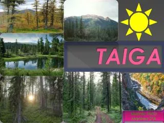
TRANSFORMATION OF LARCH-DOMINATED FORESTS AND WOODLANDS INTO MIXED TAIGA. E. Levine 1 , H. Shugart Jr. 2 , J. Ranson 1 , N. Mölders 3 , J. Shuman 2 , R. Knox 1 , G. Sun 4 , V. Kharuk 5 1 NASA’s GSFC, Biospheric Sciences Branch, Greenbelt, MD

E N D
TRANSFORMATION OF LARCH-DOMINATED FORESTS AND WOODLANDS INTO MIXED TAIGA E. Levine1, H. Shugart Jr.2, J. Ranson1, N. Mölders3, J. Shuman2, R. Knox1, G. Sun4, V. Kharuk5 1NASA’s GSFC, Biospheric Sciences Branch, Greenbelt, MD 2Dept. of Environmental Sciences, University of Virginia, Charlottesville, VA 3University of Alaska, Fairbanks, Geophysical Institute, Fairbanks, AK 4Dept. of Geography, University of Maryland, College Park, MD 5Sukachev Forest Institute, Krasnoyarsk, Russia
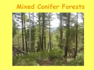
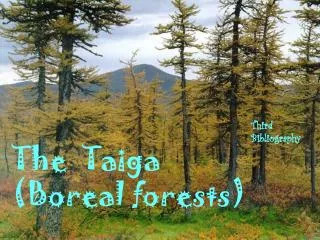
Siberian Taiga • One of the largest unaltered boreal forest areas in the world making up 19- 20% of the world’s forest area • Significant carbon sinkestimated to store 74 Pg C and 249 Pg C in the vegetation and soil, respectively • Long, severe winters (up to 6 months with mean temperatures below freezing) and short summers (50 to 100 frost-free days) • Annual temperature range: -54°C to 21°C (-65°F to 70°F ) • with occasional extremes 73°C to 32 (-100°F to 90°F ) • mean annual precipitation: 38 to 51 cm (15 to 20 in)
Major soils of the study area(US Soil Taxonomy) (Cryosol Working Group, 2003)
Siberian Larch (Larix sibirica) • Deciduous needleleaf conifer native to Russia and northern China that loses it foliage each fall • Occupies 270 million ha of boreal forest • Siberian larch prefers light and is tolerant of both heat and frost, allowing it to grow on permafrost sites, where it is often found
A R U S S I R U S S I A
In Northern Siberia • Average temperatures have risen 1 to 3°C (3 to 5°F) over the past 30 years, compared to the worldwide average increase of 0.6°C (1°F) • Noticeable changes over the past few decades include • increases in winter and fall precipitation • winter warming • higher soil temperatures • permafrost thawing • fires • insect outbreaks • ground subsidence
Some possible effects of permafrost thawing • warming of the soil profile • increased depth of active layer • increased organic decomposition • release of CO2 and methane • change in soil moisture storage • increased evaporation • increased runoff • change in forest species • Increased wildfires
AREA 3 AREA 1 AREA 2
Objectives • Use coupled forest gap and soil process models to understand their process level interaction under different scenarios • Identify the extent of the evergreen conifer invasion using a combination of well-calibrated satellite data and ground measurements • Use these tools to forecast trends of forest species biodiversity in the region
Questions • Are historical areas of larch dominance in Siberia transforming into a zone of mixed taiga in areas of disturbance? • Will the trees in this ecosystem begin to grow faster and gradually extend their reach farther north into the treeless tundra? • Will extensive changes in the larch dominated and adjacent forests impact the carbon, energy, and water cycles of Siberia? • Will hotter, drier conditions inhibiting growth and leave the forest prone to invasive species and wildfires?
VALIDATION MODEL INITIALIZATION COMBINED MODELING • Remote Sensing • Predicted pixel level attributes • height • biomass • species composition • LAI • Field Measurements • Detailed ground knowledge • Forest Attributes • Remote Sensing • Maps • Field measurements • (e.g. forest type and structure, disturbance history) • Soil Attributes • Maps • Field Measurements • (e.g. soil texture, bulk density, and horizon depths, moss thickness) • Climate • Weather Station Data • Warming and precipitation scenarios • Forest Model • (FAREAST) • Species composition • Stand structure • Seed sources • Others • Soil Model • (HSTVS) • Soil moisture flux • Soil temperature flux • Snow and moss insulation • Depth of active layer thaw • Others RESULTS • Ecological Forecasts • Projected species composition and structure • Areal impacts • Model results mapped to stratified landscapes
FAREAST: A Boreal Forest Simulator Yan, X. and Shugart, H.H. (2005) FAREAST: a forest gap model to simulate dynamics and patterns of eastern Eurasian forests. Journal of Biogeography, 32:1641-1658. • Regeneration: • Available Light • Soil Moisture • Site Quality • Depth of Thaw • Seed Bed • Seed Availability • Sprouting • Layering • Growth: • Available Light • Soil Moisture • Site Quality • Growing-Degree Days • Depth of Thaw • Diameter • Age • Height • Mortality: • Stress • Fire • Insects • Age
Krankina O.N., et al. 2005. Effects of climate, disturbance, and species on forest biomass across Russia. Can. J.For.Res. 35: 2281-2293
Hydro-Thermodynamic Soil-Vegetation Simulation (HTSVS)Mölders, N., U. Haferkorn, J. Döring, G. Kramm, 2003: Long-term numerical investigations on the water budget quantities predicted by the hydro-thermodynamic soil vegetation scheme (HTSVS) Meteorol. Atmos. Phys., 84, 115-135. • Multi-layer soil model • including peat, moss, and lichen • Multi-layer snow model • Includes simulations of • heat conduction and water diffusion • soil freezing and thawing and cross effects • release and consumption of latent heat • effects of frozen soil layers on vertical fluxes of heat, moisture and water vapor flux
HSTVS Results • Soil temperatures will be predicted more accurately if frozen soil physics are considered • The soil model captures the observed seasonal course of soil temperature well and moisture acceptably • The largest uncertainty in simulated soil temperature occurs around freezing • Results are sensitive to soil properties • Time steps larger than 10 minutes no longer captures the active layer effectively • Soil properties below 1meter are important • 20 layers and a depth of -30m provide better results