Download
1 / 24
240 likes | 346 Views
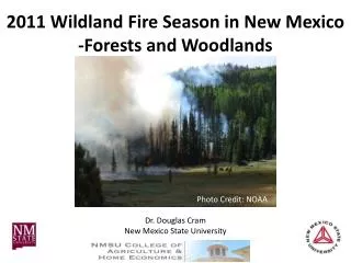
2011 Wildland Fire Season in New Mexico -Forests and Woodlands. Photo Credit: NOAA. Dr. Douglas Cram New Mexico State University. Composite Satellite Image 2011 (NOAA) . NOAA Satellite Image June 20, 2011 . Range Improvement Task Force

E N D
2011 Wildland Fire Season in New Mexico -Forests and Woodlands Photo Credit: NOAA Dr. Douglas Cram New Mexico State University
Range Improvement Task Force Cooperative Extension Service / Agricultural Experiment Station College of Agricultural, Consumer and Environmental Sciences Photo by John Fowler
Range Improvement Task Force Cooperative Extension Service / Agricultural Experiment Station College of Agricultural, Consumer and Environmental Sciences Photo by Kristen Hornig
Range Improvement Task Force Cooperative Extension Service / Agricultural Experiment Station College of Agricultural, Consumer and Environmental Sciences Photo by Kristen Hornig
Range Improvement Task Force Cooperative Extension Service / Agricultural Experiment Station College of Agricultural, Consumer and Environmental Sciences Photo by Morgan Petroski
Range Improvement Task Force Cooperative Extension Service / Agricultural Experiment Station College of Agricultural, Consumer and Environmental Sciences
Range Improvement Task Force Cooperative Extension Service / Agricultural Experiment Station College of Agricultural, Consumer and Environmental Sciences Photo by Burt Stalter
2011 Large SW Forest Fires White – 10,356 acres Las Chance – 53,342 Miller – 88,835 Horseshoe 2 – 222,954 Mayhill – 31,861 Wallow, AZ – 538,049 Track – 27,792 Wallow, NM – 15,407 Pacheco – 10,250 Las Conchas – 156, 593 Lookout – 22,687 Total – 1,178,126 acres Range Improvement Task Force Cooperative Extension Service / Agricultural Experiment Station College of Agricultural, Consumer and Environmental Sciences
Range Improvement Task Force Cooperative Extension Service / Agricultural Experiment Station College of Agricultural, Consumer and Environmental Sciences
Burn Severity Mapping Range Improvement Task Force Cooperative Extension Service / Agricultural Experiment Station College of Agricultural, Consumer and Environmental Sciences
Las Conchas Burn Severity • High 28,470 ac 25% • Moderate 39,910 ac 36% • Low 43,450 ac 39% “Not all of the acreage within the fire perimeters burned severely and in fact much was unburned or burned only at low and moderate severity.” Range Improvement Task Force Cooperative Extension Service / Agricultural Experiment Station College of Agricultural, Consumer and Environmental Sciences
Low, Moderate, or High? Range Improvement Task Force Cooperative Extension Service / Agricultural Experiment Station College of Agricultural, Consumer and Environmental Sciences
Low, Moderate, or High? Range Improvement Task Force Cooperative Extension Service / Agricultural Experiment Station College of Agricultural, Consumer and Environmental Sciences
Low, Moderate, or High? Range Improvement Task Force Cooperative Extension Service / Agricultural Experiment Station College of Agricultural, Consumer and Environmental Sciences
Low, Moderate, or High? Range Improvement Task Force Cooperative Extension Service / Agricultural Experiment Station College of Agricultural, Consumer and Environmental Sciences
Moderate Burn Severity Range Improvement Task Force Cooperative Extension Service / Agricultural Experiment Station College of Agricultural, Consumer and Environmental Sciences
Moderate Burn Severity Range Improvement Task Force Cooperative Extension Service / Agricultural Experiment Station College of Agricultural, Consumer and Environmental Sciences
Las Conchas Burn Severity • High 28,470 ac 25% • Moderate 39,910 ac 36% • Low 43,450 ac 39% “…much of these areas burned as we would expect them to…” Range Improvement Task Force Cooperative Extension Service / Agricultural Experiment Station College of Agricultural, Consumer and Environmental Sciences
41 trees 135 years Range Improvement Task Force Cooperative Extension Service / Agricultural Experiment Station College of Agricultural, Consumer and Environmental Sciences
475+ yrs old 32+ fires Range Improvement Task Force Cooperative Extension Service / Agricultural Experiment Station College of Agricultural, Consumer and Environmental Sciences
Range Improvement Task Force Cooperative Extension Service / Agricultural Experiment Station College of Agricultural, Consumer and Environmental Sciences
Doug Cram dcram@nmsu.edu 575-646-8130 Range Improvement Task Force Cooperative Extension Service / Agricultural Experiment Station College of Agricultural, Consumer and Environmental Sciences