Download
1 / 20
210 likes | 364 Views
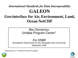
OGC GALEON (Geo-interface for Air, Land, Ocean NetCDF) Phase 1 Status and Phase 2 Plans. Ben Domenico*, Unidata UCAR Glenn Rutledge*, NCDC For AGU Joint Assembly, May 2006. *Work sponsored in part by NSF and NOAA. Outline. Background Phase 1 Accomplishments, Phase 2 Directions

E N D
OGC GALEON (Geo-interface for Air, Land, Ocean NetCDF)Phase 1 Status and Phase 2 Plans Ben Domenico*, Unidata UCAR Glenn Rutledge*, NCDC For AGU Joint Assembly, May 2006 *Work sponsored in part by NSF and NOAA
Outline • Background • Phase 1 Accomplishments, • Phase 2 Directions • WCS Implications • Observations (Many slides just for future reference)
Disparate Data Models:Different Ways of Thinking about Data • To the GIS (solid earth and societal impacts) community, the world is: • A collection of static features (e.g., roads, lakes, plots of land) with geographic footprints on the Earth (surface). • The features are discrete objects with attributes which can be stored and manipulated conveniently in a database. • To the Fluid Earth Sciences (FES -- atmosphere and oceans) communities, the world is: • A set of parameters (e.g., pressure, temperature, wind speed) which vary as continuous functions in 3-dimensional space and time. • The behavior of the parameters in space and time is governed by a set of equations. • Data are simply discrete points in the mathematical function space.
Traditional GIS view Features as points, lines, polygons Attributes in DBMS tables
FES Client Applications GIS Client Applications FES Servers GIS Servers THREDDS Server GIS Server THREDDS Server OGC or OPeNDAPADDE. FTP… protocols OpenGIS Protocols: WMS, WFS, WCS Satellite, radar, forecast model output, … datasets OGC or proprietary GISprotocols GIS Server Demographic, infrastructure, societal impacts, … datasets Taking Advantage of Web Services for Data System Interoperability
GALEON Objectives • Use standardized web service between GIS and atmospheric/oceanographic clients and servers • Determine suitability of WCS (Web Coverage Service) interface for serving traditional FES datasets to GIS community • Implement WCS gateway(s) to existing FES client/server community, based on: • *netCDF (network Common Data Form), • OPeNDAP (Open Project for Networked Data Access Protocol) • THREDDS (THematic Real-time Environmental Distributed Data Services)
WCS capabilities WCS description OPeNDAP THREDDS interface THREDDS interface NetCDF dataset WCS Client NcMLGML getCapabilities getCoverage geoTIFF netCDF describeCoverage WCS coverage GMLgenerator NetCDF geoTIFFgenerator NcML-G metadata THREDDS catalogs OPeNDAP THREDDS catalogs enhanced with NcML-GML NetCDF/OPeNDAP data server netCDF objects THREDDS enhanced catalog generation tools …
Tasks • Find or implement WCS clients and servers for netCDF datasets • Test WCS clients with WCS gateway servers • Examine possibility and implications of extending WCS to include netCDF binary encoding • Experiment with GML (Geography Markup Language) dialects for expressing Earth Science data model embodied in netCDF files
Active Participants • Unidata/UCAR (Ben Domenico, John Caron) • U of Florence and IMAA-CNR (Stefano Nativi, Lorenzo Bigagli) • International University Bremen (Peter Baumann) • George Mason University (Liping DI, Wenli Yang) • CadCorp (Martin Daly, Frank Warmerdam) • Research Systems International UK Ltd (David Burridge, Norman Barker) • NCDC, National Climatic Data Center (Glenn Rutledge, Dan Swank) • NERC Natural Environment Research Council/British Atmospheric Data Center (Dominic Lowe, Andrew Woolf) • Washington University St. Louis (Stefan Falke, Rudolf B. Husar) • Providing Specialized Expertise • Interactive Instruments (Clemens Portele) • NASA Geospatial Interoperability Office (John Evans)
Planning to Participate • Texas A&M University (Gerry Creager) • University of Alabama Huntsville (Mike Botts) • Jet Propulsion Laboratory (Rob Raskin) • University of Applied Sciences (Ralf Denzer) • ESRI, Inc (Simon Evans, Steve Kopp) • CEOP (Ben Burford), Coordinated Enhanced Observing Period of the Committee on Earth Observation Satellites (CEOS) • US EPA has expressed interest in servicing air quality data via a GALEON test site • PFEL (Roy Mendelssohn)Pacific Fisheries Environmental Laboratory
Accomplishments • Interoperability experiments with WCS client and server implementations at numerous sites (status reports on GALEON wiki and OGC portal) • Several recommendations for changes to WCS specification (formal documents on OGC portal) • Initiatives underway for GML applications profiles for explicit netCDF semantics (ncML-GML, CSML) • Dialog initiated with GMLJP2 group to determine applicability to netCDF datasets
Plans for Phase 2 • For continued experimentation with WCS implementation, use GALEON OGCnetwork • Additional client & implementations • New datasets • For WCS and GML specifications, continue as OGC GALEON Interoperability Experiment • Collaborate closely with: • OGC GEOSS Services Network (GSN) • GMLJP2 (GML JPEG2000)
OGC GEOSS Services Network (GSN)GALEON Contributions • For OGC GEOSS demonstrations in Beijing and at IGARRS in Denver • Data served via WCS at Unidata, NCDC, Washington U. in St. Louis, George Mason University • Web client access via WMS on web sites at U of Florence, Washington U. St. Louis • Thick Client access via RSI/UK, U of Florence, George Mason U. tools
Primary OGC Interface Issues • NetCDF as a sixth WCS encoding format OR • Develop netCDF application profile AND • Do away with fixed list of encoding formats (geoTIFF, HDF-EOS, NITF, DTED, GML) • Develop WCS application profile for netCDF • Augment WCS specification • Develop GML application schemas for netCDF semantics (ncML-GML, CSML, GMLJP2?)
CF-netCDF WCS Profile • Brief Description • Documentation • Standard names • Units • Coordinate types • Coordinate systems • Grid mappings • Time coordinate(s) • Code for Implementing netCDF Interface • Support • CF-netCDF and Coverage (ISO 19123) Data Model Mapping • Limitations • Compliance Testing
netCDF – Coverage Mapping (S. Nativi) Explicit mediation needed between netCDF hyperspatial data and WCS coverage models
netCDF-relatedChanges Proposed in WCS 1.1 • WCS encoding “profiles” instead of fixed list of encoding formats • Multiple “variables” or “parameters” or “fields” in a coverage (e.g., pressure, temperature, etc.) • Coverages with 3 spatial dimensions • Coverages with multiple time dimensions (e.g. forecast time in model output) • Non-spatial “height” dimension, (e.g., atmospheric pressure, ocean density) • Irregularly-spaced grids • Are collections of point observations and trajectories coverages or features?
Observations and Assessment • A handful of clients and servers have demonstrated feasibility • Commercial vendors are actively participating (RSI, ESRI, others) • GEOSS demonstrations involve WMS clients getting data from GALEON WCS servers • Finished netCDF profile is key • Other profiles are needed (e.g., OPeNDAP, HDF-EOS, GeoTIFF) • Most WCS limitations are being addressed in 1.1 • With proposed changes, WCS should be viable for FES datasets
References • GALEON Wikihttp://galeon-wcs.jot.com/WikiHome • OGC portal GALEON areahttp://portal.opengeospatial.org/index.php?m=projects&a=view&project_id=173 • OGCnetworkhttp://www.ogcnetwork.net/?q=networks • Draft CF-netCDF WCS Encoding Profilehttp://www.unidata.ucar.edu/projects/THREDDS/GALEON/netCDFprofile-short.htm