Download
1 / 17
170 likes | 435 Views
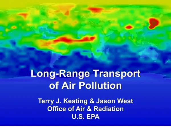
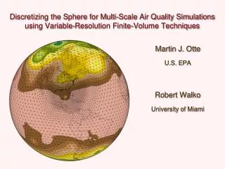
Discretizing the Sphere for Multi-Scale Air Quality Simulations using Variable-Resolution Finite-Volume Techniques. Martin J. Otte U.S. EPA Robert Walko University of Miami. The Ocean-Land-Atmosphere Model (OLAM).

E N D
Discretizing the Sphere for Multi-Scale Air Quality Simulations using Variable-Resolution Finite-Volume Techniques Martin J. Otte U.S. EPA Robert Walko University of Miami
The Ocean-Land-Atmosphere Model (OLAM) • OLAM is based partly on RAMS, a limited area model specializing in mesoscale and cloud scale simulations • The primary motivation for OLAM was to provide a global modeling framework similar to RAMS in the following aspects: • Arakawa-C grid stagger • Mass- and momentum-conserving finite-volume discretization • Compressible equations with time-split solver • Local mesh refinement • Horizontal terrain-intersecting grid levels (an option in RAMS) • Same physical parameterizations (microphysics, land, etc.) • Other aspects of RAMS were abandoned: • Boussinesq Full Navier Stokes • Polar stereographic projection No projection • Squares Triangles 4. A new dynamic core was developed to meet these requirements
Most common grid cell arrangement for global models: Spherical coordinate system: latitude, longitude, height Convenient: Grid is logically structured • Global spectral model grid • Packs gridpoints near poles • No nesting capabilites
. . . P Polar stereographic projection used in RAMS:Earth surface to planar surface • Map factors are used in all horizontal derivative terms • Spherical geometry terms must be added due to transformation • Limited to hemispheric or smaller model domain
Global RAMS 1997: “Chimera Grid” approach Lateral boundary values interpolated from interior of opposite grid Not flux conservative
Global grid structure in OLAM version 1Arakawa-C grid stagger in both square and triangular cells
The Ocean-Land-Atmosphere Model (OLAM): An expansion of RAMS into an Earth System Model Icosahedron OLAM solves a finite-volume analog of the full compressible Navier-Stokes equations in conservation form, and exactly conserves mass, momentum, and internal energy. Unstructured Grid; No overlapping grid cell; No special nest communication; Each cell communicates directly with its neighbor independently of resolution
Finite difference form: u u 2 3 1 1 2 Vol A A 1 2 2 Finite volume form: u u 1 3 2 1 2
OLAM uses the Arakawa-C grid stagger Control volumes for T, U, W W T U
Grid Nesting Example: Hurricane Wilma 8 km nest
Examine passage through 4 km nest Hurricane Wilma observed 8km run 4km nest
The Representation of Topography in GCMs The Andes mountains: -- length of 7000 km -- average height of 4 km -- typical width of 200-300 km
Amazon Basin Precipitation Results (15S – 5N; 75W – 50W) Improving representation of topography improves OLAM’s precipitation estimates El Nino year Higher resolution gives correct ENSO behavior OLAM 200 km OLAM 100 km OLAM 25 km Coarse GCMs do not capture the minimum during El Nino years (Medvigy et al., 2009, GRL)
Impact of Andes on global hydroclimateinterannual variability ENSO 400 km topography 50 km topography Spurious large Amazon convection realistic low Amazon convection Different Walker/Hadley cells? 1998 Anomaly, precipitation [mm] 25 km topography 200 km topography More drought in Pacific Northwest More drought in Australia Weaker North Atlantic storm tracks (Medvigy et al., 2009, GRL)
Summary • OLAM has been developed as the advancement of current regional forecast models to global environmental modeling • The current grid structure is capable of representing atmospheric processes from global to turbulent timescales • Todo: • Integrated ocean model (ROMS) • Thermodynamic variable (enthalpy, total energy) • Hydraulic model for proper runoff modeling • Atmospheric chemistry transport and feedbacks using CMAQ and RRTMg