Download
1 / 53
550 likes | 696 Views
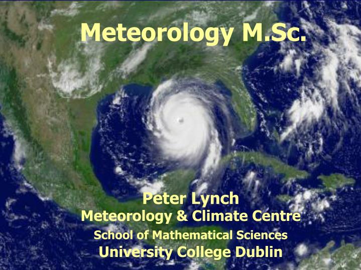
Meteorology M.Sc. Peter Lynch Meteorology & Climate Centre School of Mathematical Sciences University College Dublin. Synoptic Meteorology MAPH 40410 Peter Lynch Meteorology & Climate Centre School of Mathematical Sciences University College Dublin. Forecasting Module Lecture 1.

E N D
Meteorology M.Sc. Peter Lynch Meteorology & Climate Centre School of Mathematical Sciences University College Dublin
Synoptic Meteorology MAPH 40410 Peter Lynch Meteorology & Climate Centre School of Mathematical Sciences University College Dublin
Forecasting Module Lecture 1 Refresher: Airmasses, Fronts & Frontal Depressions
Air Masses Arctic Maritime Polar Maritime Polar Continental Returning Polar Maritime Tropical Maritime Tropical Continental
The Station Circle Windspeed and direction Wind from direction of the shaft Triangle = 50 kts Full feather =10 kts Half feather = 5 kts Just shaft < 3kts Type of medium and high cloud. Decode over page Screen temperature in tenths of a degree e.g... 167 = 16.7 C Mean sea level pressure Last 3 figures of the MSL Pressure e.g... 181 = 1018.1hPa 167 181 Visibility 01 to 50 add 00 for visibility in metres 56 to 89 subtract 50 for visibility in km Change in pressure (tendency) Difference in pressure from 3 hours in tenths of hPa and direction of up or down. Decode over page 64 10 045 Past weather Symbols as Present weather Period covered 0000,0600,1200,1800 last 6hrs 0300,0900,1500,2100 last 3hrs All other hours last hour Present weather Symbols Fog Showers 1/30 Drizzle Snow Dew point in tenths of a degree e.g.... 045 = 4.5 C Rain Thunderstorm Type of low cloud Phenomena occurred in past hour. Cloud amount and height ( Low, Medium and High) Amount of cloud in eighths /height of cloud in feet 01 to 50 add 00 for height in feet 56 to 89 subtract 50 for height in thousands of feet
, , Observations 997 9 012 , 11 001 997 007 10 11 8 45 35 06 75 15 65 30 24 20 50 4 7 11 11 9
Tephigrams & Stability The position of the ELR gives the stability of the ascent at that point DALR > ELR > SALR Conditionally Unstable DALR > SALR > ELR Absolutely Stable ELR > DALR > SALR Absolutely Unstable Any point on an ascent
EXTRATROPICAL CYCLONES • They form along the line between the polar air mass and the maritime tropical air mass. • Shearing produces cyclonic motion. • Under suitable conditions frontal surface will assume a wave shape.
EVOLUTION OF A FRONTAL DISTURBANCE stationary polar front initial stage open wave cyclone occluding fully occluded (mature)
Lifecycle of frontal disturbances 1 3 Surface isobars (solid) temperature (dashed) 2 4
Upper-level Height Contours 1 3 Note displacement of upper-level trough to west of surface low 2 4
RELATIONSHIP BETWEEN SURFACE CYCLONE AND UPPER LEVEL FLOW 500 mb height (thick lines), SLP isobars (thin lines), and layer-mean temperature (dashed).The deflection of the upper-level wave contributes to deepening of the surface low.
CYCLOGENESIS • Formation of cyclones • Close relationship between surface disturbances and flow of air aloft. • For a mid-latitude cyclone to form: cyclonic flow must be established • Inward flow of air near surface must be supported by outflow aloft. • Total spin / cyclonic height = constant
The jet stream wind is subgeostrophic in troughs, and supergeostrophic in ridges slow fast fast slow
fast fast slow
fast fast slow
Mid-latitude Frontal Disturbances:interaction between low-level and jet-level flow SL pressure and precipitation 300 mb height and wind speed warm cold
Developing frontal lows tilt westward with height surface low upper-level trough
fast fast slow Note the advection of cold and warm airmasses
Satellite Views of Wave Cyclones Mature stage Open stage, with clouds over warm and cold fronts, with clear warm sector Occluding stage
occluding stage mature stage
Finding Surface Fronts Using plotted surface charts
Finding Surface Fronts • What is a front? • A boundary between different types of air • If we can define what those differences typically are, or what we expect them to be … • … we can define the things that we should look for in order to find a front
Fronts cold air warm air cool air
Fronts on a Pressure Chart 972 976 980 4 984 3 2 988 1 992 996
Station Circles • By studying different elements on a station circle, the position of the surface front can be found • So, what’s available on a station circle? • temperature and dew point • wind speed and direction, gusts • present and past weather, visibility, cloud amount, cloud type, cloud base • pressure tendency
What happens to the weather as a front passes? Using the information from station circles
Fronts on a Pressure Chart 972 976 980 4 984 3 2 988 1 992 996
75 4 12 965 07 75 07 1 25 >200km ahead of the warm front 1
G32 11 752 31 50 09 8 18 6 08 In the warm sector, 20km ahead of the cold front 2
20km behind the cold front 08 814 18 65 3 06 7 25 1 12
>100km behind the cold front 08 840 12 72 4 04 3 28
Positioning a Surface Front • Temperature and Dewpoint • Windspeed and Direction, Gusts • Present Weather and Past Weather • Visibility • Cloud Amount, Type and Lowest Cloud Base • Pressure Tendency
Temperature and Dewpoint • Temperature isn’t such a good guide as dewpoint • The dewpoint within an airmass tends to remain the same • The dewpoint in the warm sector will be constant and fairly high • The dewpoint behind the cold front may fall gradually
Wind speed and direction • The wind will veer on the passage of a front • Veer = turn clockwise • Back = turn anticlockwise • Gusts are likely to be strongest on the cold front
Present and Past Weather The heaviest rain is often at the front • It is likely to rain ahead of a warm front • Drizzle is most likely in the warm sector • Showers develop behind a cold front
Visibility • Visibility decreases when it is raining • Drizzle will decrease the visibility more than rain (the smaller drop size is more effective at scattering light) • Visibility in the warm sector will generally be poorer • Visibility in the cold air will be very good, up to 30km or more
Clouds • Amount and type • High clouds >200km ahead of the warm front • Lowest cloud is associated with the heaviest rain, often on the front • Cloud base can be affected by orography