Download
1 / 23
230 likes | 256 Views
Leveraging Selangor’s Land Use Planning through the Optimization of its Web Enabled Spatial Information System - SISMAPS. Geospatial World Forum, Rotterdam, 13-16 May 2013. Introduction. Selangor, the fastest growing state in Malaysia Rapid Urbanisation in major cities and its peripheries

E N D
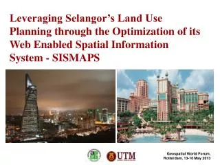
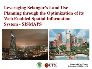
Leveraging Selangor’s Land Use Planning through the Optimization of its Web Enabled Spatial Information System - SISMAPS Geospatial World Forum, Rotterdam, 13-16 May 2013
Introduction • Selangor, the fastest growing state in Malaysia • Rapid Urbanisationin major cities and its peripheries • Kuala Lumpur conurbation: Incl. Kuala Lumpur (capital city) and several cities around it • Urbanising pressureson semi-urban or rural areas close to the cities • In effect, diverse and complex issues surrounding the state’s planning and development procedures • Selangor Town and Country Planning Department as the authority responsible to plan, monitor and coordinate land use planning • Need for an effective and efficient tool for management of information concerning planning and development
State of Selangor Located in the west of Peninsular Malaysia. Malaysia consist of Peninsular and East Malaysia.
Statistics • Rotterdam-Rijnmond (greater Rotterdam) • Population = 1.3 million • City Population = 616,250 (Feb. 1, 2012) • Size = 319 km2 (2007) • (wikipedia) • Selangor State: 8,153 sq. km (2.4% of Malaysia land area) • 9 districts and 12 local authorities • Population: 5.5 million (2010) • Highest growth rate among 13 states in Malaysia (2010 GDP = 10%, higher than the national average of 7.2%) (Source: Laporan Rancangan-Rancangan Tempatan, Negeri Selangor)
The Need for SISMAPS • To facilitate coordination and monitoring of development plans at the state and local authorities level. • To ensure development compliance to planning decisions as approved by the State Planning Committee. • To enable the auditing of development achievement and compliance to Local Plans. • To provide a comprehensive and integrated land use database that can be shared with all 12 Local Authorities . • To enable the public to view information on Local Plans.
User Requirement Analysis Data Components No. of Land Parcels Total: 1,086,447
Hardware and Software Analysis • The use of a server for more than 1 function in some LAs. • Can be categorised as ‘Ready’, ‘Ready with Condition’ and ‘Ready at MinimumLevel’. Types of Operating System used in Agencies
Human Resource Analysis in Local Authorities • Users comprise of executive and technicalsupport staffs • Executives – advanced skill and technical staffs – basic & intermediate skills • Basically all agencies are ready for SISMAPS implementation but several with minimum capability especially in terms of data updating and maintenance. GIS Users in JPBDS and Local Authorities
Problems Identified • Different GIS platform across Local Authorities and technical department requires integration • Unstandardized data structure • Poor data quality in some LAs • Infrastructure capability (Hardware and network) • Human resource
Quality of Data • Spatial Overlappings • and Gaps • Not complying with • JUPEM Cadastral Lot • Boundary • error Attributes not complete Data Structure not following the standard metadata
Hardware and Software Capabilities • Level of Readiness
Development Concept and Approach • Incorporates safety, quality, precision, validity and system integrity features at both TCPD and LA levels. • Shared activities based on 5 components : • i. Users • ii. Contents and Applications iii. Network iv. Database v. System Integration SISMAPS’ TECHNOLOGY MODEL
System Integration • Based on web services, one-stop web site access. • On-line data sharing facilities - data cataloguing, GIS visualization and data manipulation. • Integrates datafrom various stakeholders. • Fast,easyto handle and user-friendly applications.
Enterprise Database Structure • Spatial data is stored in a uniform format (12 LAs); • Ease the process of updating and review of information; • Data can be easily retrieved, displayed, analysed and reproduced; • Outputs with added value; • Data sharing platform Feature Dataset Feature Class Polygon, Line, Point Table Domain and Subtypes Relationships Topology Geometric Network Survey Dataset Raster Dataset TIN Dataset Metadata Document
SISMAPS’ Applications & Integration • SISMAPS • - Provides 5 main functions • Online EIS Local Plan • GIS for Executive • Local Plan Monitoring • Online data updating (charting) • Public Access/ User • - As ‘Platform’ to all other applications, including the monitoring module, GIS-EPC & systems integration • Systems’ Integration • - Integration of the Department’s existing applications with GIS data • - Sharing of Services between agencies- Data maintenance
SISMAPS - EIS • search and query • database • reporting and printing • metadata
Local Plans Monitoring Modules • Assess land use development approved by the local authorities in terms of performance and compliance • Emphasizes on spatial data, location and land use activities of current and proposed development • Two main modules - the Achievement Module and the Compliance Module Complying land use Conflicting land use
GIS-EPC – Data Integration • The spatial database of SISMAPS is linked to the planning information database of the EPC system (existing). • Facilitates the process of technical evaluation of planning proposals
User Statistics • Public Users • Registered Users
Conclusion • Anew tool as part of the Planning Support System • Integration of functions involvingGIS and data analysis in digital form. • Land use data and information stored in standard and periodic form facilitates development monitoring, analysis and review . • Provide a scientific analysis techniquefor assessing the status of LP implementation. • Allow for state wide and inter border local authority to monitor development
http://sismaps.jpbdselangor.gov.my Thank you… b-anazri@utm.my Ahmad Nazri Muhamad Ludin Yazid Abu Bakar Susilawati Sulaiman Mohd. Zaki Ibrahim AizuddinSafiaii Department of Urban and Regional Planning Faculty of Built Environment Universiti Teknologi Malaysia Selangor Town and Country Planning Department Malaysia