Download
1 / 33
340 likes | 543 Views
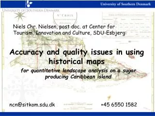
for quantitative landscape analysis on a sugar producing Caribbean island. Accuracy and quality issues in using historical maps. Niels Chr. Nielsen, post doc. at Center for Tourism, Innovation and Culture, SDU-Esbjerg:. ncn@sitkom.sdu.dk +45 6550 1582.

E N D
for quantitative landscape analysis on a sugar producing Caribbean island Accuracy and quality issues in using historical maps Niels Chr. Nielsen, post doc. at Center for Tourism, Innovation and Culture, SDU-Esbjerg: ncn@sitkom.sdu.dk +45 6550 1582
Background: Centre for Maritime and Regional Studies (CMRS) at SDU-Esbjerg • CMRS studies the interaction of the oceans and human society. With expertise from historians, archaeologists, ethnologists, and social anthropologists, our research explores the interaction between humans and the sea from the earliest times to the Present. • Example projects • ”Digital Atlas of Cultural Environments in Denmark”, • History of Marine Animal Populations (Census of Marine Life), • Digital Mobile Nature- and town walks, • Studying the controversy about the national park at Salt River Bay, St. Croix • Supporting the developement of a national park in the Danish Wadden Sea area • Main theme for the ”St. Croix in past and present” Galathea3-project: Sustainability • read more at www.cmrs.dk
a bit about Sankt Croix http://cas.umkc.edu/StCroix/orientation.htm
Land use and land cover • Land use: • The way in which, and for the purposes of which, • human beings employ the land and its resources. Land cover: The physical state of the land surface. from Meyer 1995: Meyer, W.B. 1995. Past and present land use and land cover in the USA. Consequences 1, 1: 24-33
Driving forces Social context Land use and land cover in a wider context Climate Change (modification) Land Cover #2 (physical maintenance) Land Cover #1 Land Cover #3 (change) (conversion) (maintenance) Proximate sources Land Use #1 Land Use #2 envt. impacts on Driving Forces From Ojima, Galvin and Turner (1994) and Turner, Skole and Moss (1993)
View from above St. Croix seen from the International space station (ISS), altitude 400 km, 2001.
Climate NE trade winds, quite constant over the year
First known map of St. Croix French, Lapointe 1671. NB: SSE up.
The “quarters” of St. Croix. • Coastline, borders and towns digitised from Oxholm’s map
Cronenberg and Jægersberg’s map, compiled 1749-50 Drawn at scale appx. 1:30.000 Photograph: Daniel Hopkins, with permission, from http://cas.umkc.edu/StCroix/mapping/cronenberg.htm
P.L. Oxholm, a key figure in the mapping of St. Croix in the late 18. century (1753 – 1827, general governor 1815-16)
Oxholms “topographic” map of St. Croix • Measured/compiled around 1794, printed in Copenhagen 1799, at a scale of app. 1:60.000 From Daniel Hopkins: http://cas.umkc.edu/StCroix/mapping/framesetOxholm.htm
Subset of the Cronenberg-Jaegersberg map 1750 • Note plot numbering
Subset of Georeferenced C&J map with digitised features: plantation/plot outlines from Oxholm’s map (bold lines)
Subset of georeferenced Oxholm’s map • With plot outlines from the C & J map
Land cover time series: Cronenberg 1749 ..Oxholm 1794 ..Shaw 1933 & UVI 1999
Land Cover Statistics from maps jump to conclusions
Main soil associations on St. Croix • with registered positions of plantation (great) houses 1750, also showing digitized outline of quarters from Oxholm’s map. jump to conclusions
Terrain slope on Sankt Croix from USGS terrain model, measured in per cent
Viewpoints and hiding places on St. Croix 1748 Calculated in GIS from Digital Terrain model, numbers show how many great housesa given point can be seen from (excl. vegetaion)
Conclusions - We can get some of the way following the historical maps approach • Time to think integration with other databases (VISHA) • Work in progress: still cell-based modelling to be considered. Socio-economic as well as environmental. - To wonder: are the map data of use, any added value by having the spatial dimension along with the statistical? GIS relevant as integrating reference for historical information at this level? Thank you very much.