Download
1 / 24
240 likes | 389 Views
NWS Geospatial Accuracy Issues. NFUSE presentation. Rick Koehler, PhD NOAA – NWS – OCWWS – FDTB Boulder, CO. April 9, 2008 richard.koehler@noaa.gov. Presentation purpose and outline. Possible NFUSE discussion topic - geospatial issues ACUF White Paper (recommendations 4.0 and 5.0)

E N D
NWS Geospatial Accuracy Issues NFUSE presentation Rick Koehler, PhD NOAA – NWS – OCWWS – FDTB Boulder, CO April 9, 2008 richard.koehler@noaa.gov
Presentation purpose and outline Possible NFUSE discussion topic - geospatial issues ACUF White Paper (recommendations 4.0 and 5.0) Why even worry? “Comparison” - GPS technology and NWS product Accuracy measurements Position uncertainty RIDGE geospatial errors Geospatial experiment Reference - NSRS Estimated accuracy of NWS data Needs assessment and standards Summary NFUSE team presentation
ACUF White Paper Recommendation 4.0: NWS should develop and maintain the ability to produce objective uncertainty information from the global to the regional scale. Geospatial data appropriate at one scale may not be appropriate at a different scale. Recommendation 5.0: To ensure widespread use of uncertainty information, NWS should make all raw and post-processed probabilistic products easily accessible to the Enterprise at full spatial and temporal resolution. Sufficient computer and communications resources should be acquired to ensure effective access by external users and NWS personnel. To know the full, usable spatial resolution, it is critical to know the quality and accuracy of the geospatial component. NFUSE team presentation
Why even worry? “Weather is so dynamic and models are so imprecise, we don’t have to worry about location.” Often heard comment within NWS Uniform precipitation field Not critical to have exact position Highly variable precipitation field Important to have exact position
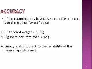
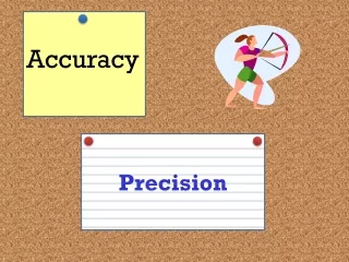
Why even worry? Error, Accuracy, and Precision “It is now generally recognized that error, inaccuracy, and imprecision can ‘make or break’ many types of GIS projects. That is, errors left unchecked can make the results of a GIS analysis almost worthless.” The Geographer's Craft Project - 1995 Ken Foote and Donald Huebner Department of Geography The University of Colorado at Boulder For NWS, let AWIPS = GIS http://www.colorado.edu/geography/gcraft/notes/error/error_f.html
“Comparison” “2 miles ahead” vs “2 miles, ± 0.1 miles” or “2 miles, ± 2.0 miles” NFUSE team presentation
Accuracy measures Data quality categories for Spatial Data Transfer Standards (SDTS) 15 Attribute accuracy Position accuracy Lineage Logical consistency Completeness Attribute 13 10 Position 11 9 5 MacEachren et al. Visualizing Geospatial Information Uncertainty: What We Know and What We Need to Know Cartography and Geographic Information Science, Vol. 32, No. 3, 2005, pp. 139-160 NFUSE team presentation
Accuracy measures But what about positional error? NFUSE team presentation
Accuracy measures Uncertainty as a distance Circle error probability (CEP) -50% chance true position within this circle Diameter root mean square ∙ 2 (2drms) - 95% prob used by NOAA/NOS Lat/Long listed for this point. But is the object really at this exact point? CEP 2 drms = 2.4 CEP 2 drms NFUSE team presentation
Position uncertainty Position data is probabilistic, not deterministic GPS Unit, 95% confidence level X X Scaled from a 1:2,00,000 map, 90% confidence level • 15 meters at 95% conf. level = 707 m2 circle (2.7 x 10⁻⁴ mi2) • 1,000 meters at 90% conf. level = 3.14 km2 circle (1.2 mi2 or 768 acres) NOS: Total error in position will not exceed 5 meters at the 95 percent confidence level. NFUSE team presentation
Position uncertainty – “field data” Low accuracy (example 3) High accuracy (example 1) Medium accuracy (example 2) Assumed location NFUSE team presentation
Position uncertainty – contour plot Assumed location Actual location (example 1) Actual location (example 2) Actual location (example 3) High accuracy 2drms = 0.10 Medium accuracy 2drms = 0.25 Low accuracy 2drms = 0.50 NFUSE team presentation
Position uncertainty - grids Gridded data basis = 1 km x 1 km Case 1 Position uncertainty 2drms= 1,000 m Case 2 Position uncertainty 2drms= 100 m Possibility of corners at the same location! Much more likely corners correctly located NFUSE team presentation
Position uncertainty - polygons Polygon “landmarks” Polygon may be drawn larger if key locations show a larger 2drms circle NFUSE team presentation
RIDGE geospatial errors Position accuracy check Get readout of a known point MD – DE – PA tri-state point “MDP Corner” survey mark NFUSE team presentation
RIDGE geospatial errors DE FireFox 4.1 km (2.5 mi) displacement IE 7 3.9 km (2.4 mi) displacement 2.6 km PA MD NFUSE team presentation
Geospatial experiment Multiple map datums Find the latitude and longitude of the flagpole Unit has several different “map datums” built into the software (new ones have 70+ datums) NFUSE team presentation
Locations from different “map datums” 2 mi2 1000 m radius Foothills Lab 500 m radius Flagpole NAD83 USGS Geospatial experiment NFUSE team presentation
Accurate, stable and consistent survey network, datums, map projections, GPS, detailed data - NAD83, NAVD88 Reference - NSRS National Spatial Reference System Longitude Latitude Topography Shoreline Boundaries Urban zones Roads Streams Vegetation Fed govt standard Entrusted to NOAA NFUSE team presentation
Reference - NSRS NWS data and geospatial reference frameworks * Meteorological models may be based upon the International Spheroid of 1924, an reference shape never used for US surveying and mapping NFUSE team presentation
Estimated accuracy of NWS data Data sources and comparisons NMAS = Natl Map Accuracy Standards NFUSE team presentation
Needs assessment Geospatial questions What’s the NFUSE assumed geospatial accuracy? What are your tolerances? Unknown data accuracy – how is this handled? ? High accuracy, no forecast affects Low accuracy, forecast affected At what point does geospatial uncertainty begin to influence forecast uncertainty? NFUSE team presentation
Position accuracy standards 3.2.1 Spatial Accuracy Accuracy is reported in ground distances at the 95% confidence level. This means that 95% of the positions will have an error with respect to true ground position that is equal to or smaller than the reported accuracy value. The reported accuracy value reflects all uncertainties, including those introduced by geodetic control coordinates, compilation, and final computation of ground coordinate values in the product. NFUSE team presentation
Summary How does geospatial uncertainty affect forecast uncertainty? Location error can affect some products (contours, polygons) Inconsistent geospatial data exists with NWS Established reference framework maintained by NOAA Existing federal standards for data accuracy Accuracy needs assessment should be considered Has this been taken into account? NFUSE team presentation