Download
1 / 1
10 likes | 87 Views
Explore the similarities and differences in land use dynamics in settlements of Machadinho d’Oeste and Vale do Anari in Rondônia, Brazil. Analyze forest cover, pasture conversion, and settlement age. This study delves into human and physical dimensions of land use in Amazonian landscapes.

E N D
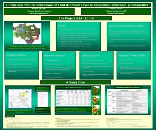
1988 1994 Machadinho Anari 1998 Amazon River • Similar biophysical features • Similar settlement age: early 80’s • Similar assets among colonists Land-Use/Land-Cover Dynamics Rondônia • Different architectures • Different institutions Machadinho d’Oeste and Vale do Anari in the State of Rondônia • Total area: 3,383 Km2 • Less forest cover in Anari (fishbone) after 15 years of colonization • Similar forest cover in both settlements when considering just private properties (51%) • Pasture conversion increased threefold in fishbone and less than twofold in Machadinho The Brazilian Amazon as a mosaic of interactions between people and environment (Landsat TM images from year 2000; photos from fieldwork) Concluding Remarks Human and Physical Dimensions of Land Use/Land Cover in Amazonian landscapes: a comparative approach Mateus Batistella Embrapa Satellite Monitoring mb@cnpm.embrapa.br Emilio F. Moran Indiana University/ACT moran@indiana.edu The Project (LBA - LC-09) A Study Case Comparative Approach: a Way to Go References Batistella, M., S. Robeson, E. F. Moran, 2003 Settlement design and landscape change in Amazônia: A multi-temporal evaluation using spatial metrics, Photogrammetric Engineering and Remote Sensing, 69(7):805-812. Lu, D., M. Batistella, and E. F. Moran, 2002. Linear Spectral Mixture Analysis of TM Data for Land-use and Land-Cover Classification in Rondonia, Brazilian Amazon. In: Proceedings of the ISPRS Commission IV Symposium: Geospatial Theory, Processing and Applications, edited by C. Armenakis and Y.C. Lee, Published by Center for Topographic Information Mapping Services Branch, Geomatics Canada, Department of Natural Resources Canada, Ottawa, Canada, pp.557-562. Batistella, M., and D. Lu, 2002. Integrating Field Data and Remote Sensing to Identify Secondary Succession Stages in the Amazon. In: Proceedings of the 29th International Symposium on Remote Sensing of Environment (ISRSE), 2002, Buenos Aires, Argentina. Batistella, M. 2001 Landscape change and land-use/land-cover dynamics in Rondônia, Brazilian Amazon. [Bloomington] : CIPEC, 2001. 257 p. (Dissertation Series, 7). Online at http://www.ecoro.cnpm.embrapa.br Batistella, M. and E. S. Brondizio, 2001. Uma estratégia integrada de monitoramento e análise de assentamentos rurais na Amazônia. In: Proceedings GIS BRASIL 2001, VII Show de Geotecnologias, Curitiba/Brasil: Fatorgis, CD-ROM, 2001. Batistella, M., E. S. Brondizio, E. F. Moran, 2000. Comparative analysis of landscape fragmentation in Rondônia, Brazilian Amazon. In: Proceedings of the International Archives of Photogrammetry and Remote Sensing and Spatial Information Sciences (IAPRS), Amsterdam: IAPRS, 2000, v. XXXIII, p. 148-155. Batistella, M. and E. F. Moran, in press. Dimensões Físicas e Humanas do Uso e Cobertura das Terras na Amazônia: uma Contribuição do LBA. Acta Amazonica. Lu, D. and M. Batistella, in press. Exploring TM Image Texture and its Relationships with Biomass Estimation in Rondônia, Brazilian Amazon. Acta Amazonica. Lu, D., E. F. Moran, and M. Batistella, in press. Linear Mixture Model Applied to Amazonian Vegetation Classification. Remote Sensing of Environment. Lu, D., P. W. Mausel, M. Batistella, and E. F. Moran, in press. Comparison of Land-Cover Classification Methods in the Brazilian Amazon Basin. Photogrammetric Engineering and Remote Sensing.