Download
1 / 23
230 likes | 420 Views
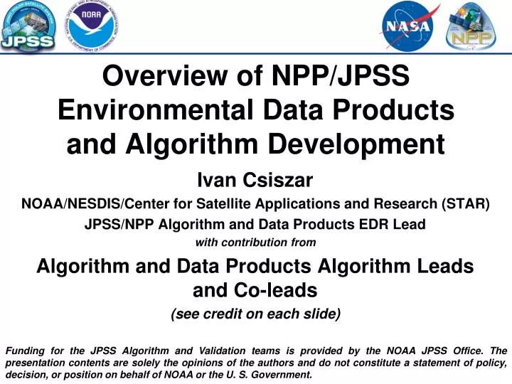
Overview of NPP/JPSS Environmental Data Products and Algorithm Development. Ivan Csiszar NOAA/NESDIS/Center for Satellite Applications and Research (STAR) JPSS/NPP Algorithm and Data Products EDR Lead with contribution from Algorithm and Data Products Algorithm Leads and Co-leads

E N D
Overview of NPP/JPSS Environmental Data Products and Algorithm Development Ivan Csiszar NOAA/NESDIS/Center for Satellite Applications and Research (STAR) JPSS/NPP Algorithm and Data Products EDR Lead with contribution from Algorithm and Data Products Algorithm Leads and Co-leads (see credit on each slide) Funding for the JPSS Algorithm and Validation teams is provided by the NOAA JPSS Office. The presentation contents are solely the opinions of the authors and do not constitute a statement of policy, decision, or position on behalf of NOAA or the U. S. Government.
Introduction • Delivery of real-time EDRs from NPP will allow for continuation and improvement of support for operational weather forecasting, environmental monitoring and disaster management. • NPP will provide a continuation of major long-term observations initiated by the Earth Observing System (EOS) TERRA, AQUA, and Aura missions to enhance our understanding of the climate change processes. • NPP EDR algorithm development, evaluation, testing and product validation responsibilities have transitioned to government-led teams. • Team leadership and composition are a mix of NOAA/NESDIS/STAR and heritage team members, many of which were from STAR. • Product validation is an integral part of the product development and evaluation process • Work is performed using program supplied (GRAVITE*, ADL* etc.) and individual / local (LCFs*, stand-alone science code etc.) resources • Coordination and collaboration between NOAA JPSS and NASA NPP Science Team will continue • Role of PEATEs* in algorithm testing and development • *GRAVITE: Government Resource for Algorithm Verification, Independent Testing, and Evaluation • ADL: Algorithm Development Library; LCF: Local Computing Facility • PEATE: Product Evaluation and Analysis Tools Element
Current status • Pre-launch preparation is complete • Planning and documentation • Algorithm and product assessments; simulated/proxy data; experience from heritage / compatible sensors (EOS, GOES-R etc.) • Cal/val plans • Resources for interaction between and among the teams and program management • Development of capabilities for algorithm testing and validation • Data access • Processing code • Visualization and validation tools • Correlative datasets for validation (heritage satellite and in-situ) • Post-launch work has begun • Early orbit check-out • Initial results are being generated • Focus on SDR and interaction between SDR and EDR teams • Continuing science support of mid- and long-term program and mission planning • Product maturity dates • Product assessments and requirements • Resource requirements
NPP/JPSS-1 Operational Environmental Data Records Provided by JPSS DPA program
CrIMSS Temperature and Moisture • EDR description: Atmospheric Vertical Temperature Profile (AVTP) and Moisture Profile (AVMP) products are provided. • Current Retrieval Strategy: • Cross-track Infrared Microwave Sounder Suite (CrIMSS) algorithm is an optimal estimation approach using co-registered cloud cleared infrared and microwave radiances. • Uses radiometric signals from CrIS and ATMS to produce AVTP and AVMP along with a pressure profile (AVPP) and intermediate ozone profile product. • Product Status and Expected Updates:This is a new algorithm using the Optimal Spectral Sampling (OSS) forward model. The CrIMSS algorithm has been tested with proxy data derived from heritage hyperspectralinfrared and microwave sounders. Product is compared post-launch to the NOAA-Unique CrIS/ATMS Processing System (NUCAPS) which is based on the heritage AIRS Science Team algorithm and will be run operationally within the NDE environment. Example of AVTP and AVMP products from Atmosheric Infrared Sounder (AIRS) on the NASA Aqua Satellite Aug. 1, 2005 AIRS composite coutesy of Tom Pagano, AIRS Science Team Chris Barnet, NOAA/NESDIS/STAR
VIIRS Imagery • EDR description: Ground Track Mercator (GTM) remapping of VIIRS SDR granules. • Current Assessment Strategy: • VIIRS imagery is being assessed for basic imagery characteristics, such as noise levels and detector-to-detector striping, in addition to many other imager characteristics related to calibration and navigation. • Sample images are being generated from both Imager-resolution bands, Medium-resolution bands, and Day-Night-Band (or Near Constant Contrast (NCC)) imagery, in order to assess the true quality of VIIRS data. • Imagery Team members will be doing both independent and collaborative analysis using their respective facilities and capabilities, using tools such and display software such as McIDAS-X/McIDAS-V and TeraScan/NEXSAT. • Product Status and Expected Updates: Imagery issues will documented and feedback will be provided to VIIRS SDR Team. Hurricane Kenneth 22 November 2011 Himalayas and adjacent areas 14 December 2011 Examples of VIIRS images displayed using imagery tools such as McIDAS-V (images courtesy of CIRA) Don Hillger, NOAA/NESDIS/STAR
VIIRS Sea Surface Temperature • EDR description:Bulk and Skin Sea Surface Temperature (SST). • Current Retrieval Strategy: • The algorithm is regression Non-Linear SST (NLSST). • Day equation is two-channel split-window 11-12 µm; Night equation is three-channel (+3.7 µm). • Skin SST is calculated from bulk by adding a constant offset, which may be day and night specific. • Product Status and Expected Updates: The algorithm is heritage AVHRR/MODIS. Elements from the new NESDIS Advanced Clear-Sky Processor for Oceans (ACSPO), Community Radiative Transfer Model with first-guess SST/atmosphere fields for improved cloud screening and SST retrievals, are explored. End-to-end processing VIIRS SDR data into ACSPO SST set up at NESDIS VIIRS MODIS http://www.star.nesdis.noaa.gov/sod/sst/micros/ MODIS minus Reynolds SST from Aqua MODIS VIIRS minus Reynolds SST from NPP VIIRS Proxy Alexander Ignatov, NOAA/NESDIS/STAR
VIIRS Ocean Color • EDR description: Water-leaving Radiance Spectra and Chlorophyll-a Concentration. • Current Retrieval Strategy: • The VIIRS atmospheric correction algorithm uses bands M6 (746 nm) and M7 (865 nm) to establish atmosphere and aerosol models to convert sensor-measured top-of-atmosphere radiance to the normalized water-leaving radiance. This is basically the same as the SeaWiFS/MODIS algorithm. • Chlorophyll-a concentration is derived from VIIRS-measured water-leaving radiance spectra data using the radiance ratio between blue and green bands. • Algorithm Status and Expected Updates:The heritage chlorophyll-a algorithm (empirical algorithm as for SeaWiFS/MODIS) will be used for VIIRS chlorophyll-a product.Thus, consistent chlorophyll-a data with SeaWiFS/MODIS can be produced. MODIS-Aqua-Measured Global Ocean Color Product in 2005 Menghua Wang, NOAA/NESDIS/STAR
VIIRS Cloud Mask (VCM) • EDR description: Detection of Cloud within each VIIRS Moderate Resolution Pixel. • Current Retrieval Strategy: • Uses spectral and spatial tests to classify a pixel’s cloudiness into 4 levels (see below). • Product Status and Expected Updates:The algorithm has evolved from and in parallel with the MODIS (MOD35) and CLAVR-x cloud masks. Post-launch tuningis neededto correct most issues. Some application specific issues may require adoption of methods developed at NOAA and NASA. Currently, VCM generally underestimates cloud relative to most other cloud mask products. • Early evaluation: 1.38 mm ch. seems superior to MODIS; 0.86 mmch. does not saturate for cloud ret. IDPS cloud mask GOES-R cloud mask alg. VIIRS Comparison of the zonally averaged cloud fraction from the VCM and other popular cloud mask products for April 2007. VCM data: UW/SSEC/PEATE. Figure : Rich Frey (CIMSS). (black = clear, blue = prob. clear, green = prob. cloudy, red = cloudy) Andrew Heidinger, NOAA/NESDIS/STAR
VIIRS Cloud Optical Properties • EDR description: Estimation of the cloud optical thickness and particle size. • Current Retrieval Strategy: • The algorithm developed by NGAS and UCLA. • Uses a direct inversion of the VIIRS 0.65, 1.6 and 3.75 mm solar reflectances . • Product Status and Expected Updates:The algorithm has evolved outside of those algorithms run at NOAA and NASA but shares similar physical basis. Current water cloud scattering tables are not appropriate for scientific use but are being regenerated. Therefore, performance relative to NOAA and NASA products is still to be determined. Comparison of the mean values of the cloud optical depth (top) and cloud particle size (bottom) for the three days of VIIRS P72 data (left) and the MODIS data (right) for the same days. (This data set is not meant for scientific analysis.) Images generated by the UW/SSEC/PEATE and figure generated by Geoff Cureton. VIIRS Andrew Heidinger, NOAA/NESDIS/STAR
VIIRS Aerosol Optical Thickness • EDR description: Sum of scattering and absorption optical thickness (AOT) of the vertical atmospheric column in a narrow band about a specified wavelength. • Current Retrieval Strategy: • Uses radiometric signals from M1-3, M5-8, and M10-11. • Separate algorithms are used for retrieval over land and ocean. • AOT and aerosol type (model) are retrieved simultaneously by minimizing the difference between observed and calculated reflectances in multiple channels. • Product Status and Expected Updates: The over-land algorithm is based on the MODIS Surface Reflectance (MOD09 Collection 5) algorithm; the over-ocean algorithm is derived from the MODIS Aerosol (MOD04 Collection 5) algorithm. No major updates are expected in the immediate future. AOT from MODIS and VIIRS are generally similar over water; over land VIIRS is somewhat larger in this example. MODIS AOT VIIRS AOT AOT at 550 nm from MODIS Aqua granule on Aug 15, 2010 18:55 UTC Slide courtesy of NPP/VIIRS Aerosol Cal/Val Team Istvan Laszlo and ShobhaKondragunta, NOAA/NESDIS/STAR
VIIRS Land Surface Reflectance • EDR description: Land Surface Reflectance (IP) and VIIRS Cloud Mask • Major activities: • - Product evaluation (pre and post first light); development of products and tools (Climate Modeling Grid, APU comparison tools, display tools for IDPS product) • - ADL like versions of the Aerosol, VCM, SR and climate modeling grid generator run at the SCF • - Work with NASA Land PEATE on proposed product improvement (processing over clouds and other exceptions) • - Development of tools to restore data from bow tie deletion process • - Interaction with VCM team to evaluate change in the VCM LUT • - Production of first light images • - Generation of corrected reflectance CMG • - Evaluated VIIRS calibration and communicated with the calibration team Tool for IDPS product Corrected Reflectance CMG Vicarious calibration Eric Vermote , UMCP/Geography
VIIRS Vegetation Index • EDR description:The VIIRS Vegetation Index EDR produces a top-of-atmosphere (TOA) NDVI and a top-of-canopy (TOC) Enhanced Vegetation Index (EVI). • Retrieval Strategy: • The TOA NDVI calculation uses the traditional NDVI formulation with TOA reflectance inputs. • To produce the NDVI product, the algorithm uses reflectance acquired by the VIIRS 375 m resolution bands • in the red part of the visible range (band I1; 640 nm) and in the near infrared (band I2; 865 nm). • The TOC Enhanced Vegetation Index (EVI)is computed utilizing a combination of 375 m resolution bands 640 nm (band I1) and 865 nm (band I2) and one 750 m resolution band, M3 (488 nm). • Product Status and Expected Updates: The algorithm is based on AVHRR and MODIS heritage. No known issues in generating the Vegetation Index products. TOC NDVI will be included in the future. NDVI and EVI calculated from on-orbit VIIRS M.Vargas, N. Shabanov NOAA/NESDIS/STAR
VIIRS Land Surface Temperature • EDR Description: Provides land surface skin temperature in cloud-free conditions. • Current Retrieval Strategy: • Split window and dual split window approaches(Atmospheric absorption is corrected using signal differences between the channels in infrared band; derived from linearization of the radiativetransfer process). • Surface Type Dependency (Coefficients of the regression algorithms are surface type dependent with the IGBP types.) • Product Status and Expected Updates:The regression coefficients have been populated using global synthetic data. Once on-orbit, the regression coefficients can be adjusted with in-situ data, as available. Post-launch LST LST Retrieval from SEVIRI, as proxy of VIIRS 1/22/2012 Yunyue (Bob) Yu, NOAA/NESDIS/STAR
VIIRS Surface Albedo • EDR Description:Broadbandsurface albedo (0.3-5.0µm) on a daily basis under cloud-free conditions. • Current Retrieval Strategy: • Single-day BPSA (Uses TOA radiances and pre-computed radiative transfer model information) • Multidate DPSA (Uses MODIS BRDF/Albedo heritage) • Product Status and Expected Updates: Both Climate and NWP models call for a representation of the surface radiation in terms of at least PAR (0.3-0.7µm) and NIR (0.7-5.0µm) radiation. NPP_D16BRDF3_L3D (PGE 319 - 2007177)Shortwave Broadband White-Sky Albedo MODIS 0.05deg WSA 2007-177 (PAR) MODIS 0.05deg WSA 2007-177 (NIR) Crystal Schaaf, Umass/Boston
VIIRS Surface Type • EDR description: Label each pixel with one of the 17 IGBP Surface Types. • Current Retrieval Strategy: • The algorithm is the C5.0 Decision Tree algorithm. • Uses annual trajectories of metrics based on VIIRS NDVI and TIR channel observations. • Uses areas with known surface type for each pixel for Decision Tree training. • Product Status and Expected Updates: The algorithm is based on the algorithm for the MODIS Collection 4 land cover product. Updates are expected to include algorithms (such as Support Vector Machines) tested at University of Maryland; About 500 sites with surface type truth will be used to validate the VIIRS EDR. VIIRS MODIS Xiwu (Jerry) Zhan, NOAA/NESDIS/STAR
VIIRS Active Fire • EDR description:Geolocation of pixels for which fires are detected. • Current Retrieval Strategy: • The algorithm is a hybrid thresholding and contextual algorithm. • Uses radiometric signals from M13 and M15, and tests spatial heterogeneity to identify candidate pixels. • Uses additional bands and a suite of tests for internal cloud mask and the rejection of false alarms. • Product Status and Expected Updates: The algorithm is based on the algorithm for the MODIS Collection 4 fire product. Updates are expected to include algorithm elements from MODIS Collection 6 product; retrieval of Fire Radiative Power (FRP) and creation of a full spatially explicit fire mask. January 19, 2012 ~11:05 UTC Ivan Csiszar, NOAA/NESDIS/STAR; Wilfrid Schroeder, UMD MODIS VIIRS
VIIRS Ice Characterization • EDR description: An ice age classification for the categories: Ice -free, New/Young Ice (less than 30 cm thickness), and All Other ice. Freshwater ice is not included. • Current Retrieval Strategy: • An energy budget approach is used to estimate sea ice thickness. • Daytime and nighttime algorithms use different approaches. • While the algorithm generates age categories, it actually uses temperature, reflectance and estimated thickness as proxies for age (i.e., age is not calculated directly). • Ice concentration is a intermediate product (IP) in the ice characterization EDR. • Product Status and Expected Updates: The uncertainty of the product is highest for nighttime retrievals. An alternative model is being investigated. VIIRS MODIS Examples of ice thickness (left) and ice age (right) over the Arctic. Jeff Key, NOAA/NESDIS/STAR
VIIRS Snow Cover • EDR description:The horizontal and vertical extent of snow cover. In addition, a binary product will give a snow/no-snow flag. While the original EDR definition included snow depth, the current specification is for snow cover only. • Current Retrieval Strategy: • Algorithm Heritage: MODIS MOD10 L2 “SnowMap” algorithm (NASA) based on the Normalized Difference Snow Index (NDSI). • A threshold-based decision-tree algorithm is employed to separate snow free and snow covered pixels. An external cloud mask is used to exclude cloudy pixels from the classification process. • A snow cover binary map produced at the VIIRS imagery resolution. Snow cover fraction is calculated by 2X2 aggregation of the binary snow cover map is produced at VIIRS moderate resolution. • Product Status and Expected Updates: The Binary Snow Map product should meet its target requirement of 90% probability of correct classification. RGB Image MOD10 Snow Map VIIRS Snow Map Jeff Key, NOAA/NESDIS/STAR
SBUV/2 ozone profile monthly zonal mean differences between Retrieved and A Priori (in %) for NOAA POES-16, -17 & -18. OMPS Ozone • EDR description: Total Ozone and Ozone Profiles. • Current Retrieval Strategy: • OMPS Nadir Mapper: total ozone, UV reflectivity, and an aerosol index are retrieved by using radiative transfer lookup tables for standard total ozone profiles matching triplets of radiances to irradiance ratios. • OMPS Nadir Profiler: vertical ozone profiles are retrieved using optimal estimation from measurements at 12 wavelengths from 253 to 340 nm and an a priori ozone profile climatology.. • Product Status and Expected Updates:Newer versions of both algorithms in use at NOAA with GOME-2 and SBUV/2 measurements will be implemented as resources allow. A higher vertical resolution ozone product using the OMPS Limb Profiler measurements will start out as a NASA NPP Science Team research product but transition to NOAA operations. VIIRS SAGE II occultation ozone profile retrieval compared to OMPS LP using OSIRIS proxy measurements Daily Level 2 GOME-2 (Dobson Units) Larry Flynn, NOAA/NESDIS/STAR
Summary and conclusions • The JPSS EDR teams are prepared for post-launch and post-activation algorithm testing, development and product validation • Algorithm updates are expected for a number of products, based on • Product evaluation and validation results • Recent algorithm development for similar products on other satellite missions • NASA EOS, GOES-R etc. • Sensor design and post-launch sensor / SDR performance • Expected product maturity stages, reflecting algorithm / product readiness and completeness of validation, are determined and continuously updated • Linkages / dependencies on SDRs and upstream EDRs are accounted for
Some relevant AMS’2012 presentations • Murty G. Divakarla, C. D. Barnet, M. Goldberg, D. Gu, X. Liu, T. King, W. J. Blackwell, X. Xiong, E. Maddy, N. R. Nalli, A. Gambacorta, G. Guo, X. L. Ma, S. Kizer, H. Xie, and K. Zhang: Pre-Launch to Post-Launch Transition and Evaluation of CrIMSS EDR Algorithm and Products. Tuesday, 24 January 2012: 3:30 PM, Rm 343/344. • Donald W. Hillger and T. J. Kopp: First Images and Products From VIIRS on NPP. Wednesday, 25 January 2012: 9:45 AM Rm 343/344. • Alexander Ignatov, X. Liang, P. Dash, J. Stroup, Y. Kihai, B. Petrenko, F. Xu, J. Sapper, R. Arnone, S. Jackson, and P. DiGiacomo: NPP VIIRS SST Algorithm and Cal/Val Activities At NOAA/NESDIS. Tuesday, 24 January 2012: 3:30 PM Rm 343/344. • Shaima L. Nasiri, P. Yang, B. Baum, and A. K. Heidinger: Building a Framework for Evaluating NPP and JPSS VIIRS Cloud Property Retrievals. Thursday, 26 January 2012: 3:45 PM Rm 242. • Ivan A. Csiszar, W. Schroeder, L. Giglio, C. O. Justice, and E. Ellicott: Establishing Active Fire Data Continuity Between Aqua MODIS and NPP VIIRS. Thursday, 26 January 2012: 9:00 AM Rm 343/344. • Mark A. Tschudi, J. A. Maslanik, X. Wang Sr., Y. Liu, and J. Key: Evaluation of Ice Characterization From NPP VIIRS. Tuesday, 24 January 2012, Hall E.
More information (open access) • NOAA/NESDIS/STAR JPSS: www.star.nesdis.noaa.gov/jpss/ • Sensor information • Code and data information • Select meeting material • Team pages • NOAA/NESDIS JPSS: www.nesdis.noaa.gov/jpss/ • Mission • Science • User community • Education and outreach • NASA NPP: jointmission.gsfc.nasa.gov • NPP information • Science and data • Mission operations • Education and outreach