Download
1 / 28
310 likes | 494 Views
History of the Office of Coast Survey and Hydrography. Objectives. Learn a little about the history of the Office of Coast Survey (OCS) Find out how OCS fits into our government’s structure The evolution of hydrographic techniques and why what we do matters. Early Beginnings.

E N D
Objectives • Learn a little about the history of the Office of Coast Survey (OCS) • Find out how OCS fits into our government’s structure • The evolution of hydrographic techniques and why what we do matters
Early Beginnings • 1807 Jefferson established a survey of the coast • Selected Ferdinand Hassler to lead the new effort "Be it enacted by the Senate and the House of Representatives of the United States of America in Congress assembled, That the President of the United States shall be, and he is hereby authorized and requested, to cause a survey to be taken of the coasts of the United States, in which shall be designated the islands and shoals, with the roads or places of anchorage, within twenty leagues of any part of the shores of the United States; and also the respective courses and distances between the principal capes, or head lands, together with such other matters as he may deem proper for completing an accurate chart of every part of the coasts within the extent aforesaid."
Early History of Coast Survey • 1807 – Survey of the Coast established • 1816 – first field work performed under Ferdinand Hassler, assisted by his son • 1836 - name changed to US Coast Survey • 1839 – first nautical chart published, Newark Bay • 1861- 1865 – US Coast Survey serves with Union Army and Navy during Civil War • 1878 - names changed to US Coast and Geodetic Survey to reflect the importance of geodesy • 1917 - Commissioned Officer Corps formed to supplement Army and Navy officers
Early Work Ferdinand Hassler directing movement of the Great Theodolite on Fire Island. Angle measurements at the end points of the Fire Island Base Line. Probably sketched by Assistant John Farley Fire Island, New York, 1836. Taken from NOAA Photo Library
US Surveying Schooner EWING • Only mutiny to date on a US federal vessel. • September 13, 1849 in the San Francisco Bay, at the height of the gold rush. The EWING was tasked with reconnaissance of west coast ports. • The five mutineers were court-martialed, found guilty, and sentenced to be hanged. • Three of the five death sentences were commuted to life of hard labor. Artist’s rendition of the EWING mutiny. From the NOAA Photo Library.
Surveying in the Civil War • Coast surveyors served the Union in most major Civil War campaigns and blockades • Often worked in advance of the Union troops • Surveyors became a specific target of the Confederate troops because of the value of their work Tripod signal erected on Lookout Mountain near Chattanooga, Tennessee by Captains John Donn and F.W. Dorr, Coast Survey. Reference Civil War photographs 1861-1865
Surveyors in the World Wars • Officers of the Coast and Geodetic Survey were transferred to the armed services for both World Wars. • They served with the Navy, Marines and Army as surveyors, hydrographers, navigators and engineers. Coast and Geodetic Survey officers transferred to the Marines in World War 2. Picture taken in the South Pacific. Credit: Mr. Norman Porter
USS PATHFINDER in WW2 • The USC&GS ship PATHFINDER was one of three USC&GS ships ordered into duty with the Navy in WW2 • Charted Pacific waters • Survived a kamikaze attack to ultimately be scuttled in Bataan in 1942 following two additional hits
Recent Changes • 1965 - Environmental Science Services Administration (ESSA) was formed • ESSA included • Coast and Geodetic Survey • Weather Bureau • Environmental Data Center • Environmental Satellite Center • ESSA Research Labs • 1970 - Richard Nixon formed NOAA, rolling ESSA, and several smaller fisheries related agencies together
NOAA’s Current Spot in US Government There are 15 Executive Agencies in US Government Department of Agriculture Commerce Defense Education Energy Health and Human Services Homeland Security Housing and Urban Development Justice Labor State Transportation Veteran Affairs the Interior the Treasury
Offices in the Department of Commerce • NOAA • Economics and Statistics Administration • International Trade Administration • National Telecommunications and Information Administration • Patent and Trademark Office • Technology Administration
Seven Line Offices in NOAA • National Environmental Satellite, Data and Information Service (NESDIS) • National Marine Fisheries Service (NMFS) • National Ocean Service (NOS) • National Weather Service (NWS) • Office of Marine and Aviation Operations (OMAO) • Office of Oceanic and Atmospheric Research (OAR) • Office of Program Planning and Integration (PPI)
8 Divisions under NOS • Center for Operational Oceanographic Products and Services (CO-OPS) • National Centers for Coastal Ocean Science (NCCOS) • National Geodetic Survey (NGS) • National Marine Sanctuary Program • NOAA Coastal Services Center • Office of Coast Survey (OCS) • Office of Ocean and Coastal Resource Management • Office of Response and Restoration (OR&R)
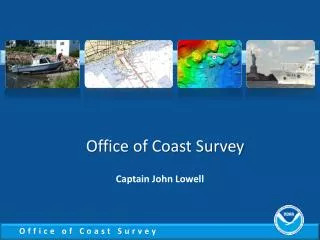
Modern Office of Coast Survey Office of Coast Survey Chief: CAPT Steve Barnum Hydrographic Surveys Divisions Chief: Jeff Ferguson Coast Survey Development Lab Chief: Mary Erickson Navigation Services Division Chief: Howard Danley Marine Charting Division Chief: CAPT John Lowell System Support Group Navigation Response Branch Chief: LCDR Larry Krepp Operations Branch Chief: Kyle Ward Hydro Systems and Technology Program Chief: LCDR EJ Van den Ameele Products Branch A Products Branch B Data Acquisition and Control Branch Chief: Crecent Moegling Customer Affairs Branch Products Branch C Marine Modeling And Analysis Pacific Hydro Branch Chief: CAPT Dave Neander Products Branch D Coast Pilot Branch Chief: Tom Loper Products Branch E Cartographic and Geospatial Technology Atlantic Hydro Branch Chief: LCDR Shep Smith Nautical Data Branch Quality Assurance, Plans and Standards Products Branch G
Office Of Coast Survey Vision • Customers have accurate and timely information to navigate and manage U.S. coastal waters. Mission • Acquire, integrate, and manage the Nation's marine information for nautical charting and coastal applications. Slogan • Navigate with confidence.
Brief History of Hydro Definition of Hydrography “The science of measuring and describing the physical features of the navigable portion of the Earth’s surface and adjoining coastal areas, with special reference to their use for the purpose of navigation”
Hydrography has been important throughout history • In 900 B.C. Homer described the rock of Scylla and the whirlpool of Charybdis (the tidal stream through the Strait of Sicily) which Greek navigators at that time avoided due to the danger which they posed. • About the year 510 B.C., the Greek historian Scylax of Caryanda explored the route of the Hindus to the Red Sea. The account of this voyage has been handed down as the PERIPLUS OF SCYLAX OF CARYANDA. This is perhaps the earliest of ancient manuscript documents, called the ‘Periploi’ (Pilots and Navigation Guides), known to exist.
Early Sounding Techniques Egyptian tomb painting, c 1450 BC. In the bow of the boat is an officer with a sounding pole. Note the men with the whips!
Evolving Technology Wire Drag Lead line
Evolving Technology • For approximately 3500 years, sounding technology was static – leadline and sounding pole • There have been many advancements in sounding technology. • In 1923 a Hayes Sonic Depth Finder was installed on the Coast and Geodetic Survey Ship GUIDE and was first used to take deep water soundings during a voyage from Norfolk, Virginia to San Diego, California. An operator with earphones listening for the return signal transmitted a sound signal through the water at the precise instant the return echo was heard. • In 1940, the 808 Fathometer, which was portable and equipped with a graphic recording device, became the C&GS standard on launches and small boats (Adams 1942). • In the late 1950's and early 1960's sidescan technology was developed as a qualitative means of obtaining the sonar equivalent of an aerial photograph. • First NOAA multi-beam survey: 1998
Evolving Technology • Large advancements in positioning were also made (reliable clocks to determine longitude, triangulation, radio positioning, and recently GPS) • Within the last 60 years, the density of available data has also dramatically increased.
Evolving Technology Multibeam Leadline Single Beam
Evolving Technology LIght Detection And Ranging (LIDAR)
Why does it matter? Our nation’s economy depends on shipping. Underkeel clearances continues to decrease as ships get deeper and deeper drafts.
Every U.S. citizen relies on the marine transportation system Energy delivery, exports, transportation, cost-effective consumer goods, recreation, environmental protection • 95,000 miles of U.S. coastline • 25,000 miles of navigable channels • 326 public/private ports • 3700 marine terminals • Supports 13M jobs, contributes $742B+ annually to U.S. GDP • 95% of U.S. foreign trade in/out by ship • 110,000 commercial/recreational fishing vessels • 78M recreational boaters
Why does it matter? • The cruise industry and eco-tourism are exploding sectors of the economy • Ferry boats now carry over 100M passengers annually • The U.S. MTS hosts more than 5 million cruise ship passengers each year