Download
1 / 41
410 likes | 513 Views
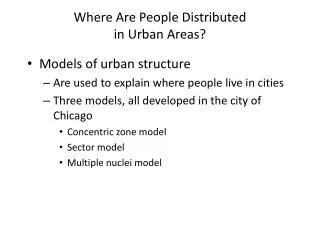
Where Are People Distributed in Urban Areas?. Models of urban structure Are used to explain where people live in cities Three models, all developed in the city of Chicago Concentric zone model Sector model Multiple nuclei model. Four Stages of U.S. Cities.

E N D
Where Are People Distributed in Urban Areas? • Models of urban structure • Are used to explain where people live in cities • Three models, all developed in the city of Chicago • Concentric zone model • Sector model • Multiple nuclei model
Four Stages of U.S. Cities In 1967, John Borchert suggested that American cities went through 4 distinct stages. • Stage 1 – The sail-wagon period 1790-1830 • Stage 2 – The iron-horse period 1830-1870 • Stage 3 – The steel-rail period 1870-1920 • Stage 4 – The auto-air-amenity period 1920-70 • ??Stage 5?? – High Technology period 1970-
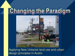
Los Angeles Western U.S. CITIES • Urban Sprawl • Much more spread out • Cities developed around the automobile - Highways • Grid street system • North/South & East/West • Suburbs are key to any Western US city • More people live in the suburbs and commute to the cities for work
Boston Eastern U.S. CITIES • Built before the automobile • Streets tend to be narrow • Dense population • Some type of mass transportation • Trains, subways, buses • Traffic is heaviest during rush hour(s) • 7am–9am & 4pm-6pm • Commute can often be measured in hours Why is it called rush hour when everyone stops?
LARGEST US CITIES BY POPULATION 6. Philadelphia 7. San Antonio 8. San Diego 9. Dallas 10. San Jose Virginia Beach 41st largest Approx. 500,000 1. New York City 2. Los Angeles 3. Chicago 4. Houston 5. Phoenix 11. Detroit 12. Jacksonville 13. San Francisco 14. Indianapolis 15. Columbus
Concentric Zone Model • Ernest Burgess (1920s); • 1) CBD • 2) Zone of transition (res. deterioration & light ind.) • 3) Blue-collar workers • 4) Middle-class • 5) Suburban ring • Dynamic: city grows; inner rings affect outer ones • Invasion & succession – continued expansion of CBD – pushes outwards
Sector Model • Homer Hoyt (1939);criticized Burgess Model as too simple & inaccurate • Zones extend along transportation routes • Growth creates a pie-shaped urban structure • Low-rent areas could extend from the CBD to the outer edge (3) • The same is true w/ high-rent, transportation, and industry
Multiple Nuclei Model • Harris & Ullman (1945); neither of two models are accurate • CBD was losing its dominant position as the nucleus of the urban area • Separate nuclei become specialized and differentiated, not located in relation to any distance attribute • Airports, seaports, universities
Where Are People Distributedin Urban Areas? • Geographic application of the models • Models can be used to show where different social groups live in the cities • Census tracts • Social area analysis • Criticism of the models • Models may be too simple • Models may be outdated
EUROPEAN CITIES • Older cities • Rome & Athens 3000 yrs ago London & Paris 2000 yrs ago • Buildings are preserved not torn down • Streets are in a dendritic pattern • Not in a grid pattern like USA • easy to get lost – very narrow streets • Not designed for cars • Wealthy live in the central city • Lower class live on the outskirts Lisbon, Portugal
Greenbelt • zone of open country w/ some scattered towns Limits urban sprawl and suburbanization (cost of gas can be 3x higher than in US)
Paris, France • City size is smaller (population & area) • #22 Paris 9 million • Not many skyscrapers in downtown region • Skyscrapers are built on the outskirts of the city • Elevators • lower class on top floor before they were invented • Old buildings – nicer rooms on the bottom floors
Results of Wars – some buildings destroyed – old & new buildings next to each other Eastern Europe concrete apartment buildings new urban revival (Prague, Berlin) Minsk, Belarus
LATIN AMERICAN CITIES • Experiencing the 2nd fastest urban growth rates in the world. • Cities are expanding due to the poverty in the countryside • City is laid out like the hub-and-spoke of a bicycle wheel. • All roads lead to the CBD • Focus of employment, entertainment, and economic activity
Latin American cities are distinctive in that their urban structure includes a “spine” of a high-income residential area. • Many of the elite live in gated communities to protect the residents from the crime that is widespread in the rest of the city Rio de Janeiro, Brazil
Sao Paulo, Brazil Squatter settlements are located along the edges of the city. • (Favelas/Barriadas) • High unemployment • Anarchy (no police presence) • Crime-ridden • Criminal activity may be the only money making activity • Prison may actually be better than slum
ASIAN CITIES • Many Asian cities are some of the most prosperous cities on Earth. • Economic development over the past four decades has been extraordinary • Built on coast for trade purposes, with ports playing an important economic role. • Much of their growth is due to trading goods to MDCs – USA & Japan. Hong Kong
Port zone – growth extends outward from port. • Specific zones that have been established for Western companies • Usually located near port for easy export • Government zone • Suburbs • Squatter settlements • Market-gardening zone • No formalized CBD (massive growth throughout the entire city)
ISLAMIC CITIES • Islamic cites located in hot, desert regions have twisted streets, because the more twisted the street, the greater the opportunity for shade. • Personal privacy valued • Windows generally small • Doors & Windows do not face each other on opposite sides of the street • Cul-de-sacs are treasured b/c of privacy • Walled cities for defense Jerusalem
Ghardaia, Algeria • Islamic cities are laid out according to Islamic principles found in the Quran. • MOSQUE – the principle mosque is located in the center of the city – focal point • Primary mosque – Jani • Space for common gatherings valued • Street markets common (Bazaar or Suq)
AFRICAN CITIES • Lowest percentage of urban population in the world today. • Fastest growing urban areas in the world today. • High unemployment rates (30+%) • Lack of modern transportation systems • Unpaved roads • Limited highways • Transportation difficult Lagos, Nigeria
Strong colonial imprint is still visible • Three distinct CBD’s • Colonial CBD • Headquarters of the Gov’t • Architecture resembles colonial power • Traditional CBD • Current commercial center • MNCs headquarters • Market CBD • Bazaar – buy & sell anything (rugs, vegetables, animals, etc.)
Problems Associated with Growth of Urban Areas • Transportation problems • Rich/Poor neighborhoods • Race Relations • Providing essential services (fresh water, sewage, disposal, electricity, schools, clinics) becomes a problem • Air, water, and noise pollution increase • Urban Sprawl results • Rapid Immigration leads to Shantytowns • In Developing countries, major cities are more connected to regions outside the country than to regions within the country
Why Do Inner Cities Face Distinctive Challenges? • Inner-city physical issues • Most significant = deteriorating housing • Filtering • Redlining • Urban renewal • Public housing • Renovated housing • Gentrification
Racial Change in Chicago Figure 13-16
Why Do Inner Cities Face Distinctive Challenges? • Inner-city social issues • The underclass • An unending cycle of social and economic issues • Homelessness • Culture of poverty
Why Do Inner Cities Face Distinctive Challenges? • Inner-city economic issues • Eroding tax base • Cities can either reduce services or raise taxes • Impact of the recession • Housing market collapse
Foreclosures in Baltimore Figure 13-18
Why Do Suburbs Face Distinctive Challenges? • Urban expansion • Annexation • Defining urban settlements • The city • Urbanized areas • Metropolitan statistical areas (MSAs) • Metropolitan divisions • Micropolitan statistical areas
Annexation in Chicago Figure 13-19
City, Urbanized Area, and MSA of St. Louis Figure 13-20
Why Do Suburbs Face Distinctive Challenges? • Urban expansion • Local government fragmentation • Council of government • Consolidations of city and county governments • Federations • Overlapping metropolitan areas
Why Do Suburbs Face Distinctive Challenges? • Peripheral model • Edge cities • Density gradient • Cost of suburban sprawl • Suburban segregation • Residential segregation • Suburbanization of businesses
Urban Realms Model • James Vance (1964): • Urban realms – parts of giant conurbations; self-sufficient suburban sectors (focused on their own independent CBD) • Edge cities– outer realms; third wave: • 1) suburbanization after WWII, • 2) malling of US (moving marketplace to suburbs in 1960s & 70s), • 3) edge cities (moving jobs to suburbs in 1980s & 90s) • Edge cities have extensive office & retail space, few residential buildings
Density Gradient Figure 13-23
Suburban Stress Figure 13-25


![Distributed Systems [ Fall 2013]](https://cdn1.slideserve.com/1583910/distributed-systems-fall-2013-dt.jpg)