Download
1 / 14
140 likes | 307 Views
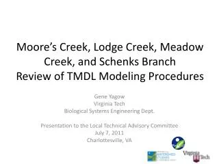
Moore’s Creek, Lodge Creek, Meadow Creek, and Schenks Branch Review of TMDL Modeling Procedures. Gene Yagow Virginia Tech Biological Systems Engineering Dept. Presentation to the Local Technical Advisory Committee July 7, 2011 Charlottesville, VA. Charlottesville City Boundary.

E N D
Moore’s Creek, Lodge Creek, Meadow Creek, and Schenks Branch Review of TMDL Modeling Procedures Gene Yagow Virginia Tech Biological Systems Engineering Dept. Presentation to the Local Technical Advisory Committee July 7, 2011 Charlottesville, VA
Charlottesville City Boundary Bay Model Boundary NWBD Jurisdictional Boundary
Livestock Numbers Moore’s Creek Bacteria TMDL
SSO Loads • Expanded record through April 2011 • Average TSS concentration based on 6 overflow events at Moore’s Creek STP (69.17 mg/L) • TSS Load calculation corrected as an annual load
Point Source Permits VPDES permits (2) Industrial wastewater permits (2) Industrial stormwater permits (9) Moore’s Creek STP = Aggregate Wastewater WLA – explicit load Virginia Oil = non-significant source of sediment Aggregate Wastewater WLA – non-significant Aggregate Regulated Stormwater WLA – implicit in Impervious load
VSMP Permits • MS4 Permits (4) • Albemarle County, City of Charlottesville, University of Virginia, VDOT • E&S Construction Permits (33) • Moore’s Creek: 92.0 acres • Meadow Creek (excluding Schenks): 63.2 acres • Schenks Branch: 15.6 acres Aggregate Regulated Stormwater WLA – implicit in Barren, Urban pervious, and Urban impervious loads Aggregate Regulated Stormwater WLA – implicit in Barren load VSMP = Virginia Storm water Management Program E&S = Erosion and Sediment MS4 = Municipal Separate Storm Sewer System Program VDOT = Virginia Department of Transportation
Channel Erosion Considerations • Meadow Creek: 9,000 linear feet of stream bank restoration (42.5% of impaired length) • Moore’s Creek IP: 7 sites identified, totaling 3,990 linear feet of stream bank stabilization • Two options for accounting: • Add into Baseline Loads (and assume these are reduced in the TMDL scenario) • Add reductions to the TMDL scenario (and assume these were calibrated into the Baseline scenario)
Representing Barren Areas • Bay Model documentation describes “Barren” areas as a “% increase” in impervious areas between scenarios (dependent on choice of scenarios?) • Include Barren in the Urban Group and distribute proportionately
TMDL Draft Modeling Documentation • Sections 2.5 and 2.6 and Chapters 4 and 5. • Questions?
Next Steps • Calculate existing and TMDL loads for sediment • Use reductions implied in TMDL loads as the first reduction scenario • Create at least a second alternative reduction scenario • Prepare Draft TMDL Report and present at a future TAC and a Public Meeting • Setup work groups to transition to Implementation
Questions? • For more information, contact Gene Yagow 540-231-2538 eyagow@vt.edu