Download

1 / 84
840 likes | 980 Views
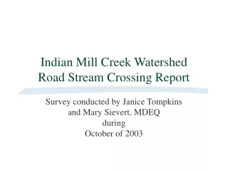
Rush Creek Watershed Road Stream Crossing Survey. Survey conducted by Janice Tompkins and Mary Sievert, MDEQ during October and November of 2003. NWR-01 64 th north of Port Sheldon Upstream View. NWR-01 64 th north of Port Sheldon Downstream View. NWR-01 64 th north of Port Sheldon

E N D
Rush Creek WatershedRoad Stream Crossing Survey Survey conducted by Janice Tompkins and Mary Sievert, MDEQ during October and November of 2003
NWR-01 64th north of Port Sheldon Upstream View
NWR-01 64th north of Port Sheldon Downstream View
NWR-01 64th north of Port Sheldon Road Crossing
NWR-02 56th north of Port Sheldon Upstream View
NWR-02 56th north of Port Sheldon Downstream View
NWR-02 56th north of Port Sheldon Road crossing
NWR-03 48th north of Port Sheldon Upstream View
NWR-03 48th north of Port Sheldon Downstream View
NWR-03 48th north of Port Sheldon Road crossing
NWR-04 40th south of Port Sheldon Upstream View
NWR-04 40th south of Port Sheldon Adjoining sod field
NWR-04 40th south of Port Sheldon Downstream View
NWR-04 40th south of Port Sheldon Road crossing
NWR-05 Van Buren west of 40th Upstream View
NWR-05 Van Buren west of 40th Downstream View
NWR-05 Van Buren west of 40th Road Crossing
NWR-06 36th north of Van Buren Upstream View
NWR-06 36th north of Van Buren Downstream View
NWR-06 36th north of Van Buren Obstructed culvert
NWR-06 36th north of Van Buren Road crossing
NWR-07 Balsam south of Port Sheldon Upstream View
NWR-07 Balsam south of Port Sheldon Downstream View
NWR-07 Balsam south of Port Sheldon Adjoining gravel pit
NWR-07 Balsam south of Port Sheldon Road crossing
WCR-01 Quincy east of 40th Upstream View
WCR-01 Quincy east of 40th Second Upstream View
WCR-01 Quincy east of 40th Downstream View
WCR-01 Quincy east of 40th Road crossing
WCR-02 Quincy east of 32nd Upstream View
WCR-02 Quincy east of 32nd Downstream View
WCR-02 Quincy east of 32nd Road crossing
WCR-03 New Holland west of 32nd Upstream View
WCR-03 New Holland west of 32nd Second Upstream View
WCR-03 New Holland west of 32nd Downstream View
WCR-03 New Holland west of 32nd View from further downstream
WCR-03 New Holland west of 32nd Road crossing
WCR-04 32nd north of Barry Upstream View
WCR-04 32nd north of Barry Downstream View
WCR-04 32nd north of Barry Road crossing
WCR-05 Oak west of Balsam Upstream View
WCR-05 Oak west of Balsam Downstream View
WCR-05 Oak west of Balsam Road crossing
ECR-01 Jackson east of 32nd Upstream View
ECR-01 Jackson east of 32nd View of perched culverts
ECR-01 Jackson east of 32nd Downstream View
ECR-01 Jackson east of 32nd View of eroded downstream streambank
ECR-01 Jackson east of 32nd Road crossing
ECR-02 Barry east of 32nd Upstream View
ECR-02 Barry east of 32nd Downstream View