Download
1 / 13
130 likes | 221 Views
Explore the ever-changing Antarctic Ice Sheet dynamics from past to present with POLENET project using GPS and seismic data. Learn about ice effects on Earth's crust, sea level rise impacts, and how GPS and seismology help measure Earth movements and material properties. Discover the science behind glacial unloading uplift rates. Access interactive maps and animations for deeper insights.

E N D
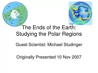
DYNAMIC ICE SHEETS The ice cover on Earth is dynamic, its extent is constantly changing in response to climate change. Throughout Earth's history several glaciations have come and gone. The movie illustrates the dynamic nature of the Antarctic Ice Sheet as shown from present day to 20,000 years ago and back to present time It is one goal of the POLENET project to contribute to the understanding of the interactions between solid Earth and ice cover through extensive geophysical data collection (mainly GPS and seismic) in Antarctica and Greenland. Click to play movie
Sea Level Rise The relationship between climate and ice sheets is complicated in detail, because various feedback mechanisms are involved. One example is the expected initial growth of the Antarctic ice sheet with climate warming due to increased snow precipitation and accumulation. With further warming, melting will surpass accumulation, and the ice sheet will decay. The melting of Earth's ice sheets will have a serious effect on global sea level rise. This is illustrated in the interactive map below. You can see which coastal areas would be flooded for a given amount of sea level rise. Use website flood.firetree.net for interactive map
Ice effects the solid earth As ice sheets grow and decay, they bend the Earth's crust …but how do we know this and how do we measure it?
How do we know? Geologist look for clues of ancient shorelines. The alternating dark and light bands of vegetation indicate how sea level has risen and fallen through geologic time. …but how can we measure it today?
Through the use of modern technologies such as the Global Positioning System and through the use of seismology.
Global Positioning System How does a GPS work? By using very precise GPS systems POLENET scientist can understand how the solid earth moves. By recording changes in latitude, longitude, and height, through time scientist can see how a particular part of the crust moves as compared to some stationary point. This gives POLENET scientist the ability to understanding if the crust beneath the ice sheets is move laterally or up or down. How does a GPS tell motion? -- Click Here
In eastern North America, the dominant vertical motion measured by GPS is that of isostatic rebound from the melting of the Laurentian Ice Sheet that covered Canada and most of the northern United States during the last ice age. The northern areas that were covered by ice are still rising in response to the release of weight as the ice melted, whereas the southern areas which were not covered by ice, are subsiding due to backflow of viscous mantle material underneath the Earth's crust to the rising northern areas. Back to GPS Page -- click here
GPS in more detail Back to GPS Page
Seismology Seismology is the science of earthquake waves. The velocities of waves traveling through the Earth can be measured and depend on the material properties of the layers they pass in the Earth's interior. Therefore, the arrival times of earthquake waves at various seismic stations can give us clues whether the crust is stiff or weak in certain areas. The stiffness of the crust determines the rate of uplift after glacial unloading. Use IRIS current seismology animation for AED