Download
1 / 19
200 likes | 339 Views
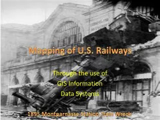
Mapping of U.S. Railways. Through the use of GIS Information Data Systems. 1895 Montparnasse Station Train Wreck. O bjectives. Give a little history. Compare the ways of the past With the world of today. Importance of GIS Data Systems with Railway . Railway History.

E N D
Mapping of U.S. Railways Through the use of GIS Information Data Systems 1895 Montparnasse Station Train Wreck
Objectives Give a little history Compare the ways of the past With the world of today Importance of GIS Data Systems with Railway
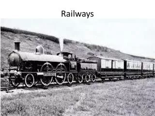
RailwayHistory The golden spike ceremony at Promontory Point, Utah in 1869
Compare the past with the present Today the United States has more than 250,000 miles of railroads. Speeds approaching 200 miles an hour are becoming common on some lines. At the present time, trans continental railroads carry more freight than passenger traffic modern locomotive - Trans continental railroad
1807: The very first passenger train ran from Swansea to Mumbles on March 25th 1862: President Abraham Lincoln signs the Pacific Railway Act, which authorizes the construction of the first transcontinental railroad. 1900: Casey Jones rode the "Cannonball" into history on April 30th. Leviathan 4-4-0 Steam Locomotive No.63
1916: saw peak mileage at over 254,000 and railroads held virtually 100% of all interstate traffic 1934: Construction of the first streamlined electric locomotives begins. 1970: Congress passes the Rail Passenger Service Act creating Amtrak "North Coast Limited" passenger train
Surveys took any where from weeks to months Influences upon the Surveyor could and did affect the results of the map Right Half of James Hayward's 1828 plan of a survey for the proposed Boston and Providence Railway.
With the use of GIS surveys are able to limit the amount of problems to arise, except those from operator error Railway right of way Surveys
The Last Coal Burning Steam Engine on display in downtown Trinidad, Colorado. Engine 683 was manufactured in 1906 and put into service with the Colorado & Southern
Railroad Service Across Iowa GIS Data Exchange Capabilities
This map shows the connections at various points, The railway tracks were used in both directions and Time was standardized to the nearest major city. Grand Trunk Railway ca.1867
With the use of GIS data systems items like B-class stations and the existence of foot over bridges can be managed effectively. GIS based Railway Station Management System
With a GIS data system time schedules, products, material goods are easily tracked. Delaware & Hudson "Adirondack" powered by ex-Santa Fe, Alco PA diesel locomotives at Montreal Station.
In the past tracking passengers, products, material goods, and time schedules were done by clerks on paper. .
The importance of GIS data systems for the Railway has helped improve performance, safety, maintenance plus other aspects of the railway system. Amtrak Railway map
Sources: http://www.mapindia.org/2005/papers/Transportation/268.htm http://members.kos.net/sdgagnon/te3.html http://railpassengerusa.com/events.php http://www.neiu.edu/~rgutierr/red_city/trains.html http://www.flickr.com www.historicalstockphotos.com www.oursurprisingworld.com http://commons.wikimedia.org/wiki/File:Leviathan_63_Train_Festival_2009.jpg www.americanghostsandhauntings.com http://memory.loc.gov/ammem/gmdhtml/rrhtml/rrintro.html http://www.sdrm.org/history/timeline/> http://www.american-rails.com/railroad-history.html http://railpassengerusa.com/events.php> http://www.mapindia.org/2005/papers/Transportation/268.htm http://clintoncountyohgis.org/surveys_railroad_row.htm http://www.ctre.iastate.edu/educweb/ce352/lec24/gista.htm http://wikipedy.com/trans_continental_railroad_facts.htm http://ptatransitauthority.blogspot.com/2009/03/modern-locomotives.html http://www.esri.com/industries/railways/index.html http://www.trainweb.org/mdamtrak199/trainsounds.html http://www.dieselairhorns.com/sounds.html?album=5